
 United Kingdom
 France
 Germany
 Netherlands
 Sweden
 USA
USA
 Italy
Italy
 Spain
Spain
More From Contributor


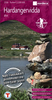

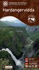

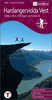
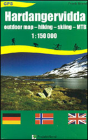
Hardangervidda
Hardangervidda on a GPS compatible outdoor map at 1:150, 000 from Project Nord, showing hiking and winter trails, huts and campsites, other tourist facilities and places of interest, etc. Coverage extends from Finse and the Hardangerjøkulen glacier in the north to Rødal in the south, and west-east from Odda and the Sørfjorden to beyond Geilo and to Rjukan.Topography is presented by contours at 100m intervals with altitude colouring, plus numerous spot heights and graphics to indicate marshland. Local footpaths and waymarked hiking trails are highlighted, as are waymarked winter ski routes. Symbols for mountain huts indicate whether staffed or self-service and where appropriate show the initials for the tourist or trekking association responsible for its upkeep. More symbols
provide further tourist information including restaurants and cafes, car parks, and various places of interest. The map has a UTM grid, plus margin ticks for latitude and longitude at 15’ intervals. Map legend includes English.
provide further tourist information including restaurants and cafes, car parks, and various places of interest. The map has a UTM grid, plus margin ticks for latitude and longitude at 15’ intervals. Map legend includes English.

Product Description
Reviews/Comments
Add New
Vouchers
No voucher codes found.
Do you know a voucher code for this product or supplier? Add it to Insights for others to use.
Do you know a voucher code for this product or supplier? Add it to Insights for others to use.
 Denmark