More From Contributor

£11.50
Topographic survey of France at 1:25, 000 in IGN`s excellent TOP25 / Série Bleue series. All the maps are GPS compatible, with a 1km UTM grid plus latitude & longitude lines at 5’ intervals. Contours are at 5m intervals except for mountainous areas where the maps have contours at 10m intervals, vividly enhanced by hill shading & graphics for rocky terrain. Colouring with graphics indicates different types of vegetation or land use (deciduous or coniferous forests, moors, orchards, vineyards, etc). PLEASE NOTE: coverage of France at this scale is currently being revised – the format & the presentation of each title are indicated by the letters at the end of its Sheet Reference number (e.g. 0416ET, 3531ETR, 1923SB, etc.)MAPS WITH FULL TOURIST OVERPRINT & AN ENGLISH MAP LEGEND: all TOP25 maps & the SB editions of Série Bleue have an overprint highlighting waymarked walking trails including long-distance GR routes &, where appropriate, ski routes. Symbols indicate campsites, gîtes d’etape, refuges, equestrian centres & other recreational facilities or sites, tourist information centres, cultural heritage, etc. Towns & locations of particular interest are highlighted.- ET or OT = single-sided TOP25 map covering approx. 29x 21 km / 18x 13 miles.- ETR or OTR = waterproof & tear resistant TOP25 map covering the same area as the corresponding ET or OT number, but double-sided, printed on a smaller size sheet with a good overlap between the sides.- SB = Série Bleue map with full tourist overprint; these maps, first introduced in summer 2014, each cover approx. 29x 24km / 18x 15 miles.SÉRIE BLEUE maps with numbers ending in E (Est) or O (Ouest): most editions now indicate the GR routes, but do not show any other tourist information. Map legend is in French only. Each map covers approx. 14x 20km / 9x 12 miles. ...
Archived Product
£2.95
Harborne in 1901 in a fascinating series of reproductions of old Ordnance Survey plans in the Alan Godfrey Editions, ideal for anyone interested in the history of their neighbourhood or family. Selected towns in Great Britain & Ireland are covered by maps showing the extent of urban development in the last decades of the 19th & early 20th century. In this title: the map covers the Harborne area of south Birmingham, including a small portion of Edgbaston. Coverage stretches from Beech Lane eastward to York Street & St John's church, & from Woodbourne Road southward to Greenfield Road. Features include Lordswood House, Oaklands, Queen's Park, Tally Ho Club Ground, St Joseph's House, Beech Lanes Farm, Chad Valley Works, Harborne railway branch with terminus, part of Westfield Road, Metchley Abbey (in south-easten corner of map), St John the Baptist's church, High Street area. On the reverse are a timetable for the Harborne Branch & directory entries for Augustus Road, Clarence Road, Greenfield Road, High Street, Lonsdale Road, Lordswood Road, Station Road, Wentworth Road, Westfield Road. Though the publishers have used the Warwickshire sheet number, this map also covers Staffordshire sheet 72.11 & Worcestershire sheet 5.11. About the Alan Godfrey Editions of the 25 ...
Archived Product
£3.50
Harborne in 1901 in a fascinating series of reproductions of old Ordnance Survey plans in the Alan Godfrey Editions, ideal for anyone interested in the history of their neighbourhood or family. The map covers the Harborne area of south Birmingham, including a small portion of Edgbaston. Coverage stretches from Beech Lane eastward to York Street & St John`s church, & from Woodbourne Road southward to Greenfield Road. Features include Lordswood House, Oaklands, Queen`s Park, Tally Ho Club Ground, St Joseph`s House, Beech Lanes Farm, Chad Valley Works, Harborne railway branch with terminus, part of Westfield Road, Metchley Abbey (in south-easten corner of map), St John the Baptist`s church, High Street area. On the reverse are a timetable for the Harborne Branch & directory entries for Augustus Road, Clarence Road, Greenfield Road, High Street, Lonsdale Road, Lordswood Road, Station Road, Wentworth Road & Westfield Road. Though the publishers have used the Warwickshire sheet number, this map also covers Staffordshire sheet 72.11 & Worcestershire sheet 5.11. About the Alan Godfrey Editions of the 25” OS Series: Selected towns in Great Britain & Ireland are covered by maps showing the extent of urban development in the last decades of the 19th & early 20th century. The plans have been taken from the Ordnance Survey mapping & reprinted at about 15 inches to one mile (1:4, 340). On the reverse most maps have historical notes & many also include extracts from contemporary directories. Most maps cover about one mile (1.6kms) north/south, one & a half miles (2.4kms) across; adjoining sheets can be combined to provide wider coverage.FOR MORE INFORMATION & A COMPLETE LIST OF ALL AVAILABLE TITLES PLEASE CLICK ON THE SERIES LINK. ...
Archived Product
£3.50
Harborne South in 1901 in a fascinating series of reproductions of old Ordnance Survey plans in the Alan Godfrey Editions, ideal for anyone interested in the history of their neighbourhood or family. The map covers the southern part of Harborne & the northern fringe of Northfield. Coverage stretches from Victoria Road southward to Weoley Park Farm & the northern tip of Selly Oak Park, & from Metchley Lane westward to Barnes Hill. Features include St Peter`s church, Harborne Hall, Mill Farm, Dudley Canal, California area, site of Weoley Castle, Metchley Grange, The Grove, Harborne House, Gravel Bank, Welsh House Farm, etc. On the reverse are street directory entries for Harborne Lane, Metchley Lane, Northfield Road, Old Church Road, St Mary`s Road, St Peter`s Road & Victoria Road. This title also

Includes::
Worcestershire sheet 5.15. About the Alan Godfrey Editions of the 25” OS Series: Selected towns in Great Britain & Ireland are covered by maps showing the extent of urban development in the last decades of the 19th & early 20th century. The plans have been taken from the Ordnance Survey mapping & reprinted at about 15 inches to one mile (1:4, 340). On the reverse most maps have historical notes & many also include extracts from contemporary directories. Most maps cover about one mile (1.6kms) north/south, one & a half miles (2.4kms) across; adjoining sheets can be combined to provide wider coverage.FOR MORE INFORMATION & A COMPLETE LIST OF ALL AVAILABLE TITLES PLEASE CLICK ON THE SERIES LINK.

...
Archived Product
£7.99
It was a beautiful winter`s day. Anders, his wife & their feisty six-year-old, Maja, set out across the ice of the Swedish archipelago to visit the lighthouse on Gavasten. There was no one around, so they let her go on ahead. & she disappeared, seemingly into thin air, & was never found. Two years later, Anders is a broken alcoholic, his life ruined. He returns to the archipelago, the home of his childhood & his family. But all he finds are Maja`s toys & through the haze of memory, loss & alcohol, he realizes that someone
- or something
- is trying to communicate with him. Soon enough, his return sets in motion a series of horrifying events which exposes a mysterious & troubling relationship between the inhabitants of the remote island & the sea.

...
Archived Product
£10.99
HILLARY RODHAM CLINTON`S INSIDE ACCOUNT OF THE CRISES, CHOICES & CHALLENGES SHE FACED DURING HER FOUR YEARS AS AMERICA`S 67TH SECRETARY OF STATE, & HOW THOSE EXPERIENCES DRIVE HER VIEW OF THE FUTURE. ` All of us face hard choices in our lives, ` Hillary Rodham Clinton writes at the start of this personal chronicle of years at the centre of world events. ` Life is about making such choices. Our choices & how we handle them shape the people we become.` In the aftermath of her 2008 presidential run, she expected to return to representing New York in the Unites States Senate. To her surprise, her formal rival for the Democratic Party nomination, newly elected President Barack Obama, asked her to serve in his administration as Secretary of State. This memoir is the story of the four extraordinary & historic years that followed, & the hard choices that she & her colleagues confronted. Secretary Clinton & President Obama had to decide how to repair fractured alliances, wind down two wars & address a global financial crisis. They faced a rising competitor in China, growing threats from Iran & North Korea, & revolutions across the Middle East. Along the way, they grappled with some of the toughest dilemmas of US foreign policy, especially the decision to send Americans into harm`s way, from Afghanistan to Libya to the hunt for Osama bin Laden. By the end of her tenure, Secretary Clinton had visited 112 countries, travelled nearly one million miles & gained a truly global perspective on many of the major trends reshaping the landscape of the twenty-first century, from economic inequality to climate change to revolutions in energy, communications & health. Drawing on conversations with numerous leaders & experts, Secretary Clinton offers her views on what it will take for the United States to compete & thrive in an interdependent world. She makes a passionate case for human rights & the full participation in society of girls, youth & LGBT people. An astute eyewitness to decades of social change, she distinguishes the trendlines from the headlines & describes the progress occurring throughout the world, day after day. Secretary Clinton`s descriptions of diplomatic conversations at the highest levels offer readers a masterclass in international relations, as does her analysis of how we can best use `smart power` to deliver security & prosperity in a rapidly changing world
- one in which America remains the indispensable nation.
...
Archived Product
£5.99
There are countless daring, clever & ruthless travellers & explorers from throughout history. But who was the toughest nut of all? Bursting full of entertaining & witty fact-filled text in bite sized chunks & jam-packed with hilarious full-colour illustrations throughout. From Christopher Columbus to Neil Armstrong & countless other tough-nuts, Hard Nuts of History Travellers & Explorers

Includes::
Hardometers & a Hard Nut rating for some of the toughest travellers & explorers of all time.

...
Archived Product
£6.99
A damning indictment of Utilitarianism & the dehumanising influence of the Industrial Revolution, Charles Dickens`s ” Hard Times” is edited with an introduction & notes by Kate Flint in ” Penguin Classics”. In ” Hard Times”, the Northern mill-town of Coketown is dominated by the figure of Mr Thomas Gradgrind, school headmaster & model of Utilitarian success. Feeding both his pupils & family with facts, he bans fancy & wonder from any young minds. As a consequence his obedient daughter Louisa marries the loveless businessman & `bully of humanity` Mr Bounderby, & his son Tom rebels to become embroiled in gambling & robbery. &, as their fortunes cross with those of free-spirited circus girl Sissy Jupe & victimized weaver Stephen Blackpool, Gradgrind is eventually forced to recognize the value of the human heart in an age of materialism & machinery. This edition of ” Hard Times” is based on the text of the first volume publication of 1854. Kate Flint`s introduction sheds light on the frequently overlooked character interplay in Dickens`s great critique of Victorian industrial society. Charles Dickens is one of the best-loved novelists in the English language, whose 200th anniversary was celebrated in 2012. His most famous books, including ” Oliver Twist”, ” Great Expectations”, ”A Tale of Two Cities”, ” David Copperfield” & ” The Pickwick Papers”, have been adapted for stage & screen & read by millions. If you enjoyed ” Hard Times”, you might like Dickens` ” Bleak House”, also available in ” Penguin Classics”. ”A masterpiece...a completely serious work of art”. (F.R. Leavis). ...
Archived Product
£1.99
Unusually for Dickens, Hard Times is set, not in London, but in the imaginary mid-Victorian Northern industrial town of Coketown with its blackened factories, downtrodden workers & polluted environment. This is the soulless domain of the strict utilitarian Thomas Gradgrind & the heartless factory owner Josiah Bounderby. However human joy is not excluded thanks to ` Mr Sleary`s Horse-Riding` circus, a gin-soaked & hilarious troupe of open-hearted & affectionate people who act as an antidote to all the drudgery & misery endured by the ordinary citizens of Coketown. ...
Archived Product
£5.99
The Penguin English Library Edition of Hard Times by Charles Dickens` Now, what I want is, Facts. Teach these boys & girls nothing but Facts. Facts alone are wanted in life. Plant nothing else, & root out everything else` Coketown is dominated by the figure of Mr Thomas Gradgrind, school owner & model of Utilitarian success. Feeding both his pupils & his family with facts, he bans fancy & wonder from young minds. As a consequence his obedient daughter Louisa marries the loveless businessman & `bully of humility` Mr Bounderby, & his son Tom rebels to become embroiled in gambling & robbery. &, as their fortunes cross with those of free-spirited circus girl Sissy Jupe & victimised weaver Stephen Blackpool, Gradgrind is eventually forced to recognise the value of the human heart in an age of materialism & machinery. The Penguin English Library
- 100 editions of the best fiction in the English language, from the eighteenth century & the first novels to the beginning of the First World War.
...
Archived Product

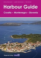
Harbour Guide Croatia, Montenegro And Slovenia

Imray has commissioned this English language edition of Skagerrak Forlag`s Harbour Guide to Slovenia, Croatia and Montenegro, which covers the coasts of those countries and their islands. The Norwegian publisher has already established a comprehensive series of Harbour Guides (Havneguiden) for the Baltic Sea that concentrate on providing the user with the clearest possible information for entering harbours and anchorages. This joint venture extends the series to the Adriatic. Each harbour is presented on its own page with specially commissioned aerial photos annotated to show approach lines and anchoring places, supported by clear harbour plans, a fact box and sailing directions. Aerial photographs offer a quick overview of the character of the harbour, its atmosphere, facilities and
fairways, danger spots and mooring points. Depths, skerries and shallows are clearly marked. Large scale plans, one per harbour, include depths, safest approaches and berthing details. Each harbour text is divided into two sections; a General overview describing the history and scenery of the area and information on what to see and do when there, and a Berthing section with information on how to approach and the hazards to watch out for, and where it is safe and sheltered to tie up. Fact boxes provide a quick overview of the harbour facilities, useful websites and contact details. The book is divided into five sailing areas each with a helpful overview chart on which harbours are marked.
RIP - This product is no longer available on our network. It was last seen on 25.09.2019

This page now acts as a permanent archive for this product. Add more information using the comments box below to ensure it can still be found by future generations.

Use our search facility to see if it is available from an alternative contributor.
  • Availability: Out Of Stock
  • Supplier: Stanfords
  • SKU: 9781846237454
Availability: In Stock
£57.50

Product Description

Imray has commissioned this English language edition of Skagerrak Forlag`s Harbour Guide to Slovenia, Croatia & Montenegro, which covers the coasts of those countries & their islands. The Norwegian publisher has already established a comprehensive series of Harbour Guides (Havneguiden) for the Baltic Sea that concentrate on providing the user with the clearest possible information for entering harbours & anchorages. This joint venture extends the series to the Adriatic. Each harbour is presented on its own page with specially commissioned aerial photos annotated to show approach lines & anchoring places, supported by clear harbour plans, a fact box & sailing directions. Aerial photographs offer a quick overview of the character of the harbour, its atmosphere, facilities & fairways, danger spots & mooring points. Depths, skerries & shallows are clearly marked. Large scale plans, one per harbour, include depths, safest approaches & berthing details. Each harbour text is divided into two sections; a General overview describing the history & scenery of the area & information on what to see & do when there, & a Berthing section with information on how to approach & the hazards to watch out for, & where it is safe & sheltered to tie up. Fact boxes provide a quick overview of the harbour facilities, useful websites & contact details. The book is divided into five sailing areas each with a helpful overview chart on which harbours are marked.

Reviews/Comments

Add New

Intelligent Comparison

Oooops!
We couldn't find anything!
Perhaps this product's unique.... Or perhaps we are still looking for comparisons!
Click to bump this page and we'll hurry up.

Price History

Vouchers

No voucher codes found.
Do you know a voucher code for this product or supplier? Add it to Insights for others to use.

Facebook

Jargon Buster

Watch - A small clock designed to be worn on a person
History - Anything that happens in the past. An acedemic subject.
Quick - Something that is fast
Language - the method of communication used in different areas. Humans and computers have many different languages.
Large - something that takes up more space than normal.
Language - The way humans communicate either written and spoken.

Supplier Information

Stanfords
Stanfords was established in 1853 and opened their iconic Covent Garden flagship store in 1901. They have become the top retailer of maps, travel books and accessories in the UK and arguably offer the largest selection of maps and travel books worldwide. Famous names such as Captain Robert Falcon Scott, Ranulph Fiennes and Michael Palin have purchased from Stanfords. They now have a shop in Bristol and both stores together with other venues operate a calendar of events including talks, book signings and exhibitions. As a specialist map retailer, the map selection is comprehensive and includes road maps, street maps and walking maps from worldwide destinations, as well as a selection of world atlases and wall maps. Books include travel guides and travel literature. Stanfords also stock globes, from miniatures made of blue marble to magnificent floor-standing globes. The website features a selection of interesting articles on travel topics.
Page Updated: 2023-11-12 20:15:36

Community Generated Product Tags

Oh No! The productWIKI community hasn't generated any tags for this product yet!
Menu