
 United Kingdom
 France
 Germany
 Netherlands
 Sweden
 USA
USA
 Italy
Italy
 Spain
Spain
More From Contributor


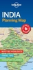


India NGS Classic Wall Map ENCAPSULATED
India wall map from the National Geographic Society, size 61 x 76cm (24” x 30” approx) – encapsulated version, in the NGS traditional classic style: on a light base with both internal state boundaries and international borders shown in colour.Coverage includes all of Nepal, Bhutan and Bangladesh, plus most of Tibet, eastern and northern Pakistan, Sri Lanka, etc. Disputed international borders between with Pakistan and China are marked. City names are given in their current version with the historical names in brackets; Kolkata (Calcutta), Varanasi (Banaras), Kochi (Cochin), etc. Topography is indicated by relief shading with names of various mountain ranges, peaks (heights in metres), etc. National parks are highlighted. The map shows the network of main road and rail
connections and indicates locations of airports. Latitude and longitude lines are drawn at 4° intervals.* This title is also available on paper without the encapsulation.
connections and indicates locations of airports. Latitude and longitude lines are drawn at 4° intervals.* This title is also available on paper without the encapsulation.

Product Description
Reviews/Comments
Add New
Vouchers
No voucher codes found.
Do you know a voucher code for this product or supplier? Add it to Insights for others to use.
Do you know a voucher code for this product or supplier? Add it to Insights for others to use.
 Denmark