
 United Kingdom
 France
 Germany
 Netherlands
 Sweden
 USA
USA
 Italy
Italy
 Spain
Spain
More From Contributor


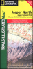

Jasper South - Jasper National Park
The southern part of the Jasper National Park on a double-sided, contoured, GPS compatible recreational map at 1:100, 000 from the National Geographic printed on light, waterproof and tear-resistant synthetic paper. Coverage extends along the Icefields Parkway to just beyond Jasper Village.This title is part of a series of four recreational maps of the Banff and Jasper National Parks from the National Geographic Society. Each map is double-sided to cover a wider area. Topography is very vividly presented by contours at 30m intervals enhanced by relief shading and altitude colouring. Heights are given both in feet and metres. Boundaries of the region’s numerous protected areas indicate their official status, from national parks to provincial natural areas.Road network shows improved
roads, routes requiring high clearance vehicles and restricted access administrative roads. The marking for maintained trails differentiates between routes for hiking and horse riding and those also suitable for bikes. The trails are annotated with distances in both miles and kilometres. A very wide range of symbols highlights local facilities and recreational areas: different types of accommodation including campgrounds, cabins and hostels, parking and picnic areas, trailheads, horse riding facilities, boat tours, etc. The maps have a 1-km UTM grid plus latitude and longitude crosshairs at 10’. Each title also includes general information about the region, safety tips, and useful contact details.
roads, routes requiring high clearance vehicles and restricted access administrative roads. The marking for maintained trails differentiates between routes for hiking and horse riding and those also suitable for bikes. The trails are annotated with distances in both miles and kilometres. A very wide range of symbols highlights local facilities and recreational areas: different types of accommodation including campgrounds, cabins and hostels, parking and picnic areas, trailheads, horse riding facilities, boat tours, etc. The maps have a 1-km UTM grid plus latitude and longitude crosshairs at 10’. Each title also includes general information about the region, safety tips, and useful contact details.

Product Description
Reviews/Comments
Add New
Vouchers
No voucher codes found.
Do you know a voucher code for this product or supplier? Add it to Insights for others to use.
Do you know a voucher code for this product or supplier? Add it to Insights for others to use.
 Denmark