More From Contributor

£410.00
Political map of the world from Kümmerly+ Frey, size 190 x 112cm (75” x 44” approx) – on magnetic board, with countries in pleasant pastel colours against light blue seas, a presentation which will appeal to anyone who prefers gentler shades. Subtle relief shading with plenty of names of topographic features provides physical information. The map has English language place names throughout; countries, cities & all other features. Within USA, Canada, Brazil & Australia internal state or provincial boundaries are indicated. Principal road connections are shown, with main railway lines particularly easy to see against the background colouring. On oceans the map shows the extent of the ice shelf in the Polar Regions & main shipping lanes. Central Pacific, from Alaska/ Siberia to New Zeal&, is repeated on both sides for better presentation of that region. Projection is van der Grinten. PLEASE NOTE: Kümmerly+ Frey’s political maps of the world are published in two sizes (140x 99cm /55 x 39” approx or 190x 112cm / 75”x 44 approx), available on paper, encapsulated & on pin board or magnetic board – PLEASE CLICK ON THE SERIES LINK TO SEE ALL THE OPTIONS. These magnetic board maps are produced on dem&. Please get in touch with us for more information. ...
Archived Product
£370.00
Political map of the world from Kümmerly+ Frey, size 190 x 112cm (75” x 44” approx) – on pin board, with countries in pleasant pastel colours against light blue seas, a presentation which will appeal to anyone who prefers gentler shades. Subtle relief shading with plenty of names of topographic features provides physical information. The map has English language place names throughout; countries, cities & all other features. Within USA, Canada, Brazil & Australia internal state or provincial boundaries are indicated. Principal road connections are shown, with main railway lines particularly easy to see against the background colouring. On oceans the map shows the extent of the ice shelf in the Polar Regions & main shipping lanes. Central Pacific, from Alaska/ Siberia to New Zeal&, is repeated on both sides for better presentation of that region. Projection is van der Grinten. PLEASE NOTE: Kümmerly+ Frey’s political maps of the world are published in two sizes (140x 99cm /55 x 39” approx or 190x 112cm / 75”x 44 approx), available on paper, encapsulated & on pin board or magnetic board – PLEASE CLICK ON THE SERIES LINK TO SEE ALL THE OPTIONS. ...
Archived Product
£195.00
Political map of the world from Kümmerly+ Frey, size 140 x 99cm (55” x 39” approx) – on magnetic board, with countries in pleasant pastel colours against light blue seas, a presentation which will appeal to anyone who prefers gentler shades. Subtle relief shading with plenty of names of topographic features provides physical information. The map has English language place names throughout; countries, cities & all other features. Within USA, Canada, Brazil & Australia internal state or provincial boundaries are indicated. Principal road connections are shown, with main railway lines particularly easy to see against the background colouring. On oceans the map shows the extent of the ice shelf in the Polar Regions & main shipping lanes. Central Pacific, from Alaska/ Siberia to New Zeal&, is repeated on both sides for better presentation of that region. Projection is van der Grinten. PLEASE NOTE: Kümmerly+ Frey’s political maps of the world are published in two sizes (140x 99cm /55 x 39” approx or 190x 112cm / 75”x 44 approx), available on paper, encapsulated & on pin board or magnetic board – PLEASE CLICK ON THE SERIES LINK TO SEE ALL THE OPTIONS. These magnetic board maps are produced on dem&. Please get in touch with us for more information. ...
Archived Product
£195.00
Political map of the world from Kümmerly+ Frey, size 140 x 85cm / (55” x 33.5” approx) – on magnetic board, with countries in pleasant pastel colours against light blue seas, a presentation which will appeal to anyone who prefers gentler shades. Subtle relief shading with plenty of names of topographic features provides physical information. The map has English language place names throughout; countries, cities & all other features. Within USA, Canada, Brazil & Australia internal state or provincial boundaries are indicated. Principal road connections are shown, with main railway lines particularly easy to see against the background colouring. On oceans the map shows the extent of the ice shelf in the Polar Regions & main shipping lanes. Central Pacific, from Alaska/ Siberia to New Zeal&, is repeated on both sides for better presentation of that region. Projection is van der Grinten. PLEASE NOTE: Kümmerly+ Frey’s political maps of the world are published in two sizes (140x 99cm /55 x 39” approx or 190x 112cm / 75”x 44 approx), available on paper, encapsulated & on pin board or magnetic board – PLEASE CLICK ON THE SERIES LINK TO SEE ALL THE OPTIONS. These magnetic board maps are produced on dem&. Please get in touch with us for more information. ...
Archived Product
£175.00
Political map of the world from Kümmerly+ Frey, size 140 x 99cm (55” x 39” approx) – on pin board, with countries in pleasant pastel colours against light blue seas, a presentation which will appeal to anyone who prefers gentler shades. Subtle relief shading with plenty of names of topographic features provides physical information. The map has English language place names throughout; countries, cities & all other features. Within USA, Canada, Brazil & Australia internal state or provincial boundaries are indicated. Principal road connections are shown, with main railway lines particularly easy to see against the background colouring. On oceans the map shows the extent of the ice shelf in the Polar Regions & main shipping lanes. Central Pacific, from Alaska/ Siberia to New Zeal&, is repeated on both sides for better presentation of that region. Projection is van der Grinten. PLEASE NOTE: Kümmerly+ Frey’s political maps of the world are published in two sizes (140x 99cm /55 x 39” approx or 190x 112cm / 75”x 44 approx), available on paper, encapsulated & on pin board or magnetic board – PLEASE CLICK ON THE SERIES LINK TO SEE ALL THE OPTIONS. ...
Archived Product
£14.95
Stunning satellite image of the Karakoram, centred on K2 & the Baltoro Glacier, produced by the Polish Mountaineering Association & annotated with names of peaks & glaciers, numerous spot heights, passes, trekking & approach routes, base camps & seasonal settlements. The image, derived from data gathered by Spot 4 & Landsat 7 in 2001, was published in 2004 to celebrate the 100th anniversary of the Association & the 50th anniversary of the first ascent of K2.-The map has margin ticks showing latitude & longitude at intervals of 10 ...
Archived Product
£24.00
High quality survey map of the area around Mount Qogori (K2) showing hiking & climbing routes. The contour interval is 40m but there is no grid & international borders are not shown. On the reverse is some relevant information translated into English. ...
Archived Product
£12.99
When eleven climbers died on K2 on August 1, 2008, it was a stark reminder that the world`s second-highest mountain has, for more than a century, been regarded as the most difficult & dangerous of all-for every four people who reach the top, one dies in the attempt. K2, The Savage Mountain tells the dramatic story of the 1953 American expedition, led by Charles S. Houston, when a combination of terrible storms & illness stopped the team short of the 28, 251-foot summit. Then on the descent, tragedy struck, & how the climbers made it back to safety is renowned in the annals of climbing. K2, The Savage Mountain captures this sensational tale with an unmatched power that has earned this book its place as one of the classics of mountaineering literature. ...
Archived Product
£16.50
Stunning satellite image of the K2 & the Baltoro Glacier in the Karakoram at 1:80, 000, produced by the Polish Mountaineering Association & annotated with names of peaks, glaciers & passes, numerous spot heights, trekking & approach routes, base camps & seasonal settlements. Centered on the peak of K2, coverage extends from the Sughet Jangal (‘ Yinhongtan – Chinese Base Camp) southwards to just beyond the peak of Masherbrum, & west
- east from the Dumordo River to beyond the Gasherbrum group of peaks. The overprint distinguishes between mule paths, easy or moderate glacier trails, & alpine routes. Peak heights indicate the sources from which they were taken. The map has margin ticks for latitude & longitude at intervals of 10’. All the text is in English & a glossary of main terms used in local names is also provided. The image, derived from data gathered by Spot 4 & Landsat 7 in 2001, was originally published in 2004 to celebrate the 100th anniversary of the Association & the 50th anniversary of the first ascent of K2, & is now available in a new 2nd edition, updated & revised in 2013. This title is also available as a wall map.
...
Archived Product
£19.99
A wall map with a stunning satellite image of the K2 & the Baltoro Glacier in the Karakoram at 1:80, 000, size 99 x 68cm ...
Archived Product

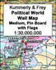
K+F 30M Political World Wall Map MEDIUM, PIN BOARD, WITHOUT FLAGS

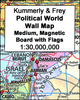
Political map of the world from Kümmerly+Frey, size 140 x 85cm /(55” x 33.5” approx) – on pin board, with countries in pleasant pastel colours against light blue seas, a presentation which will appeal to anyone who prefers gentler shades. Subtle relief shading with plenty of names of topographic features provides physical information.The map has English language place names throughout; countries, cities and all other features. Within USA, Canada, Brazil and Australia internal state or provincial boundaries are indicated. Principal road connections are shown, with main railway lines particularly easy to see against the background colouring. On oceans the map shows the extent of the ice shelf in the Polar Regions and main shipping lanes. Central Pacific, from Alaska/Siberia to
New Zealand, is repeated on both sides for better presentation of that region. Projection is van der Grinten. PLEASE NOTE: Kümmerly+Frey’s political maps of the world are published in two sizes (140x99cm /55 x39” approx or 190x112cm / 75”x 44 approx), available on paper, encapsulated and on pin board or magnetic board – PLEASE CLICK ON THE SERIES LINK TO SEE ALL THE OPTIONS.
RIP - This product is no longer available on our network. It was last seen on 25.09.2019

This page now acts as a permanent archive for this product. Add more information using the comments box below to ensure it can still be found by future generations.

Use our search facility to see if it is available from an alternative contributor.
  • Availability: Out Of Stock
  • Supplier: Stanfords
  • SKU: XL0000018530
Availability: In Stock
£175.00

Product Description

Political map of the world from Kümmerly+ Frey, size 140 x 85cm / (55” x 33.5” approx) – on pin board, with countries in pleasant pastel colours against light blue seas, a presentation which will appeal to anyone who prefers gentler shades. Subtle relief shading with plenty of names of topographic features provides physical information. The map has English language place names throughout; countries, cities & all other features. Within USA, Canada, Brazil & Australia internal state or provincial boundaries are indicated. Principal road connections are shown, with main railway lines particularly easy to see against the background colouring. On oceans the map shows the extent of the ice shelf in the Polar Regions & main shipping lanes. Central Pacific, from Alaska/ Siberia to New Zeal&, is repeated on both sides for better presentation of that region. Projection is van der Grinten. PLEASE NOTE: Kümmerly+ Frey’s political maps of the world are published in two sizes (140x 99cm /55 x 39” approx or 190x 112cm / 75”x 44 approx), available on paper, encapsulated & on pin board or magnetic board – PLEASE CLICK ON THE SERIES LINK TO SEE ALL THE OPTIONS.

Reviews/Comments

Add New

Intelligent Comparison

Oooops!
We couldn't find anything!
Perhaps this product's unique.... Or perhaps we are still looking for comparisons!
Click to bump this page and we'll hurry up.

Price History

Vouchers

No voucher codes found.
Do you know a voucher code for this product or supplier? Add it to Insights for others to use.

Facebook

Jargon Buster

Paper - A thin sheet mainly used for writing. Available in a variety of colours. Made mainly from wood pulp.
Ice - Frozen water, the solid state of water.
Blue - A primary colour
magnetic - A susbstance affected at a microscopic level by an applied magnetic field.
Brazil - A country in South America
Physical - Used to describe strength or visual properties of an item
Wall - A physical barrier between two areas
World - A physical grouping, commonly used to describe earth and everything associated with ti
Size - is the measurement of how big an object is in space.
Language - the method of communication used in different areas. Humans and computers have many different languages.
Road - a manmade lane or a path that is used to speed up travel.
Ice - Frozen water, Ice is cold to the touch and forms when water reaches 0 degrees centigrade.
Subtle - Something that is delicate and not to harsh, can be difficult to describe.
Language - The way humans communicate either written and spoken.

Supplier Information

Stanfords
Stanfords was established in 1853 and opened their iconic Covent Garden flagship store in 1901. They have become the top retailer of maps, travel books and accessories in the UK and arguably offer the largest selection of maps and travel books worldwide. Famous names such as Captain Robert Falcon Scott, Ranulph Fiennes and Michael Palin have purchased from Stanfords. They now have a shop in Bristol and both stores together with other venues operate a calendar of events including talks, book signings and exhibitions. As a specialist map retailer, the map selection is comprehensive and includes road maps, street maps and walking maps from worldwide destinations, as well as a selection of world atlases and wall maps. Books include travel guides and travel literature. Stanfords also stock globes, from miniatures made of blue marble to magnificent floor-standing globes. The website features a selection of interesting articles on travel topics.
Page Updated: 2023-11-12 20:15:36

Community Generated Product Tags

Oh No! The productWIKI community hasn't generated any tags for this product yet!
Menu