
 United Kingdom
 France
 Germany
 Netherlands
 Sweden
 USA
USA
 Italy
Italy
 Spain
Spain
More From Contributor

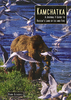


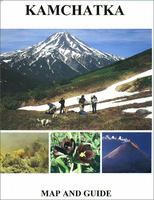
Kamchatka Map-Guide
Kamchatka south of latitude 58°N on a contoured topographic map at 1:1, 000, 000 from EWP, with enlargements for its four most visited areas, plus extensive notes on its geography, history, climate, and useful tourist information. All place names are in the Latin alphabet only.Coverage of the peninsula starts at 58°N. Relief is shown by contours, enhanced by shading and spot heights. Additional colouring and/or graphics indicate different types of terrain and vegetation (volcanic craters, lava flows, forests, etc), although the low-contrast of the print reproduction from the original Russian survey mapping makes some of the fine detail a little difficult to discern. Classification of the road network indicates unsurfaced, earth or winter roads passable when frozen. The map
also indicates the bathymetry of the surrounding seas, with the nearby Komandor Islands included on inset. Latitude and longitude lines are at 1° intervals.Four panels at larger scales show: Petropavlovsk Kamchatskii area (1:200, 000), Kronotsky Lake region (1:340, 000), Kliuchevskaya Sopka (1:200, 000) and Mutnovskaya Sopka (1:500, 000). Extensive additional information includes a list of abbreviations for geographical features and notes on the transliteration from Cyrillic alphabet with a pronunciation guide. Map legend and all the text are in English. Current edition of this title was published in 2003.
also indicates the bathymetry of the surrounding seas, with the nearby Komandor Islands included on inset. Latitude and longitude lines are at 1° intervals.Four panels at larger scales show: Petropavlovsk Kamchatskii area (1:200, 000), Kronotsky Lake region (1:340, 000), Kliuchevskaya Sopka (1:200, 000) and Mutnovskaya Sopka (1:500, 000). Extensive additional information includes a list of abbreviations for geographical features and notes on the transliteration from Cyrillic alphabet with a pronunciation guide. Map legend and all the text are in English. Current edition of this title was published in 2003.

Product Description
Reviews/Comments
Add New
Vouchers
No voucher codes found.
Do you know a voucher code for this product or supplier? Add it to Insights for others to use.
Do you know a voucher code for this product or supplier? Add it to Insights for others to use.
 Denmark