More From Contributor

£9.99
Greek island of Kalymnos on a light, waterproof & tear-resistant, contoured & GPS compatible map at 1:25, 000 from Terrain Editions, with a street plan of Kalymnos Town (Pothia) at 1:3, 500. The reverse side

Includes::
information on the island’s rock climbing sites, plus descriptions of 13 specially selected hiking trails. All place names are shown in both Greek & Latin alphabet. Map legend & all the text include English. Maps of the Greek islands from Terrain Editions have topography well presented by contours at 20m intervals (unless indicated differently in the map`s individual description), enhanced by spot heights, subtle relief shading & additional altitude colouring. Road network is very clearly graded according to width & the type of surface, distinguishing between good & rough dirt roads. Distances are marked on most small local roads, as well as locations of petrol stations and/or tyre repair workshops; scenic routes are highlighted. Each map also shows which ports are served by ferry services. Hiking paths are graded as main or narrow trails. National parks & other protected areas are marked & a wide range of symbols indicate various places of interest & recreational facilities, with main sights clearly highlighted. Most titles distinguish between sandy & pebble beaches; some also indicate beaches with natural shade and/or the type of sea bed. The maps have a UTM grid, plus latitude & longitude margin ticks. The reverse side of each title is covered by general information about the isl&, illustrated with colour photos. Many titles also include brief descriptions of recommended hiking trails and/or a street plan of the island’s main town, with colouring clearly showing various tourist facilities. To see the other titles in this series please click on the series link.

...
Archived Product
£13.99
The Kalymnos Trail is a multi-day 100km trekking route around the Greek island of Kalymnos in the South Aegean. The route links many of the more interesting places on the island: mountain tops & monasteries, cliffs & castles, beaches & Byzantine ruins. Trail passes through complex terrain & is best suited to those with experience of hiking & scrambling in mountain environments. This guide

Includes::
an introduction to the Kalymnian landscape, flora, fauna, history & archeological sites, with practical advice on hiking on the isl&. With a detailed description of The Kalymnos Trail in a series of 10 full-day or half-day hikes. Maps based on the Terrain 1:25 000 series & a description of 16 additional walks & hikes on the isl&.

...
Archived Product
£9.95
A double-side map presenting the Kamchatska oblast in two halves: the northern portion (from Ust-Kamchatsk to the northern border) is at the smaller scale of 1:1, 200, 000, the rest is at 1:800, 000. The Commander Islands are displayed in an inset. Road detail distinguishes paved & unpaved roads, & shows intermediate driving distances. Topographic details portrayed include swamps, waterfalls, glaciers, gullies, lava fields & volcanoes. General relief is shown by elevation tinting & spot heights for selected peaks. District boundaries are marked, also nature reserves & national parks. A range of symbols denote various features eg. hotels, post offices, campgrounds, archeological sites, natural curiosities, hospitals & helicopter excursion centes. Various recreational & wildlife observing localities are also indicated eg. fishing, rafting, seal colonies, diving sites. Latitude & longitude lines are drawn at 1 ...
Archived Product
£8.99
A ten-year-old boy lives in world of Superman comics & games of Risk
- a world in which men have superpowers & boys can conquer
...
Archived Product
£9.99
Kamchatka Peninsula at 1:1, 700, 000 on an indexed map at 1:1, 700, 000 from ITMB with an enlargement showing in greater detail the Valley of the Geysers, plus a street plan of Petropavlovsk-Kamchatsky. On the reverse is an indexed map showing a section of eastern Siberia at 1:3, 600, 000. All place names are in the Latin alphabet. On one side the Kamchatka administrative region is presented at 1:1, 700, 000 with altitude colouring plus names of mountain ranges, peaks etc, & plenty of spot heights (elevation in metres) showing its topography. Graphics indicate swamps, hot springs & geysers, glaciers, extinct volcanoes & lava fields, national parks, etc. The map shows the region’s network of main, secondary & selected other roads, indicating paved or unpaved, 4WD & winter only routes. Driving distances are marked on main routes. Symbols show local airports, locations with medical facilities, campgrounds, sport & recreational areas, etc. The map has latitude & longitude lines at 1º intervals & an index of towns marked on it. Adjoining panels show in greater detail the Valley of the Geysers, main traffic routes & selected facilities in Petropavlovsk-Kamchatsky, plus the administrative division of the Kamchatka Krai into districts. Also included are notes on the peninsula’s geography & volcanoes. On the reverse is a section of eastern Siberia shown at 1:3, 600, 000. Coverage starts just west of Chita & extends east to include Sakhalin Isl&. There is an overlap with the Kamchatka map along the northern coast of the Kamchatka Peninsula; the north-easternmost part of Chukotka is not included. Topography is presented by altitude colouring (elevation in feet) with names of mountain ranges. The map shows the region’s road network, railway lines (indicating Trans-Siberian, Baikal
- Amur, & Trans-Manchurian sections), & locations with air transport connections. Symbols highlight various places of interest. The map is indexed & has faint latitude & longitude lines at 5º intervals.
...
Archived Product
£13.95
Kamchatka Krai including the whole of the peninsula with on a large, double-sided topographic map from Roskartografia with enlargements at 1:200, 000 for the Kluchevskaya Sopka group & Shiveluch volcanoes. All place names in Cyrillic & a map legend is in Russian only. The map covers the area, including the Komandorski/ Commander Islands, at 1:1, 000, 000, dividing Kamchatka Peninsula north/south. Contours are at 100m or 200m intervals, with spot heights & additional graphics and/or colouring to show swamps, rocks, different types of forests, etc. Road network

Includes::
unsurfaced roads & indicates tracks passable only in winter. Internal administrative boundaries are marked & towns indicate their administrative status. Latitude & longitude lines are drawn at 1

...
Archived Product
£15.95
Kamchatka Peninsula with the rest of the Kamchatka Krai on double-sided topographic map at 1:1, 000, 000 from DV AGP, with an enlargement for the environs of Petropavlovsk-Kamchatsky, plus an administrative map of the region. All place names in Cyrillic & the map legend is in Russian only. The map covers the region, including the Komandorski/ Commander Islands shown on an inset, at 1:1, 000, 000, dividing Kamchatka Peninsula north/south. Contours are at 100m or 200m intervals, with spot heights & additional graphics and/or colouring to show swamps, rocks, different types of forests, etc. Road network

Includes::
unsurfaced roads & tracks, indicating those passable only in winter. Internal administrative boundaries are marked & towns indicate their administrative status. Latitude & longitude lines are drawn at 1º intervals.. All place names are in Cyrillic alphabet & map legend is in Russian only. The environs of Petropavlovsk-Kamchatsky are presented in greater detail at 1:200, 000, & another panel shows the Kamchatka Krai with their administrative subdivisions.IMPORTANT
- PLEASE NOTE BEFORE ORDERING: Supplies of all maps published in Russia are very irregular & we cannot guarantee a definite delivery time for titles not in stock. If a title is currently out of stock, it may be advisable to choose an alternative publication.


...
Archived Product
£9.95
Kamchatka south of latitude 58°N on a contoured topographic map at 1:1, 000, 000 from EWP, with enlargements for its four most visited areas, plus extensive notes on its geography, history, climate, & useful tourist information. All place names are in the Latin alphabet only. Coverage of the peninsula starts at 58°N. Relief is shown by contours, enhanced by shading & spot heights. Additional colouring and/or graphics indicate different types of terrain & vegetation (volcanic craters, lava flows, forests, etc), although the low-contrast of the print reproduction from the original Russian survey mapping makes some of the fine detail a little difficult to discern. Classification of the road network indicates unsurfaced, earth or winter roads passable when frozen. The map also indicates the bathymetry of the surrounding seas, with the nearby Komandor Islands included on inset. Latitude & longitude lines are at 1° intervals. Four panels at larger scales show: Petropavlovsk Kamchatskii area (1:200, 000), Kronotsky Lake region (1:340, 000), Kliuchevskaya Sopka (1:200, 000) & Mutnovskaya Sopka (1:500, 000). Extensive additional information

Includes::
a list of abbreviations for geographical features & notes on the transliteration from Cyrillic alphabet with a pronunciation guide. Map legend & all the text are in English. Current edition of this title was published in 2003.

...
Archived Product
£13.95
Kamchatka Oblast & Koriakskiy Autonomous Region Road Atlas in a series of detailed atlases of the administrative provinces of the Russian Federation from Roskartografia, with road information shown on a topographic base. Road network

Includes::
minor local roads, service stations, & distances between junctions. Colour coding distinguishes between federal roads & those which are the responsibility of local government. In many areas tracks & footpaths are included. The atlases also show railway lines, as well as inland waterways with locations of locks & the direction of the current. Cities & towns are marked according to the size of their population. Symbols indicate natural landmarks, post offices, hospitals & other facilities, museums, monuments, etc. Topography is shown by contours at 100m intervals & spot heights. Each atlas has an index &

Includes::
an administrative map of the region & a key to Russian road signs. In some atlases coverage is provided only for the areas with roads & not for the whole province. Please see individual descriptions or images of the area coverage supplied with each title. All place names are in the Cyrillic alphabet & the text, including map legends, is in Russian only. In this title: only the areas with roads are covered. Also included are basic street plans of Petropavlovsk-Kamchatskij at 1:70, 000 & Palana at 1:12, 000.IMPORTANT
- PLEASE NOTE BEFORE ORDERING: Supplies are very erratic & no delivery date can be guaranteed for titles currently not in stock. Also, we occasionally receive copies with different covers or in different sizes to those indicated on our website. But the cartography & basic information remains as described above.


...
Archived Product

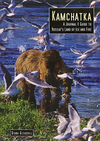
Kamchatka - A Journal And Guide To Russia`s Land Of Ice And Fire

Kamchatka in the Odyssey Guides series; aimed at travellers particularly interested in the culture and history of their destination; the guides focus on the atmosphere, customs, and distinctive character of a country, region or city. As the only English language publisher based in China, Odyssey Guides specialize in Asian destinations, relying on the expertise of local writers. This gives readers more of an insider’s perspective, in companion with the practicalities of navigating through remote Asian landscapes. Each title is heavily dedicated to the culture of the destination, all with accompanying colour photography. The guides also showcase a range of literary excerpts which are taken from travel writers together with translations from the work of indigenous writers and poets,
creating a distinctive tone unique to the publisher. There are also basic overview location maps and concise practical advice for visitors, including information on getting there and around, itineraries, climate, health, clothing and equipment, money, photography, communications, security, shopping, media, food and drink, holidays and behavior, customs and etiquette.
RIP - This product is no longer available on our network. It was last seen on 25.09.2019

This page now acts as a permanent archive for this product. Add more information using the comments box below to ensure it can still be found by future generations.

Use our search facility to see if it is available from an alternative contributor.
  • Availability: Out Of Stock
  • Supplier: Stanfords
  • SKU: 9789622177802
Availability: In Stock
£15.95

Product Description

Kamchatka in the Odyssey Guides series; aimed at travellers particularly interested in the culture & history of their destination; the guides focus on the atmosphere, customs, & distinctive character of a country, region or city. As the only English language publisher based in China, Odyssey Guides specialize in Asian destinations, relying on the expertise of local writers. This gives readers more of an insider’s perspective, in companion with the practicalities of navigating through remote Asian landscapes. Each title is heavily dedicated to the culture of the destination, all with accompanying colour photography. The guides also showcase a range of literary excerpts which are taken from travel writers together with translations from the work of indigenous writers & poets, creating a distinctive tone unique to the publisher. There are also basic overview location maps & concise practical advice for visitors, including information on getting there & around, itineraries, climate, health, clothing & equipment, money, photography, communications, security, shopping, media, food & drink, holidays & behavior, customs & etiquette.

Reviews/Comments

Add New

Intelligent Comparison

Oooops!
We couldn't find anything!
Perhaps this product's unique.... Or perhaps we are still looking for comparisons!
Click to bump this page and we'll hurry up.

Price History

Vouchers

No voucher codes found.
Do you know a voucher code for this product or supplier? Add it to Insights for others to use.

Facebook

Jargon Buster

Ice - Frozen water, the solid state of water.
History - Anything that happens in the past. An acedemic subject.
Colour - The categorised spectrum of light visable to humans
Fire - the release of energy through heat and light.
Language - the method of communication used in different areas. Humans and computers have many different languages.
Ice - Frozen water, Ice is cold to the touch and forms when water reaches 0 degrees centigrade.
Equipment - A product or good that is tactile.
Practical - Weather a task is easy to carry out and realistically succeed.
Language - The way humans communicate either written and spoken.

Supplier Information

Stanfords
Stanfords was established in 1853 and opened their iconic Covent Garden flagship store in 1901. They have become the top retailer of maps, travel books and accessories in the UK and arguably offer the largest selection of maps and travel books worldwide. Famous names such as Captain Robert Falcon Scott, Ranulph Fiennes and Michael Palin have purchased from Stanfords. They now have a shop in Bristol and both stores together with other venues operate a calendar of events including talks, book signings and exhibitions. As a specialist map retailer, the map selection is comprehensive and includes road maps, street maps and walking maps from worldwide destinations, as well as a selection of world atlases and wall maps. Books include travel guides and travel literature. Stanfords also stock globes, from miniatures made of blue marble to magnificent floor-standing globes. The website features a selection of interesting articles on travel topics.
Page Updated: 2023-11-12 20:15:36

Community Generated Product Tags

Oh No! The productWIKI community hasn't generated any tags for this product yet!
Menu