
 United Kingdom
 France
 Germany
 Netherlands
 Sweden
 USA
USA
 Italy
Italy
 Spain
Spain
More From Contributor


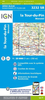
La Tablas De Daimiel National Park 25K CNIG Map/Guide
La Tablas de Daimiel National Park north of Ciudad Real on a large, double-sided, contoured and GPS compatible map at 1:25, 000 on a from IGN/CNIG with cartography from their topographic survey of Spain. The central part of the map, the swamps between the Guadiana and Gigüela Rivers, is shown enlarged on a satellite image indicating access from car park and the Information Centre to bird watching sites. The map is accompanied by a 47 page Spanish language guide with descriptions of four walks, contact details for recommended accommodation, etc. The map has contours at 10m intervals enhanced by relief shading, plus colouring and graphics to show different types of vegetation. Hiking trails are highlighted, indicating routes which are described in the guide. A wide range of symbols
indicate various facilities and places of interest, including different types of accommodation (campsites, refuges, etc), restaurants, sites for other recreational pursuits (climbing, caving, paragliding, etc), petrol stations, bus connections, etc. The map has a 1km UTM grid and margin ticks for latitude and longitude. Map legend is in Spanish only.To see other titles in this series please click on the series link.
indicate various facilities and places of interest, including different types of accommodation (campsites, refuges, etc), restaurants, sites for other recreational pursuits (climbing, caving, paragliding, etc), petrol stations, bus connections, etc. The map has a 1km UTM grid and margin ticks for latitude and longitude. Map legend is in Spanish only.To see other titles in this series please click on the series link.
Product Description
Reviews/Comments
Add New
Vouchers
No voucher codes found.
Do you know a voucher code for this product or supplier? Add it to Insights for others to use.
Do you know a voucher code for this product or supplier? Add it to Insights for others to use.
 Denmark