
 United Kingdom
 France
 Germany
 Netherlands
 Sweden
 USA
USA
 Italy
Italy
 Spain
Spain
More From Contributor


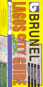
Lagos
Large, indexed street plan Lagos, with more detailed coverage of Ikeja district, Victoria Island and Lagos island. On the main map at 1;35, 000 coverage extends from Victoria Island in the south-east to Abule-Egba district in the north-west and thus comfortably includes the international airport. Main roads are named, as are districts, and selected locations are indicated e.g. hospitals, estates and markets. The map is indexed for streets and districts.The inset of Ikeja at 1:21, 000 shows access to the airport and, like the Victoria and Lagos Islands, Lekki & Ikoyi map on the reverse, includes symbols indicating various government offices and other public buildings, embassies, police stations, hospitals and clinics, taxi ranks, shopping centres and markets, hotels,
restaurants and petrol stations. The islands area map (1:20, 000, see cartography sample) is indexed for streets and various other locations, e.g. commercial premises, federal offices, hotels and restaurants, police stations, hospitals and petrol stations.
restaurants and petrol stations. The islands area map (1:20, 000, see cartography sample) is indexed for streets and various other locations, e.g. commercial premises, federal offices, hotels and restaurants, police stations, hospitals and petrol stations.

Product Description
Reviews/Comments
Add New
Intelligent Comparison
Archived Product
Laos Stanfords
£9.50
Archived Product
Laos Stanfords
£11.19
Archived Product
Laos Stanfords
£11.19
Archived Product
Laos Stanfords
£8.99
Archived Product

Vagos Stanfords
£17.99
Archived Product

Vagos Stanfords
£17.99
Archived Product
Lamego Stanfords
£17.99
Archived Product
Lamego Stanfords
£17.99
Vouchers
No voucher codes found.
Do you know a voucher code for this product or supplier? Add it to Insights for others to use.
Do you know a voucher code for this product or supplier? Add it to Insights for others to use.
 Denmark