More From Contributor

£20.50
Le Nord à pied, FFRP Topo-guide Ref. No. D059, with 41 day walks of varying length & difficulty in the department Le Nord, stretching along the Belgian border from the coast near Dunkerque, past Lille & Valenciennes, to Cambrai & Avesnes-sur-Helpe. Current edition of this title was published in November 2009. To see the list of other FFRP guides with day walks please click on the series link.ABOUT THE FFRP (Fédération française de la randonnée pédestre) TOPOGUIDES: published in a handy A5 paperback format, the guides are the best companions for hiking in France. In addition to their topo-guides to the long-distance GR routes FFRP also publish an extensive range of guides with local day walks. Each walk in presented on a colour extract from IGN`s 1:50, 000 or 1:25, 000 topographic survey mapping overprinted with the route, with important points cross-referenced to the accompanying text, in French only, placed on the adjoining page. For each walk the guides also indicate the degree of difficulty & provide information on length, time & change in altitude, waymarking signs, access by road & parking facilities. An “info practiques” section of the guide indicates where shops, restaurants & accommodation can be found. The guides are published on high quality paper & include descriptions of the most interesting aspects of the surrounding region: historical & cultural sites, local specialties, fauna & flora, etc, all illustrated with colour photos. ...
Archived Product
£11.50
Topographic survey of France at 1:25, 000 in IGN`s excellent TOP25 / Série Bleue series. All the maps are GPS compatible, with a 1km UTM grid plus latitude & longitude lines at 5’ intervals. Contours are at 5m intervals except for mountainous areas where the maps have contours at 10m intervals, vividly enhanced by hill shading & graphics for rocky terrain. Colouring with graphics indicates different types of vegetation or land use (deciduous or coniferous forests, moors, orchards, vineyards, etc). PLEASE NOTE: coverage of France at this scale is currently being revised – the format & the presentation of each title are indicated by the letters at the end of its Sheet Reference number (e.g. 0416ET, 3531ETR, 1923SB, etc.)MAPS WITH FULL TOURIST OVERPRINT & AN ENGLISH MAP LEGEND: all TOP25 maps & the SB editions of Série Bleue have an overprint highlighting waymarked walking trails including long-distance GR routes &, where appropriate, ski routes. Symbols indicate campsites, gîtes d’etape, refuges, equestrian centres & other recreational facilities or sites, tourist information centres, cultural heritage, etc. Towns & locations of particular interest are highlighted.- ET or OT = single-sided TOP25 map covering approx. 29x 21 km / 18x 13 miles.- ETR or OTR = waterproof & tear resistant TOP25 map covering the same area as the corresponding ET or OT number, but double-sided, printed on a smaller size sheet with a good overlap between the sides.- SB = Série Bleue map with full tourist overprint; these maps, first introduced in summer 2014, each cover approx. 29x 24km / 18x 15 miles.SÉRIE BLEUE maps with numbers ending in E (Est) or O (Ouest): most editions now indicate the GR routes, but do not show any other tourist information. Map legend is in French only. Each map covers approx. 14x 20km / 9x 12 miles. ...
Archived Product
£25.00
Le Pain"idien Cookbook presents over 100 recipes for simple, elegant boulangerie fare
- handmade bread, breakfast, tartines,
...
Archived Product
£20.50
Le Parc de l` Avesnois à pied, FFRP topo-guide Ref. No. PN07, with 26 walks of varying length & difficulty, plus 360km of local GR de Pays routes. Current edition of this title was published in January 2007. To see the list of other FFRP guides with day walks please click on the series link.ABOUT THE FFRP (Fédération française de la randonnée pédestre) TOPOGUIDES: published in a handy A5 paperback format, the guides are the best companions for hiking in France. In addition to their topo-guides to the long-distance GR routes FFRP also publish an extensive range of guides with local day walks. Each walk in presented on a colour extract from IGN`s 1:50, 000 or 1:25, 000 topographic survey mapping overprinted with the route, with important points cross-referenced to the accompanying text, in French only, placed on the adjoining page. For each walk the guides also indicate the degree of difficulty & provide information on length, time & change in altitude, waymarking signs, access by road & parking facilities. An “info practiques” section of the guide indicates where shops, restaurants & accommodation can be found. The guides are published on high quality paper & include descriptions of the most interesting aspects of the surrounding region: historical & cultural sites, local specialties, fauna & flora, etc, all illustrated with colour photos. ...
Archived Product
£20.50
Le Parc de Millevaches en Limousin à pied, topo-guide Ref. No. PN017, with 18 day walks of varying length & difficulty, plus 270kms of hiking circuits in the department of Creuse. Current edition of this title was published in March 2011. To see the list of other FFRP guides with day walks please click on the series link.ABOUT THE FFRP (Fédération française de la randonnée pédestre) TOPOGUIDES: published in a handy A5 paperback format, the guides are the best companions for hiking in France. In addition to their topo-guides to the long-distance GR routes FFRP also publish an extensive range of guides with local day walks. Each walk in presented on a colour extract from IGN`s 1:50, 000 or 1:25, 000 topographic survey mapping overprinted with the route, with important points cross-referenced to the accompanying text, in French only, placed on the adjoining page. For each walk the guides also indicate the degree of difficulty & provide information on length, time & change in altitude, waymarking signs, access by road & parking facilities. An “info practiques” section of the guide indicates where shops, restaurants & accommodation can be found. The guides are published on high quality paper & include descriptions of the most interesting aspects of the surrounding region: historical & cultural sites, local specialties, fauna & flora, etc, all illustrated with colour photos. ...
Archived Product
£20.99
Le Parc du Lubéron à pied, FFRP topo-guide Ref. No. PN01, with 27 day walks of varying length & difficulty in the Natural Park around Apt, Folcalquier & Manosque. Each walk is presented on a separate colour extract from IGN’s topographic survey of France at 1:25, 000, with its description cross-referenced to the map. Current edition of this title was published in May 2015. To see the list of other FFRP guides with day walks please click on the series link.ABOUT THE FFRP (Fédération française de la randonnée pédestre) TOPOGUIDES: published in a handy A5 paperback format, the guides are the best companions for hiking in France. In addition to their topo-guides to the long-distance GR routes FFRP also publish an extensive range of guides with local day walks. Each walk in presented on a colour extract from IGN`s 1:50, 000 or 1:25, 000 topographic survey mapping overprinted with the route, with important points cross-referenced to the accompanying text, in French only, placed on the adjoining page. For each walk the guides also indicate the degree of difficulty & provide information on length, time & change in altitude, waymarking signs, access by road & parking facilities. An “info practiques” section of the guide indicates where shops, restaurants & accommodation can be found. The guides are published on high quality paper & include descriptions of the most interesting aspects of the surrounding region: historical & cultural sites, local specialties, fauna & flora, etc, all illustrated with colour photos. ...
Archived Product
£20.50
Le Parc d` Armorique à pied, FFRP topo-guide Ref. No. PN12, with 43 day walks of varying length & difficulty in western Brittany. Current edition of this title was published in March 2016. To see the list of other FFRP guides with day walks please click on the series link.ABOUT THE FFRP (Fédération française de la randonnée pédestre) TOPOGUIDES: published in a handy A5 paperback format, the guides are the best companions for hiking in France. In addition to their topo-guides to the long-distance GR routes FFRP also publish an extensive range of guides with local day walks. Each walk in presented on a colour extract from IGN`s 1:50, 000 or 1:25, 000 topographic survey mapping overprinted with the route, with important points cross-referenced to the accompanying text, in French only, placed on the adjoining page. For each walk the guides also indicate the degree of difficulty & provide information on length, time & change in altitude, waymarking signs, access by road & parking facilities. An “info practiques” section of the guide indicates where shops, restaurants & accommodation can be found. The guides are published on high quality paper & include descriptions of the most interesting aspects of the surrounding region: historical & cultural sites, local specialties, fauna & flora, etc, all illustrated with colour photos. ...
Archived Product
£17.99
L` Aveyron à pied, FFRP topo-guide Ref. No.D012, with 50 day walks of varying length & difficulty throughout the department of Ayveron. Each walk is presented on a separate colour extract from IGN’s topographic survey of France at 1:25, 000, with its description cross-referenced to the map. Current edition of this title was published in February 2015. To see the list of other FFRP guides with day walks please click on the series link.ABOUT THE FFRP (Fédération française de la randonnée pédestre) TOPOGUIDES: published in a handy A5 paperback format, the guides are the best companions for hiking in France. In addition to their topo-guides to the long-distance GR routes FFRP also publish an extensive range of guides with local day walks. Each walk in presented on a colour extract from IGN`s 1:50, 000 or 1:25, 000 topographic survey mapping overprinted with the route, with important points cross-referenced to the accompanying text, in French only, placed on the adjoining page. For each walk the guides also indicate the degree of difficulty & provide information on length, time & change in altitude, waymarking signs, access by road & parking facilities. An “info practiques” section of the guide indicates where shops, restaurants & accommodation can be found. The guides are published on high quality paper & include descriptions of the most interesting aspects of the surrounding region: historical & cultural sites, local specialties, fauna & flora, etc, all illustrated with colour photos. ...
Archived Product
£20.99
Le parc naturel régional Normandie Maine à pied, FFRP topo-guide Ref. No. PN21, with 33 day walks of varying length & difficulty in the park. Each walk is presented on a separate colour extract from IGN’s topographic survey of France at 1:25, 000, with its description cross-referenced to the map. Current edition of this title was published in May 2015. To see the list of other FFRP guides with day walks please click on the series link.ABOUT THE FFRP (Fédération française de la randonnée pédestre) TOPOGUIDES: published in a handy A5 paperback format, the guides are the best companions for hiking in France. In addition to their topo-guides to the long-distance GR routes FFRP also publish an extensive range of guides with local day walks. Each walk in presented on a colour extract from IGN`s 1:50, 000 or 1:25, 000 topographic survey mapping overprinted with the route, with important points cross-referenced to the accompanying text, in French only, placed on the adjoining page. For each walk the guides also indicate the degree of difficulty & provide information on length, time & change in altitude, waymarking signs, access by road & parking facilities. An “info practiques” section of the guide indicates where shops, restaurants & accommodation can be found. The guides are published on high quality paper & include descriptions of the most interesting aspects of the surrounding region: historical & cultural sites, local specialties, fauna & flora, etc, all illustrated with colour photos. ...
Archived Product
£13.99
Le Parc du Pilat à pied, FFRP topo-guide Ref. No. PN05, with 22 day walks of varying length & difficulty in the regional park between St. Etienne & the Rhone. Each walk is presented on a separate colour extract from IGN’s topographic survey of France at 1:25, 000 and/or 1:50, 000, with its description cross-referenced to the map. Current edition of this title was published in April 2014.ABOUT THE FFRP (Fédération française de la randonnée pédestre) TOPOGUIDES: published in a handy A5 paperback format, the guides are the best companions for hiking in France. In addition to their topo-guides to the long-distance GR routes FFRP also publish an extensive range of guides with local day walks. Each walk in presented on a colour extract from IGN`s 1:50, 000 or 1:25, 000 topographic survey mapping overprinted with the route, with important points cross-referenced to the accompanying text, in French only, placed on the adjoining page. For each walk the guides also indicate the degree of difficulty & provide information on length, time & change in altitude, waymarking signs, access by road & parking facilities. An “info practiques” section of the guide indicates where shops, restaurants & accommodation can be found. The guides are published on high quality paper & include descriptions of the most interesting aspects of the surrounding region: historical & cultural sites, local specialties, fauna & flora, etc, all illustrated with colour photos. ...
Archived Product

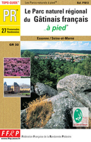
Le Parc Du Gâtinais à Pied FFRP Topo-guide No. PN13

Le Parc du Gâtinais à pied, FFRP topo-guide ref. no. PN13, one of the titles in an extensive series of light, A5-size, high quality paperback guides published by the Fédération Française de la Randonnée Pédestre in association with local authorities, ramblers’ clubs, etc. The guides have *colour extracts from the French topographic survey at 1:25, 000 or 1:50, 000 overprinted with local hiking routes*. Each guide offers a selection of day walks of different length and difficulty of terrain, all clearly graded. *Several titles also include a section of a long-distance GR route or a shorter GRP (GR de Pays) route or circuit.*The descriptions provide information on various places of interest along the routes and directions for special points marked on the accompanying maps.
*All the text is in French*, but there is also a fair amount of information conveyed by symbols: waymarking, parking facilities, villages with local shops, cafes and restaurants, etc. Most guides have numerous colour photos and drawings of local flora and fauna.Guides with day walks are indicated on the accompanying series grid by yellow or blue boxes.*In this guide:* 28 day walks of varying length and difficulty.
RIP - This product is no longer available on our network. It was last seen on 25.09.2019

This page now acts as a permanent archive for this product. Add more information using the comments box below to ensure it can still be found by future generations.

Use our search facility to see if it is available from an alternative contributor.
  • External links may include paid for promotion
  • Availability: Out Of Stock
  • Supplier: Stanfords
  • SKU: 9782751400148
Availability: In Stock
£20.50

Product Description

Le Parc du Gâtinais à pied, FFRP topo-guide ref. no. PN13, one of the titles in an extensive series of light, A5-size, high quality paperback guides published by the Fédération Française de la Randonnée Pédestre in association with local authorities, ramblers’ clubs, etc. The guides have *colour extracts from the French topographic survey at 1:25, 000 or 1:50, 000 overprinted with local hiking routes*. Each guide offers a selection of day walks of different length & difficulty of terrain, all clearly graded. * Several titles also include a section of a long-distance GR route or a shorter GRP (GR de Pays) route or circuit.* The descriptions provide information on various places of interest along the routes & directions for special points marked on the accompanying maps. * All the text is in French*, but there is also a fair amount of information conveyed by symbols: waymarking, parking facilities, villages with local shops, cafes & restaurants, etc. Most guides have numerous colour photos & drawings of local flora & fauna. Guides with day walks are indicated on the accompanying series grid by yellow or blue boxes.* In this guide:* 28 day walks of varying length & difficulty.

Reviews/Comments

Add New

Intelligent Comparison

Oooops!
We couldn't find anything!
Perhaps this product's unique.... Or perhaps we are still looking for comparisons!
Click to bump this page and we'll hurry up.

Price History

Vouchers

No voucher codes found.
Do you know a voucher code for this product or supplier? Add it to Insights for others to use.

Facebook

Jargon Buster

Hiking - An outdoor activity envolving walking in nature
Blue - A primary colour
Yellow - A primary colour. The sun is often described as yellow
Colour - The categorised spectrum of light visable to humans
Day - The time it takes a planet or other space objects to complete one rotation.
Quality - An object that has quality is superior in function and finish than a less quality object.
Size - is the measurement of how big an object is in space.

Supplier Information

Stanfords
Stanfords was established in 1853 and opened their iconic Covent Garden flagship store in 1901. They have become the top retailer of maps, travel books and accessories in the UK and arguably offer the largest selection of maps and travel books worldwide. Famous names such as Captain Robert Falcon Scott, Ranulph Fiennes and Michael Palin have purchased from Stanfords. They now have a shop in Bristol and both stores together with other venues operate a calendar of events including talks, book signings and exhibitions. As a specialist map retailer, the map selection is comprehensive and includes road maps, street maps and walking maps from worldwide destinations, as well as a selection of world atlases and wall maps. Books include travel guides and travel literature. Stanfords also stock globes, from miniatures made of blue marble to magnificent floor-standing globes. The website features a selection of interesting articles on travel topics.
Page Updated: 2023-11-12 20:15:36

Community Generated Product Tags

Oh No! The productWIKI community hasn't generated any tags for this product yet!
Menu