
 United Kingdom
 France
 Germany
 Netherlands
 Sweden
 USA
USA
 Italy
Italy
 Spain
Spain
More From Contributor


Longitude
The tenth anniversary edition of the dramatic human story of an epic scientific quest: the search for the solution of how to calculate longitude and the unlikely triumph of an English genius. With a new Foreword by the celebrated astronaut Neil Armstrong. `Sobel has done the impossible and made horology sexy -- no mean feat` New Scientist Anyone alive in the 18th century would have known that `the longitude problem` was the thorniest scientific dilemma of the day - and had been for centuries. Lacking the ability to measure their longitude, sailors throughout the great ages of exploration had been literally lost at sea as soon as they lost sight of land. Thousands of lives, and the increasing fortunes of nations, hung on a resolution. The quest for a solution had occupied scientists and
their patrons for the better part of two centuries when, in 1714, Parliament upped the ante by offering a king`s ransom (GBP20, 000) to anyone whose method or device proved successful. Countless quacks weighed in with preposterous suggestions. The scientific establishment throughout Europe -- from Galileo to Sir Isaac Newton -- had mapped the heavens in both hemispheres in its certain pursuit of a celestial answer. In stark contrast, one man, John Harrison, dared to imagine a mechanical solution. Full of heroism and chicanery, brilliance and the absurd, Longitude is also a fascinating brief history of astronomy, navigation and clockmaking.
their patrons for the better part of two centuries when, in 1714, Parliament upped the ante by offering a king`s ransom (GBP20, 000) to anyone whose method or device proved successful. Countless quacks weighed in with preposterous suggestions. The scientific establishment throughout Europe -- from Galileo to Sir Isaac Newton -- had mapped the heavens in both hemispheres in its certain pursuit of a celestial answer. In stark contrast, one man, John Harrison, dared to imagine a mechanical solution. Full of heroism and chicanery, brilliance and the absurd, Longitude is also a fascinating brief history of astronomy, navigation and clockmaking.

Product Description
Reviews/Comments
Add New
Intelligent Comparison
Archived Product
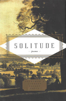
Solitude Stanfords
£9.99
Vouchers
No voucher codes found.
Do you know a voucher code for this product or supplier? Add it to Insights for others to use.
Do you know a voucher code for this product or supplier? Add it to Insights for others to use.
 Denmark