
 United Kingdom
 France
 Germany
 Netherlands
 Sweden
 USA
USA
 Italy
Italy
 Spain
Spain
More From Contributor


Longton West 1898
Longton West in 1898 in a fascinating series of reproductions of old Ordnance Survey plans in the Alan Godfrey Editions, ideal for anyone interested in the history of their neighbourhood or family. The map covers the western part of Longton, including the Dresden area. Coverage stretches from Vauxhall Street and Rosslyn Road westward to Longton Mill and from Longton station southward to Queens Park. Features include the Cemetery, Dresden area with streets of small terraces, Blurton Green Farm, St Paul`s church, Town Hall, tramways, potteries and earthenware manufactories, Longton Hall Colliery, Longton Hall, Swingle Hill, disused iron works, mineral lines, Blurton Tileries, Hollybush Farm, etc. On the reverse are directory extracts including a Dresden & Florence
Alphabetical List for 1892-3.About the Alan Godfrey Editions of the 25” OS Series:Selected towns in Great Britain and Ireland are covered by maps showing the extent of urban development in the last decades of the 19th and early 20th century. The plans have been taken from the Ordnance Survey mapping and reprinted at about 15 inches to one mile (1:4, 340). On the reverse most maps have historical notes and many also include extracts from contemporary directories. Most maps cover about one mile (1.6kms) north/south, one and a half miles (2.4kms) across; adjoining sheets can be combined to provide wider coverage.FOR MORE INFORMATION AND A COMPLETE LIST OF ALL AVAILABLE TITLES PLEASE CLICK ON THE SERIES LINK.
Alphabetical List for 1892-3.About the Alan Godfrey Editions of the 25” OS Series:Selected towns in Great Britain and Ireland are covered by maps showing the extent of urban development in the last decades of the 19th and early 20th century. The plans have been taken from the Ordnance Survey mapping and reprinted at about 15 inches to one mile (1:4, 340). On the reverse most maps have historical notes and many also include extracts from contemporary directories. Most maps cover about one mile (1.6kms) north/south, one and a half miles (2.4kms) across; adjoining sheets can be combined to provide wider coverage.FOR MORE INFORMATION AND A COMPLETE LIST OF ALL AVAILABLE TITLES PLEASE CLICK ON THE SERIES LINK.

Product Description
Reviews/Comments
Add New
Intelligent Comparison
Archived Product
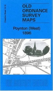
Poynton West 1896 Stanfords
£3.50
Archived Product

Darlington West 1898 Stanfords
£3.50
Archived Product
London West 1920 Stanfords
£7.99
Archived Product

Longton East 1922 Stanfords
£3.50
Archived Product
London West 1805-1822 Stanfords
£7.99
Archived Product
London West 1897-1909 Stanfords
£7.99
Archived Product
Denton West 1916 Stanfords
£2.95
Archived Product

Denton West 1916 Stanfords
£3.50
Vouchers
No voucher codes found.
Do you know a voucher code for this product or supplier? Add it to Insights for others to use.
Do you know a voucher code for this product or supplier? Add it to Insights for others to use.
 Denmark