More From Contributor

£9.99
Magenta Bobble Filtered Water Bottle: Bobble water bottles provide a chic & self filtering way for you to take better tasting & healthier drinking water with you when you're on the move at home or when away travelling. The integral carbon based filter is proven to last you 300 fills of the bottle and/or should be replaced after 2 months or 40 gallons/150 litres of liquid. This product is made from recycled PET (RPET) & it 100% recyclable. It meets & exceeds NSF International Standard 42 for chlorine, taste & odour reduction. Do not use where water is microbiologically unsafe. Bobble bottles are not dishwasher safe. Replacement filters are also available from Stanfords. ...
Archived Product
£12.99
Map No. 1292, Maggia, in the topographic survey of Switzerland at 1:25, 000 from Bundesamt für Landestopographie (swisstopo), covering the whole country on 247 small format sheets, with special larger maps published for popular regions including some titles now available in hiking versions. Highly regarded for their superb use of graphic relief & hill shading, the maps give an almost 3-D picture of Switzerland`s mountainous terrain. Contours are at 10 m intervals, with 20m intervals in the mountainous areas. All the maps have a 1-km grid for Swiss national coordinates (datum CH 1903). * Small format sheets (Nos. 1011
- 1374)* Map legend in the language of the area covered by the map. Additional margin ticks show latitude & longitude in steps of 2`. The area covered by each map is 17 x 12 km (11 x 7 miles approx). * Special larger sheets (Nos. from 2501 onwards) – STANDARD editions:* No map legend is included but a separate leaflet can be provided instead. The area covered by each map is 25 x 17 km (15 x 11 miles approx).* Special larger sheets (Nos. from 2501 onwards) – HIKING editions:* An overprint highlights hiking, mountain & alpine paths, including regional & national long-distance trails. The maps also show bus routes with bus stops, plus inns in remote locations. The area covered by each map is 25 x 17 km (15 x 11 miles approx).
...
Archived Product
£9.99
From the bard of the Beat Generation, Jack Kerouac`s Maggie Cassidy is an autobiographical novel of young love, published in Penguin Modern Classics. Though publishers stopped Maggie Cassidy`s Jack Duluoz & On the Road`s Sal Paradise from sharing the same name, Kerouac meant the books to be two parts of the same life. While On the Road made Paradise (and Kerouac) a hero for generations to come of the disaffected & restless, Maggie Cassidy is an affectionate portrait of the teenager that made the man
- of friendship & first love growing up in a New England mill town. Duluoz is a high school athletics & football star who meets Maggie Cassidy & begins a devoted, inconstant, tender adolescent love affair. It is one of the most sustained, poetic pieces of Kerouac`s `spontaneous prose`. Jack Kerouac (1922-69) was an American novelist, poet, artist & part of the Beat Generation. His first published novel, The Town & the City, appeared in 1950, but it was On the Road, published in 1957, that made Kerouac famous. Publication of his many other books followed, among them The Subterraneans, Big Sur, & The Dharma Bums. Kerouac died in Florida at the age of forty-seven. If you enjoyed Maggie Cassidy, you might like Kerouac`s The Subterraneans & Pic, also available in Penguin Modern Classics.
...
Archived Product
£8.99
` Coveney is the only writer who could get under Smith`s skin, capturing her steeliness & vulnerability` INDEPENDENT ON SUNDAY From her days as a star of West End comedy & revue, Dame Maggie`s path has led to international renown & numerous accolades including two Academy Awards. Recently she has been as prominent on our screens as ever, with high-profile roles as the formidable Dowager Countess of Grantham in DOWNTON ABBEY, as Professor Minerva Mc Gonagall in the HARRY POTTER movie franchise & as the eccentric Miss Shepherd in the film version of THE LADY IN THE VAN by Alan Bennett. Paradoxically she remains an enigmatic figure, rarely appearing in public & carefully guarding her considerable talent. Drawing on personal archives, interviews & encounters with the actress, as well as conversations with immediate family & dear friends, Michael Coveney`s biography is a captivating portrait of the real Maggie Smith. ...
Archived Product
£10.99
This title is shortlisted for the Carnegie Medal & a 2012 Costa Award winner. Narrated against the backdrop of a ruthless regime determined to beat its enemies in the race to the moon, Magoot Moon is the stunning new novel from award-winning author Sally Gardner. When his best friend Hector is suddenly taken away, Standish Treadwell realises that it is up to him, his grandfather & a small band of rebels to confront & defeat the ever-present oppressive forces of the Motherl&. Utterly original & stunning, it is impossible not to be moved by Magoot Moon`s powerful story & the unforgettable heroism of Standish. ...
Archived Product
£3.50
Maghera & District in 1900 in the Alan Godfrey Edition of historical Ordnance Survey mapping at one inch to one mile. The map is split between Counties Londonderry & Antrim, & covers the area from Maghera & Tobermore eastward to Gracehill & northward to Kilrea. Features include the towns or villages of Ahogill, Kilrea, Maghera, Portglenone & Tobermore, the Moravian settlement of Gracehill, the old Central Derry railway through Maghera, etc. On the reverse is a more detailed map of the centre of Maghera. On the reverse is a detailed village plan for Derrygonnelly, showing the houses lined along the main (only) street; also St Michael`s RC chapel, Fair Green, ruined church, creamery, plus a short directory of the village. The introduction by Séamas Mac Annaidh is in both English & Irish. * About Alan Godfrey Editions of OS 1” to 1 mile maps of Ireland:* The maps provide an invaluable overview of a wider area, typically 18 x 12 miles (29 x 19kms approx.), & offer historical mapping for small villages not covered by the more detailed series for which the Godfrey Editions are better known. All the maps include historical notes & all, unless indicated in the individual description, also include a large scale map of a small town or village in the area. ...
Archived Product
£2.95
Maghull South in 1906 in a fascinating series of reproductions of old Ordnance Survey plans in the Alan Godfrey Editions, ideal for anyone interested in the history of their neighbourhood or family. Selected towns in Great Britain & Ireland are covered by maps showing the extent of urban development in the last decades of the 19th & early 20th century. In this title: the map covers an area that was largely rural, including the southern part of Maghull. Part of the village is in the top right quarter of the map, including Maghull station, Great Mogul Hotel, Kensington Farm, Kennessee Green, Maghull Hall, St George's RC church, Leeds & Liverpool Canal. Coverage extends westward to Old Race Course Farm, Broadwood House, Wood End Farm, Brook House Farm (lower left corner) & a stretch of the Cheshire Lines Railway with Sefton & Maghull station. On the reverse are directories of Maghull in 1905 & 1918, plus a section of James Sherriff's map of the area in 1823. About the Alan Godfrey Editions of the 25 ...
Archived Product
£3.50
Maghull South in 1906 in a fascinating series of reproductions of old Ordnance Survey plans in the Alan Godfrey Editions, ideal for anyone interested in the history of their neighbourhood or family. The map covers an area that was largely rural, with the southern part of Maghull in the top right quarter, including Maghull station, Great Mogul Hotel, Kensington Farm, Kennessee Green, Maghull Hall, St George`s RC church, Leeds & Liverpool Canal, etc. Coverage extends westward to Old Race Course Farm, Broadwood House, Wood End Farm, Brook House Farm (lower left corner) & a stretch of the Cheshire Lines Railway with Sefton & Maghull station. On the reverse are directories of Maghull in 1905 & 1918, plus a section of James Sherriff`s map of the area in 1823. About the Alan Godfrey Editions of the 25” OS Series: Selected towns in Great Britain & Ireland are covered by maps showing the extent of urban development in the last decades of the 19th & early 20th century. The plans have been taken from the Ordnance Survey mapping & reprinted at about 15 inches to one mile (1:4, 340). On the reverse most maps have historical notes & many also include extracts from contemporary directories. Most maps cover about one mile (1.6kms) north/south, one & a half miles (2.4kms) across; adjoining sheets can be combined to provide wider coverage.FOR MORE INFORMATION & A COMPLETE LIST OF ALL AVAILABLE TITLES PLEASE CLICK ON THE SERIES LINK. ...
Archived Product
£9.95
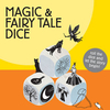
Revive the art of storytelling using these nine beautifully illustrated wooden dice to create the most imaginative, funny & bizarre stories. Once upon a time there was a beautiful princess, who lived all alone in an enchanted forest with only a top hat & a magnifying glass for company. One fine day, a singing frog on a broomstick flew past. This is the perfect family game that will stimulate the imaginations of children & adults alike. Ideal for playing by a log fire. (Carries EU Toy Safety Directive `CE` logo). ...
Archived Product

Magglingen / Macolin Swisstopo 2504

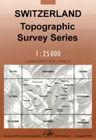
Map No. 2504, Magglingen/Macolin, in the topographic survey of Switzerland at 1:25, 000 from Bundesamt für Landestopographie (swisstopo), covering the whole country on 247 small format sheets, with special larger maps published for popular regions including some titles now available in hiking versions.Highly regarded for their superb use of graphic relief and hill shading, the maps give an almost 3-D picture of Switzerland`s mountainous terrain. Contours are at 10 m intervals, with 20m intervals in the mountainous areas. All the maps have a 1-km grid for Swiss national coordinates (datum CH 1903). Small format sheets (Nos. 1011 - 1374)Map legend in the language of the area covered by the map. Additional margin ticks show latitude and longitude in steps of 2`. The area covered by
each map is 17 x 12 km (11 x 7 miles approx). Special larger sheets (Nos. from 2501 onwards) – STANDARD editions: No map legend is included but a separate leaflet can be provided instead. The area covered by each map is 25 x 17 km (15 x 11 miles approx).Special larger sheets (Nos. from 2501 onwards) – HIKING editions: An overprint highlights hiking, mountain and alpine paths, including regional and national long-distance trails. The maps also show bus routes with bus stops, plus inns in remote locations. The area covered by each map is 25 x 17 km (15 x 11 miles approx).
RIP - This product is no longer available on our network. It was last seen on 25.09.2019

This page now acts as a permanent archive for this product. Add more information using the comments box below to ensure it can still be found by future generations.

Use our search facility to see if it is available from an alternative contributor.
  • Availability: Out Of Stock
  • Supplier: Stanfords
  • SKU: 9783302025049
Availability: In Stock
£20.99

Product Description

Map No. 2504, Magglingen/ Macolin, in the topographic survey of Switzerland at 1:25, 000 from Bundesamt für Landestopographie (swisstopo), covering the whole country on 247 small format sheets, with special larger maps published for popular regions including some titles now available in hiking versions. Highly regarded for their superb use of graphic relief & hill shading, the maps give an almost 3-D picture of Switzerland`s mountainous terrain. Contours are at 10 m intervals, with 20m intervals in the mountainous areas. All the maps have a 1-km grid for Swiss national coordinates (datum CH 1903). Small format sheets (Nos. 1011
- 1374) Map legend in the language of the area covered by the map. Additional margin ticks show latitude & longitude in steps of 2`. The area covered by each map is 17 x 12 km (11 x 7 miles approx). Special larger sheets (Nos. from 2501 onwards) – STANDARD editions: No map legend is included but a separate leaflet can be provided instead. The area covered by each map is 25 x 17 km (15 x 11 miles approx). Special larger sheets (Nos. from 2501 onwards) – HIKING editions: An overprint highlights hiking, mountain & alpine paths, including regional & national long-distance trails. The maps also show bus routes with bus stops, plus inns in remote locations. The area covered by each map is 25 x 17 km (15 x 11 miles approx).

Reviews/Comments

Add New

Intelligent Comparison

Oooops!
We couldn't find anything!
Perhaps this product's unique.... Or perhaps we are still looking for comparisons!
Click to bump this page and we'll hurry up.

Price History

Vouchers

No voucher codes found.
Do you know a voucher code for this product or supplier? Add it to Insights for others to use.

Facebook

Jargon Buster

Hiking - An outdoor activity envolving walking in nature
swiss - Short for Switzerland, one of the richest countries in the world
switzerland - A landlocked country in western Europe. One of the richest countries in the world
Language - the method of communication used in different areas. Humans and computers have many different languages.
Km - Kilometre. A unit of measurement equal to 1000 metres.
Small - something that takes up less space than normal.
Popular - Something that is admired and liked by many people.
Regional - An adjective to describe a set geographic area.
Language - The way humans communicate either written and spoken.

Supplier Information

Stanfords
Stanfords was established in 1853 and opened their iconic Covent Garden flagship store in 1901. They have become the top retailer of maps, travel books and accessories in the UK and arguably offer the largest selection of maps and travel books worldwide. Famous names such as Captain Robert Falcon Scott, Ranulph Fiennes and Michael Palin have purchased from Stanfords. They now have a shop in Bristol and both stores together with other venues operate a calendar of events including talks, book signings and exhibitions. As a specialist map retailer, the map selection is comprehensive and includes road maps, street maps and walking maps from worldwide destinations, as well as a selection of world atlases and wall maps. Books include travel guides and travel literature. Stanfords also stock globes, from miniatures made of blue marble to magnificent floor-standing globes. The website features a selection of interesting articles on travel topics.
Page Updated: 2023-11-12 20:15:36

Community Generated Product Tags

Oh No! The productWIKI community hasn't generated any tags for this product yet!
Menu