More From Contributor

£30.00
Follow the conflict of the Second World War from 1939 to 1945 in this unique volume, published in association with Imperial War Museums, London, featuring historical maps & photographs from their archives, & fascinating commentary from an expert historian. Over 150 maps tell the story of how this global war was fought. Types of maps featured: Strategic maps showing theatres of war, frontiers & occupied territories. Maps covering key battles & offensives on major fronts. Planning & operations maps showing defences in detail. Propaganda & educational maps for the armed forces & general public. Maps showing dispositions of Allied & enemy forces. Bomber & V-weapon target maps Descriptions of key historical events accompany the maps, giving an illustrated history of the war from an expert historian. Key topics covered include:1939: Invasion of Pol&. 1940: German invasion of Low Countries & France.1940: Battle of Britain & German invasion threat. Dec 1941: Pearl Harbor.1942: Turning points: Midway, Alamein, Stalingrad.1941-45: Barbarossa & the Eastern Front. The War at Sea. The advances to Jerusalem, Damascus & Baghdad. The War in the Air.1944: Neptune & Overlord; D-Day & liberation of France. ...
Archived Product
£20.00
The Second World War was a watershed in world history: the seizing of power by Hitler & the Nazis, the slowly building crescendo of annexations that led to Blitzkrieg, the conquest of Europe, the U-boat war, the strategic bombing campaign, the invasion of Russia, Stalingrad & D-Day, & the long German retreat to unconditional surrender. Mapping the Second World War does not try to retell every point in the story of the war in Europe, rather it seeks to provide
- through contemporary documents
- a different view of the war & suggest avenues for further research. Presenting over 100 maps it looks both at the broad sweep of events
- such as the invasion of Europe in June 1944
- & at details
- the two-man X-craft attack on the battleship Tirpitz
- to provide a fascinating sample of how events during the war were mapped out. Charts & maps were vital to the conduct of the war: before each military event there was planning, the reconnaissance, the conjecture as to enemy dispositions: after the event there would be debriefing, analysis of success & failure, & a redrawing of maps to show new troop positions & boundaries. Many of the maps selected have been used in actual combat & are marked up accordingly. Such battlefield annotations add to this fascinating overview of some of the key events in the Second World War & are referenced in the extended accompanying map captions. The volume is complete with a detailed narrative introduction to the progress of the war.


...
Archived Product
£29.95
Mapping Asia presents an authoritative selection of the most important antique maps of Asia & the Middle East produced from the time of Alexander the Great to the early nineteenth century, by cartographers from Engl&, France, Portugal, Holl&, Turkey, Italy, & China. A fascinating visual chronicle of the maps & their makers, this book explores the history of Europe`s discovery of lands to the east, from Constantinople to present-day Alaska. It tells the stories of the thriving trade that linked east & west beginning with the ancient Silk Road, the explorers
- such as Magellan & Sir Francis Drake
- who continually searched for new lands & routes to reach the east beginning in the fifteenth century, & the indigenous peoples who struggled to retain their autonomy in the face of European missionary activity & influence. Mapping Asia reproduces in full color 80 beautifully rendered & rare maps, more than 40 of which have never been published for the general public. Each map is accompanied by an accessible essay that provides extensive background on the mapmaker & how the map was originally produced, & describes the geography, sites, & details on the map. Most

...
Archived Product
£19.95
Today the world is focusing unprecedented attention on Asia & the Middle East
- rediscovering a cultural, political, & geographical
...
Archived Product
£30.00
” Mapping the Universe: the Interactive History of Astronomy” is the story of man`s quest through the ages to unlock the secrets of our universe, understand where we come from & where we are going. Lavishly illustrated throughout, it follows this journey for knowledge from the first musings of Stone Age people on the position of the stars & planets in the sky, to Galileo`s first visions of Orion through a telescope, to our first steps on the moon, & right up to the photographs of our magnificent universe which are being sent back from the Plank telescope today. Beautifully reproduced documents make it possible for the reader to experience hands-on, & appreciate at each stage, what over ten thousand years of history astronomers were discovering, & how & why this was significant. ...
Archived Product
£8.99
Mapping Time is an account for the general reader of the history & underlying basis of each of the most important calendars of the world, from antiquity to modern times. There are descriptions of prehistoric calendars, of those devised by the Egyptians, the Mayans, the Aztecs, & other civilizations, of the short-lived French Republican calendar, which introduced a ten-day week, & of our present-day Gregorian calendar. This fascinating & highly entertaining book is the perfect guide to understanding the background of time in the run up to the millennium. `an easily accessible mine of material` TLS ` Richards makes even the most arcane complications arising from the accident of Earth`s spin & orbit seem fascinating` New Scientist. ...
Archived Product
£7.99
Maps is a quirky compendium of essays on maps, places & people; many of them written by leading writers including Iain Sinclair & the Guardian`s David Mc Kie & Chris Arnrot as well as writers from the London Review of Books, academic journals, a journalist from the World Service & biographers: Iain Sinclair
- Walking Through Liverpool Chris Arnot
- Lost Cricket Grounds of England David Belbin
- Graham Greene in Nottingham Ross Bradshaw & Ian Parks
- The Land of Green Ginger Andy Croft
- Reading Poetry in Siberia Richard Dennis
- Mapping Gissing`s Novels Gillian Darley
- Ian Nairn & Jack Kerouac: On the Road Roberta Dewa
- Wilford: An English Village in the 1950s John Lucas
- Uprisings in the South West David Mc Kie
- The Mapping of Surnames Deirdre O` Byrne
- The Famine Roads of Ireland John Payne
- Death on the Border: Walter Benjamin Mark Patterson
- A Short Walk up Dere Street Andrew Whitehead
- Beyond Boundary Passage: London Fiction Sara Jane Palmer
- A Walk to Tafraoute Paul Barker
- The Other Britain: Leeds Robert Macfarlane
- The Guga Men


...
Archived Product
£20.00
This book of maps is a visual feast for readers of all ages, with lavishly drawn illustrations from the incomparable Mizielinskis. The maps show not only borders, cities, rivers, & peaks, but also places of historical & cultural interest, eminent personalities, iconic animals & plants, cultural events & many more fascinating facts associated with every region. ...
Archived Product
£12.95
We all rely on the apparent accuracy & objectivity of maps, but often do not see the very process of mapping as political. Are the power & purpose of maps inherently political? Maps & Politics addresses this important question & seeks to emphasize that the apparent objectivity' of the map-making & map-using process cannot be divorced from aspects of the politics of representation. Maps have played, & continue to play, a major role in both international & domestic politics. They show how visual geographical representations can be made to reflect & advance political agendas in powerful ways. The major developments in this field over the last century are responses both to cartographic progression & to a greater emphasis on graphic imagery in societies affected by politicization, democratization, & consumer & cultural shifts. Jeremy Black asks whether bias-free cartography is possible & demonstrates that maps are not straight-forward visual texts, but contain political & politicizing subtexts that need to be read with care. ...
Archived Product
£49.00
Maps are universal forms of communication, easily understood & appreciated regardless of culture or language. This truly magisterial book introduces readers to the widest range of maps ever considered in one

Volume:
maps from different time periods & a variety of cultures; maps made for divergent purposes & depicting a range of environments; & maps that embody the famous, the important, the beautiful, the groundbreaking, & the amusing. Built around the functions of maps
- the kinds of things maps do & have done
- maps confirms the vital role of maps throughout history in commerce, art, literature, & national identity. The book begins by examining the use of maps for wayfinding, revealing that even maps as common & widely used as these products of historical circumstances & cultural differences. The second chapter considers maps whose makers employed the smallest of scales to envision the broadest of human stages
- the world, the heavens, even the act of creation itself. The next chapter looks at maps that are, literally, at the opposite end of the scale from cosmological & world maps
- maps that represent specific parts of the world & provide a close-up view of areas in which their makers lived, worked, & moved. Having shown how maps help us get around & make sense of our greater & lesser worlds, ” Maps” then turns to the ways in which certain maps can be linked to particular events in history, exploring how they have helped Americans, for instance, to understand their past, cope with current events, & plan their national future. The fifth chapter considers maps that represent data from scientific instruments, population censuses, & historical records. These maps illustrate, for example, how diseases spread, what the ocean floor looks like, & how the weather is tracked & predicted. Next comes a turn to the imaginary, featuring maps that depict entire fictional worlds, from Hell to Utopia & from Middle Earth to the fantasy game World of Warcraft. The final chapter traces the origins of map consumption throughout history & ponders the impact of cartography on modern society.A companion volume to the most ambitious exhibition on the history of maps ever mounted in North America, ” Maps” will challenge readers to stretch conventional thought about what constitutes a map & how many different ways we can understand graphically the environment in which we live. Collectors, historians, mapmakers & users, & anyone who has ever ”gotten lost” in the lines & symbols of a map will find much to love & learn from in this book.


...
Archived Product

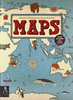
Mapping The World: The Story Of Cartography

Mapping the World takes you on a journey through the history of cartography and is essentially a history of the world and how its territories were discovered and explored. Maps have been an integral part of the way humans have lived for approximately 8, 000 years. The first accurate maps were produced in Ancient Babylonia. The earliest world map is the Babylonian World Map, which is symbolic and not an exact representation. It deliberately doesn`t include the Persians or the Egyptians. The Ancient Greeks also produced maps, although they were mostly imaginary reconstructions of the world. Maps have been crucial in the development of empires, have helped to win wars, and have encouraged man to venture further than his or her known boundaries. Beautifully illustrated, Mapping the World
is a fascinating look at how the science of cartography developed, how maps are used not just for getting from A to B, and why cartography is so important to our history of the world and the world we live in. Nowadays, we take the use of Sat Nav and Google maps for granted, but this book reflects on the fact that it all began with human imagination and the desire for knowledge.
RIP - This product is no longer available on our network. It was last seen on 25.09.2019

This page now acts as a permanent archive for this product. Add more information using the comments box below to ensure it can still be found by future generations.

Use our search facility to see if it is available from an alternative contributor.
  • Availability: Out Of Stock
  • Supplier: Stanfords
  • SKU: 9780233004396
Availability: In Stock
£20.00

Product Description

Mapping the World takes you on a journey through the history of cartography & is essentially a history of the world & how its territories were discovered & explored. Maps have been an integral part of the way humans have lived for Approx. 8, 000 years. The first accurate maps were produced in Ancient Babylonia. The earliest world map is the Babylonian World Map, which is symbolic & not an exact representation. It deliberately doesn`t include the Persians or the Egyptians. The Ancient Greeks also produced maps, although they were mostly imaginary reconstructions of the world. Maps have been crucial in the development of empires, have helped to win wars, & have encouraged man to venture further than his or her known boundaries. Beautifully illustrated, Mapping the World is a fascinating look at how the science of cartography developed, how maps are used not just for getting from A to B, & why cartography is so important to our history of the world & the world we live in. Nowadays, we take the use of Sat Nav & Google maps for granted, but this book reflects on the fact that it all began with human imagination & the desire for knowledge.

Reviews/Comments

Add New

Intelligent Comparison

Oooops!
We couldn't find anything!
Perhaps this product's unique.... Or perhaps we are still looking for comparisons!
Click to bump this page and we'll hurry up.

Price History

Vouchers

No voucher codes found.
Do you know a voucher code for this product or supplier? Add it to Insights for others to use.

Facebook

Jargon Buster

Human - A highly developed and adapted mamal and deminant species on earth
History - Anything that happens in the past. An acedemic subject.
World - A physical grouping, commonly used to describe earth and everything associated with ti
Accurate - A measurement of precision when all elements are correct.

Supplier Information

Stanfords
Stanfords was established in 1853 and opened their iconic Covent Garden flagship store in 1901. They have become the top retailer of maps, travel books and accessories in the UK and arguably offer the largest selection of maps and travel books worldwide. Famous names such as Captain Robert Falcon Scott, Ranulph Fiennes and Michael Palin have purchased from Stanfords. They now have a shop in Bristol and both stores together with other venues operate a calendar of events including talks, book signings and exhibitions. As a specialist map retailer, the map selection is comprehensive and includes road maps, street maps and walking maps from worldwide destinations, as well as a selection of world atlases and wall maps. Books include travel guides and travel literature. Stanfords also stock globes, from miniatures made of blue marble to magnificent floor-standing globes. The website features a selection of interesting articles on travel topics.
Page Updated: 2023-11-12 20:15:36

Community Generated Product Tags

Oh No! The productWIKI community hasn't generated any tags for this product yet!
Menu