More From Contributor

£16.99
Follow the development, decline & revival of Britain's railways through a unique collection of old & new maps, commentaries & photographs. Charting the rich history of Britain's railways from 1819 to the present day, this fascinating compendium shows how trains have played an essential part in British life for nearly 200 years. Throughout this engaging book is a series of 'milepost' features on key events, eras & personalities in the history of Britain's railways. From the enormous role the railways played in the World Wars to modern events, like the opening of the Channel Tunnel, this extensive book shows you how British history is firmly tied to the railways. The story is traced from early 'waggonways', through the steam era to today's diesel & electric railways. Mapping the Railways will appeal to railway enthusiasts, historians & general interest readers alike. Over 100 railway maps: Historical & modern rail network maps Extracts from Ordnance Survey sheets Plans for proposed railway schemes Track diagrams & official reports Pictorial maps, posters & ephemera Cartography by Bartholomew, Airey, Bradshaw & many others Pivotal events in railway history: The nineteenth century saw the foundations laid for our modern railway network, with huge building projects constructing thousands of miles of track, bridges & tunnels Expansion slowed in the early twentieth century as competition from the car & the lorry began to bite Railways made an enormous contribution to the World Wars, then underwent massive re-equipment after nationalization Drastic change followed the ' Beeching Report' of 1963, which advocated closure of underused rail lines The modern era has seen an expansion of the network again, with the building of the Channel Tunnel & the re-opening of a significant number of lines closed under the ' Beeching axe', many as heritage railways. ...
Archived Product
£25.00
A history of mapping Britain`s roads. The story of Britain`s road development
- graphically & beautifully illustrated on our maps
...
Archived Product
£14.99
The story of Britain`s road development
- graphically & beautifully illustrated on our maps
- is also the story of its political,

...
Archived Product
£30.00
Follow the conflict of the Second World War from 1939 to 1945 in this unique volume, published in association with Imperial War Museums, London, featuring historical maps & photographs from their archives, & fascinating commentary from an expert historian. Over 150 maps tell the story of how this global war was fought. Types of maps featured: Strategic maps showing theatres of war, frontiers & occupied territories. Maps covering key battles & offensives on major fronts. Planning & operations maps showing defences in detail. Propaganda & educational maps for the armed forces & general public. Maps showing dispositions of Allied & enemy forces. Bomber & V-weapon target maps Descriptions of key historical events accompany the maps, giving an illustrated history of the war from an expert historian. Key topics covered include:1939: Invasion of Pol&. 1940: German invasion of Low Countries & France.1940: Battle of Britain & German invasion threat. Dec 1941: Pearl Harbor.1942: Turning points: Midway, Alamein, Stalingrad.1941-45: Barbarossa & the Eastern Front. The War at Sea. The advances to Jerusalem, Damascus & Baghdad. The War in the Air.1944: Neptune & Overlord; D-Day & liberation of France. ...
Archived Product
£20.00
The Second World War was a watershed in world history: the seizing of power by Hitler & the Nazis, the slowly building crescendo of annexations that led to Blitzkrieg, the conquest of Europe, the U-boat war, the strategic bombing campaign, the invasion of Russia, Stalingrad & D-Day, & the long German retreat to unconditional surrender. Mapping the Second World War does not try to retell every point in the story of the war in Europe, rather it seeks to provide
- through contemporary documents
- a different view of the war & suggest avenues for further research. Presenting over 100 maps it looks both at the broad sweep of events
- such as the invasion of Europe in June 1944
- & at details
- the two-man X-craft attack on the battleship Tirpitz
- to provide a fascinating sample of how events during the war were mapped out. Charts & maps were vital to the conduct of the war: before each military event there was planning, the reconnaissance, the conjecture as to enemy dispositions: after the event there would be debriefing, analysis of success & failure, & a redrawing of maps to show new troop positions & boundaries. Many of the maps selected have been used in actual combat & are marked up accordingly. Such battlefield annotations add to this fascinating overview of some of the key events in the Second World War & are referenced in the extended accompanying map captions. The volume is complete with a detailed narrative introduction to the progress of the war.


...
Archived Product
£19.95
Today the world is focusing unprecedented attention on Asia & the Middle East
- rediscovering a cultural, political, & geographical
...
Archived Product
£30.00
” Mapping the Universe: the Interactive History of Astronomy” is the story of man`s quest through the ages to unlock the secrets of our universe, understand where we come from & where we are going. Lavishly illustrated throughout, it follows this journey for knowledge from the first musings of Stone Age people on the position of the stars & planets in the sky, to Galileo`s first visions of Orion through a telescope, to our first steps on the moon, & right up to the photographs of our magnificent universe which are being sent back from the Plank telescope today. Beautifully reproduced documents make it possible for the reader to experience hands-on, & appreciate at each stage, what over ten thousand years of history astronomers were discovering, & how & why this was significant. ...
Archived Product
£20.00
Mapping the World takes you on a journey through the history of cartography & is essentially a history of the world & how its territories were discovered & explored. Maps have been an integral part of the way humans have lived for Approx. 8, 000 years. The first accurate maps were produced in Ancient Babylonia. The earliest world map is the Babylonian World Map, which is symbolic & not an exact representation. It deliberately doesn`t include the Persians or the Egyptians. The Ancient Greeks also produced maps, although they were mostly imaginary reconstructions of the world. Maps have been crucial in the development of empires, have helped to win wars, & have encouraged man to venture further than his or her known boundaries. Beautifully illustrated, Mapping the World is a fascinating look at how the science of cartography developed, how maps are used not just for getting from A to B, & why cartography is so important to our history of the world & the world we live in. Nowadays, we take the use of Sat Nav & Google maps for granted, but this book reflects on the fact that it all began with human imagination & the desire for knowledge. ...
Archived Product
£8.99
Mapping Time is an account for the general reader of the history & underlying basis of each of the most important calendars of the world, from antiquity to modern times. There are descriptions of prehistoric calendars, of those devised by the Egyptians, the Mayans, the Aztecs, & other civilizations, of the short-lived French Republican calendar, which introduced a ten-day week, & of our present-day Gregorian calendar. This fascinating & highly entertaining book is the perfect guide to understanding the background of time in the run up to the millennium. `an easily accessible mine of material` TLS ` Richards makes even the most arcane complications arising from the accident of Earth`s spin & orbit seem fascinating` New Scientist. ...
Archived Product
£7.99
Maps is a quirky compendium of essays on maps, places & people; many of them written by leading writers including Iain Sinclair & the Guardian`s David Mc Kie & Chris Arnrot as well as writers from the London Review of Books, academic journals, a journalist from the World Service & biographers: Iain Sinclair
- Walking Through Liverpool Chris Arnot
- Lost Cricket Grounds of England David Belbin
- Graham Greene in Nottingham Ross Bradshaw & Ian Parks
- The Land of Green Ginger Andy Croft
- Reading Poetry in Siberia Richard Dennis
- Mapping Gissing`s Novels Gillian Darley
- Ian Nairn & Jack Kerouac: On the Road Roberta Dewa
- Wilford: An English Village in the 1950s John Lucas
- Uprisings in the South West David Mc Kie
- The Mapping of Surnames Deirdre O` Byrne
- The Famine Roads of Ireland John Payne
- Death on the Border: Walter Benjamin Mark Patterson
- A Short Walk up Dere Street Andrew Whitehead
- Beyond Boundary Passage: London Fiction Sara Jane Palmer
- A Walk to Tafraoute Paul Barker
- The Other Britain: Leeds Robert Macfarlane
- The Guga Men


...
Archived Product

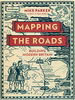
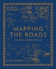
Mapping The Silk Road And Beyond

Mapping Asia presents an authoritative selection of the most important antique maps of Asia and the Middle East produced from the time of Alexander the Great to the early nineteenth century, by cartographers from England, France, Portugal, Holland, Turkey, Italy, and China. A fascinating visual chronicle of the maps and their makers, this book explores the history of Europe`s discovery of lands to the east, from Constantinople to present-day Alaska. It tells the stories of the thriving trade that linked east and west beginning with the ancient Silk Road, the explorers - such as Magellan and Sir Francis Drake - who continually searched for new lands and routes to reach the east beginning in the fifteenth century, and the indigenous peoples who struggled to retain their autonomy
in the face of European missionary activity and influence. Mapping Asia reproduces in full color 80 beautifully rendered and rare maps, more than 40 of which have never been published for the general public. Each map is accompanied by an accessible essay that provides extensive background on the mapmaker and how the map was originally produced, and describes the geography, sites, and details on the map. Most
RIP - This product is no longer available on our network. It was last seen on 25.09.2019

This page now acts as a permanent archive for this product. Add more information using the comments box below to ensure it can still be found by future generations.

Use our search facility to see if it is available from an alternative contributor.
  • Availability: Out Of Stock
  • Supplier: Stanfords
  • SKU: 9780714844091
Availability: In Stock
£29.95

Product Description

Mapping Asia presents an authoritative selection of the most important antique maps of Asia & the Middle East produced from the time of Alexander the Great to the early nineteenth century, by cartographers from Engl&, France, Portugal, Holl&, Turkey, Italy, & China. A fascinating visual chronicle of the maps & their makers, this book explores the history of Europe`s discovery of lands to the east, from Constantinople to present-day Alaska. It tells the stories of the thriving trade that linked east & west beginning with the ancient Silk Road, the explorers
- such as Magellan & Sir Francis Drake
- who continually searched for new lands & routes to reach the east beginning in the fifteenth century, & the indigenous peoples who struggled to retain their autonomy in the face of European missionary activity & influence. Mapping Asia reproduces in full color 80 beautifully rendered & rare maps, more than 40 of which have never been published for the general public. Each map is accompanied by an accessible essay that provides extensive background on the mapmaker & how the map was originally produced, & describes the geography, sites, & details on the map. Most

Reviews/Comments

Add New

Intelligent Comparison

Oooops!
We couldn't find anything!
Perhaps this product's unique.... Or perhaps we are still looking for comparisons!
Click to bump this page and we'll hurry up.

Price History

Vouchers

No voucher codes found.
Do you know a voucher code for this product or supplier? Add it to Insights for others to use.

Facebook

Jargon Buster

Silk - A natural fibre made by silk worms
antique - An old collectible item with desirable qualities.
England - A country within the United Kingdom.
France - A state situated in Western Europe with several overseas territories.
History - Anything that happens in the past. An acedemic subject.
Day - The time it takes a planet or other space objects to complete one rotation.
Italy - a country in Europe.
Road - a manmade lane or a path that is used to speed up travel.

Supplier Information

Stanfords
Stanfords was established in 1853 and opened their iconic Covent Garden flagship store in 1901. They have become the top retailer of maps, travel books and accessories in the UK and arguably offer the largest selection of maps and travel books worldwide. Famous names such as Captain Robert Falcon Scott, Ranulph Fiennes and Michael Palin have purchased from Stanfords. They now have a shop in Bristol and both stores together with other venues operate a calendar of events including talks, book signings and exhibitions. As a specialist map retailer, the map selection is comprehensive and includes road maps, street maps and walking maps from worldwide destinations, as well as a selection of world atlases and wall maps. Books include travel guides and travel literature. Stanfords also stock globes, from miniatures made of blue marble to magnificent floor-standing globes. The website features a selection of interesting articles on travel topics.
Page Updated: 2023-11-12 20:15:36

Community Generated Product Tags

Oh No! The productWIKI community hasn't generated any tags for this product yet!
Menu