
 United Kingdom
 France
 Germany
 Netherlands
 Sweden
 USA
USA
 Italy
Italy
 Spain
Spain
More From Contributor


Milton North 1898
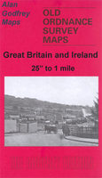
Milton North in 1898 in a fascinating series of reproductions of old Ordnance Survey plans in the Alan Godfrey Editions, ideal for anyone interested in the history of their neighbourhood or family. The map covers the area around and to the north of Milton and east of Smallthorne. The Milton area includes St Philip & St James church, Market Street, station, etc. Part of Baddeley Green is in the north-eastern corner. Part of Norton in the Moors, including St Bartholomew`s church, is near the top of the map; Ford Green with station, Ford Green Iron Works and mineral railways is at the west of the map. Part of the Caldon Canal is also shown. Directories for Norton-in-the-Moors and Milton & Abbey are on the reverse.About the Alan Godfrey Editions of the 25” OS Series:Selected towns in
Great Britain and Ireland are covered by maps showing the extent of urban development in the last decades of the 19th and early 20th century. The plans have been taken from the Ordnance Survey mapping and reprinted at about 15 inches to one mile (1:4, 340). On the reverse most maps have historical notes and many also include extracts from contemporary directories. Most maps cover about one mile (1.6kms) north/south, one and a half miles (2.4kms) across; adjoining sheets can be combined to provide wider coverage.FOR MORE INFORMATION AND A COMPLETE LIST OF ALL AVAILABLE TITLES PLEASE CLICK ON THE SERIES LINK.
Great Britain and Ireland are covered by maps showing the extent of urban development in the last decades of the 19th and early 20th century. The plans have been taken from the Ordnance Survey mapping and reprinted at about 15 inches to one mile (1:4, 340). On the reverse most maps have historical notes and many also include extracts from contemporary directories. Most maps cover about one mile (1.6kms) north/south, one and a half miles (2.4kms) across; adjoining sheets can be combined to provide wider coverage.FOR MORE INFORMATION AND A COMPLETE LIST OF ALL AVAILABLE TITLES PLEASE CLICK ON THE SERIES LINK.

Product Description
Reviews/Comments
Add New
Intelligent Comparison
Archived Product

Middleton North 1915 Stanfords
£3.50
Archived Product
Middleton North 1915 Stanfords
£2.95
Archived Product

Bolton North 1908 Stanfords
£3.50
Archived Product
Maidstone North 1866 Stanfords
£3.50
Archived Product

Pendleton North 1889 Stanfords
£3.50
Archived Product

Darlington North 1896 Stanfords
£3.50
Archived Product
Loughton North 1895 Stanfords
£2.95
Archived Product
Stirling North 1896 Stanfords
£2.95
Vouchers
No voucher codes found.
Do you know a voucher code for this product or supplier? Add it to Insights for others to use.
Do you know a voucher code for this product or supplier? Add it to Insights for others to use.
 Denmark