More From Contributor
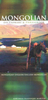
£11.50
Indexed, waterproof & tear-resistant road map of Mongolia at 1:1, 600, 000 with topographic & tourist information, published by Reise Know-How as part of their highly acclaimed World Mapping Project. The map is double-sided to provide the best balance between a good scale & a convenient size sheet; a very generous overlap means that Ulaan-Baatar is included on both sides. Names of many towns are given with alternative versions, whilst larger towns are also the Cyrillic alphabet. The country’s topography is presented by light altitude colouring with spot heights, mountain passes, & names of mountain ranges. The map also shows caves, oases & seasonal rivers & lakes. Internal administrative boundaries are shown with names of the provinces. Road network

Includes::
unsurfaced local roads & tracks, gives driving distances on main & secondary roads, & shows border crossings. The course of the Trans-Mongolian Railway is clearly marked & local airfields are indicated. Symbols highlight various places of interest, including national parks & protected areas, UNESCO world heritage sites, Buddhist monasteries, rock paintings, etc. The map has a latitude & longitude grid at intervals of 1°. The index of localities

Includes::
a separate list of national parks & reserves. Map legend

Includes::
English.


...
Archived Product
£39.95
Mongolia Road Atlas at 1:1, 000, 000 from the Ulaanbaatar based publishers Monsadur, in a spiral-bound format, with English map legend, plus enlargements for the environs of the capital, Hagtal & Harhorin region & several distance tables. The atlas provides a very detailed picture of the country ...
Archived Product
£13.50
Mongolia Road Edition Wall map at 1:2, 000, 000 from Gizi Map, size 124 x 67cm (49” x 27” approx), with its road network presented on a base with relief shading showing the country’s physical geography. Names of larger towns & selected smaller locations, as well as of many topographic features are also shown in Cyrillic alphabet. The map provides a very fine presentation of the country’s geography through relief shading & graphics for salt flats, swamps, etc, plus numerous spot heights & plenty of names of mountain ranges & peaks. National parks & other protected areas are highlighted. Road network indicates country tracks, gives distances on main routes, & shows locations of border crossings. Railway lines are included & domestic airports are marked. The map also shows boundaries of administrative provinces. Various places of interest are marked, including archaeological remains, natural curiosities, etc. Latitude & longitude lines are drawn at 1° intervals. Dual index, in both Latin & Cyrillic alphabet, is on the reverse. Map legend

Includes::
English. Current edition was published in 2008 &

Includes::
a street plan of Ullanbaatar, although less detailed than in the geographical version of this map, as below.PLEASE NOTE: this map is also available in a geographical edition with bold altitude colouring & updated in 2012. Both versions are also published in a folded format.


...
Archived Product
£18.99
Colloquial Mongolian is easy to use & completely up to date! Written by experience teachers of the language, Colloquial Mongolian offers a step-by-step approach to written & spoken Mongolian. No previous knowledge of the language is required. Features include: Guide to reading & writing the alphabet Lively dialogues in true-to-life situations Concise grammar explanations A variety of exercises with full answer key, grammar summary, suffix index & two-way glossary Explanatory notes on Mongolian culture & customs By the end of this rewarding course you will be able to communicate confidently & effectively in Mongolian in a broad range of everyday situations. Accompanying audio material is available to purchase separately on CD/MP3 format, or comes included in the great value Colloquials Pack. ...
Archived Product
£11.50
Mongolian vocabulary & phrases are given in both the Roman alphabet & the Mongolian Cyrillic script, enabling the user to pronounce words easily while becoming familiar with the script. Featuring: * 3, 500 total entries * Basic Mongolian grammar * Travel-oriented phrases * Commonsense pronunciation * Interesting & helpful cultural information ...
Archived Product
£3.99
The Lonely Planet Mongolian Phrasebook is not only an extensive list of useful phrases, but also an ideal tool to start getting to grips with a language & beginning two-way communication. Containing excellent sections on language basics such as numbers, question phrases, dates, phrase construction, grammar & pronunciation, as well as containing concise but well-rounded two-way dictionaries, Lonely Planet phrasebooks enable you to quickly & confidently construct your own phrases in addition to those given. The given phrases cover all the essential travel & tourism categories such as transport, communications, business meetings & accommodation, as well as in-depth categories such as health, food & social interaction. The phrasebooks are designed to enable more than just simple question-answer communication, allowing the start of two-way conversations ...
Archived Product
£9.99
Monique Dembele saves lives & dispenses hope in a place where childbirth is a life-&-death matter. Her unquenchable passion to improve the lot of the women & children in her West African village is matched by her buoyant humour in the face of unhappy marriage & backbreaking work. This is the deeply compelling story of the rare friendship between a young development volunteer & this midwife who defies tradition & becomes
- too early in her own life
- a legend.

...
Archived Product
£11.50
Topographic survey of France at 1:25, 000 in IGN`s excellent TOP25 / Série Bleue series. All the maps are GPS compatible, with a 1km UTM grid plus latitude & longitude lines at 5’ intervals. Contours are at 5m intervals except for mountainous areas where the maps have contours at 10m intervals, vividly enhanced by hill shading & graphics for rocky terrain. Colouring with graphics indicates different types of vegetation or land use (deciduous or coniferous forests, moors, orchards, vineyards, etc). PLEASE NOTE: coverage of France at this scale is currently being revised – the format & the presentation of each title are indicated by the letters at the end of its Sheet Reference number (e.g. 0416ET, 3531ETR, 1923SB, etc.)MAPS WITH FULL TOURIST OVERPRINT & AN ENGLISH MAP LEGEND: all TOP25 maps & the SB editions of Série Bleue have an overprint highlighting waymarked walking trails including long-distance GR routes &, where appropriate, ski routes. Symbols indicate campsites, gîtes d’etape, refuges, equestrian centres & other recreational facilities or sites, tourist information centres, cultural heritage, etc. Towns & locations of particular interest are highlighted.- ET or OT = single-sided TOP25 map covering approx. 29x 21 km / 18x 13 miles.- ETR or OTR = waterproof & tear resistant TOP25 map covering the same area as the corresponding ET or OT number, but double-sided, printed on a smaller size sheet with a good overlap between the sides.- SB = Série Bleue map with full tourist overprint; these maps, first introduced in summer 2014, each cover approx. 29x 24km / 18x 15 miles.SÉRIE BLEUE maps with numbers ending in E (Est) or O (Ouest): most editions now indicate the GR routes, but do not show any other tourist information. Map legend is in French only. Each map covers approx. 14x 20km / 9x 12 miles. ...
Archived Product
£3.50
Monk Bretton & Smithies in 1904 in a fascinating series of reproductions of old Ordnance Survey plans in the Alan Godfrey Editions, ideal for anyone interested in the history of their neighbourhood or family. SThe map covers an area just north of Barnsley, including the hamlet of Smithies & north part of Monk Bretton. Features include Monk Bretton Colliery, Monk Bretton station, Wallsend Main Colliery, etc. About the Alan Godfrey Editions of the 25” OS Series: Selected towns in Great Britain & Ireland are covered by maps showing the extent of urban development in the last decades of the 19th & early 20th century. The plans have been taken from the Ordnance Survey mapping & reprinted at about 15 inches to one mile (1:4, 340). On the reverse most maps have historical notes & many also include extracts from contemporary directories. Most maps cover about one mile (1.6kms) north/south, one & a half miles (2.4kms) across; adjoining sheets can be combined to provide wider coverage.FOR MORE INFORMATION & A COMPLETE LIST OF ALL AVAILABLE TITLES PLEASE CLICK ON THE SERIES LINK. ...
Archived Product

Mongolian Pack

Colloquial Mongolian is easy to use and completely up to date!

Written by experience teachers of the language, Colloquial Mongolian offers a step-by-step approach to written and spoken Mongolian. No previous knowledge of the language is required.

RIP - This product is no longer available on our network. It was last seen on 25.09.2019

This page now acts as a permanent archive for this product. Add more information using the comments box below to ensure it can still be found by future generations.

Use our search facility to see if it is available from an alternative contributor.
  • External links may include paid for promotion
  • Availability: Out Of Stock
  • Supplier: Stanfords
  • SKU: 9780415167161
Availability: In Stock
£34.99

Product Description

Colloquial Mongolian is easy to use & completely up to date!

Written by experience teachers of the language, Colloquial Mongolian offers a step-by-step approach to written & spoken Mongolian. No previous knowledge of the language is required.

Features include:

Guide to reading & writing the alphabet

Lively dialogues in true-to-life situations

Concise grammar explanations

A variety of exercises with full answer key, grammar summary, suffix index & two-way glossary

Explanatory notes on Mongolian culture & customs

By the end of this rewarding course you will be able to communicate confidently & effectively in Mongolian in a broad range of everyday situations.

This pack contains 120 of audio material, recorded on both cassettes & CDs. They will help you perfect your pronunciation, listening & speaking skills.

Reviews/Comments

Add New

Intelligent Comparison

Oooops!
We couldn't find anything!
Perhaps this product's unique.... Or perhaps we are still looking for comparisons!
Click to bump this page and we'll hurry up.

Price History

Vouchers

No voucher codes found.
Do you know a voucher code for this product or supplier? Add it to Insights for others to use.

Facebook

Jargon Buster

Date - A day on a calendar
Date - A social activity whith a current or potential partner
Key - A physical or virtual device or code used for opening something
Audio - Also known as sound. An audible vibration wave which can be heard.
Language - the method of communication used in different areas. Humans and computers have many different languages.
Rewarding - Achieving and doing something good.
Experience - To gain further knowledge by practising.
Teachers - A person who educates others, typically in a school.
Language - The way humans communicate either written and spoken.

Supplier Information

Stanfords
Stanfords was established in 1853 and opened their iconic Covent Garden flagship store in 1901. They have become the top retailer of maps, travel books and accessories in the UK and arguably offer the largest selection of maps and travel books worldwide. Famous names such as Captain Robert Falcon Scott, Ranulph Fiennes and Michael Palin have purchased from Stanfords. They now have a shop in Bristol and both stores together with other venues operate a calendar of events including talks, book signings and exhibitions. As a specialist map retailer, the map selection is comprehensive and includes road maps, street maps and walking maps from worldwide destinations, as well as a selection of world atlases and wall maps. Books include travel guides and travel literature. Stanfords also stock globes, from miniatures made of blue marble to magnificent floor-standing globes. The website features a selection of interesting articles on travel topics.
Page Updated: 2023-11-12 20:15:36

Community Generated Product Tags

Oh No! The productWIKI community hasn't generated any tags for this product yet!
Menu