
 United Kingdom
 France
 Germany
 Netherlands
 Sweden
 USA
USA
 Italy
Italy
 Spain
Spain
More From Contributor


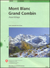
Mont Blanc - Courmayeur - Chamonix - La Thuile
Mont Blanc - Courmayeur - Chamonix - La Thuile area at 1:25, 000 in a series of contoured, GPS compatible walking maps from the Turin based Istituto Geografico Centrale, highlighting hiking trails including long-distance routes, ski routes and alpine accommodation. The maps have contours at 25m intervals, enhanced by shading and graphic relief for very clear presentation of the terrain. An overprint highlights local hiking paths, indicating difficult sections, long-distance routes such as the GTA (Grande Traversata delle Alpi), Tour Monte Rosa, etc. Also marked are ski routes showing hazardous sections.The maps also indicate locations of various types of alpine accommodation: refuges, shelters, hostels, campsites, etc. Cable car lines and chair lifts are marked, and for road
users local roads with restricted entry are indicated. Each map covers approximately 22 x 25 km /13 x 15 miles. All the maps have a 2-km UTM grid. Map legend includes English.
users local roads with restricted entry are indicated. Each map covers approximately 22 x 25 km /13 x 15 miles. All the maps have a 2-km UTM grid. Map legend includes English.
Product Description
Reviews/Comments
Add New
Vouchers
No voucher codes found.
Do you know a voucher code for this product or supplier? Add it to Insights for others to use.
Do you know a voucher code for this product or supplier? Add it to Insights for others to use.
 Denmark