More From Contributor

£14.95
Sailors have been navigating the seas for thousands of years, & navigational technology has progressed exponentially during that time. This concise yet comprehensive volume from popular Sheridan House author Donald Launer begins with the impressive developments in navigation undertaken by early seafarers, & follows the art & science of navigation through the ages to their culmination in the huge advances made by our contemporaries. Launer explores the navigational tools invented by each civilization, &

Includes::
generous illustrations to help readers envision the tools used. Written in an accessible, conversational style, with no unexplained jargon or terminology, Navigation Through the Ages will appeal especially to sailors & to anyone with an interest in the history of science & the exploration of our world.

...
Archived Product
£8.99
With over two-thirds of the globe covered by water, the ability to navigate safely & quickly across the oceans has been crucial throughout human history. As seafarers attempted longer & longer voyages from the sixteenth century onwards in search of profit & new lands, the tools of navigation became ever more sophisticated. The development of instruments over the last five hundred years has seen some revolutionary changes, spurred on by the threat of disaster at sea & the possibility of huge rewards from successful voyages. As this book shows, the solution of the infamous longitude problem, the extraordinary impact of satellite positioning & other advances in navigation have successfully brought together seafarers, artisans & scientists in search of better ways of getting from A to B & back again. ...
Archived Product
£1595.00
Made of wood, brass hardware, with a leather top, hand rubbed black French finish, somewhat beat-up: proof of its many voyages & colorful history. The desktop is complete with drawers & brass bound. If we do not have this item in stock we will order it for you from our supplier. Delivery generally takes 3 weeks within the UK. For overseas delivery queries please email sales@stanfords.co.uk ...
Archived Product
£1595.00
Made of wood, brass hardware, with a leather top, hand rubbed cream French finish, somewhat beat-up: proof of its many voyages & colorful history. The desktop is complete with drawers & brass bound. If we do not have this item in stock we will order it for you from our supplier. Delivery generally takes 3 weeks within the UK. For overseas delivery queries please email sales@stanfords.co.uk ...
Archived Product
£160.00
Decorative & well-executed globe from the age of exploration. Stand is detailed turned wood, French finish. Exact reproduction of 16th C. Mercator globe, hand applied paper gores. If we do not have this item in stock we will order it for you from our supplier. Delivery generally takes 3 weeks within the UK. For overseas delivery queries please email sales@stanfords.co.uk ...
Archived Product
£420.00
Furniture of the British Imperial Navy. Hand rubbed black & honey wooden chair. Comfortable & roomy with curved details. The Navy Chair is sturdy & durable to survive a students dorm room or decorate a living room. If we do not have this item in stock we will order it for you from our supplier. Delivery generally takes 3 weeks within the UK. For overseas delivery queries please email sales@stanfords.co.uk ...
Archived Product
£420.00
Furniture of the British Imperial Navy. Hand rubbed cream & honey wooden chair. Comfortable & roomy with curved details. The Navy Chair is sturdy & durable to survive a students dorm room or decorate a living room. If we do not have this item in stock we will order it for you from our supplier. Delivery generally takes 3 weeks within the UK. For overseas delivery queries please email sales@stanfords.co.uk ...
Archived Product
£6.95
Naxos on a map from Kompass, with a simple plan of Naxos Town & tourist overprint highlighting places of interest & some hiking trails. Contours at 40m intervals & colouring to indicate various types of vegetation show the topography & land use. The overprint shows a few hiking routes & highlights various places of interest & tourist facilities, including campsites & youth hostels, sport & recreational facilities, beaches, surfing & diving sites, etc. All place names are in both Greek & Latin alphabet. The map has a UTM grid. Map legend

Includes::
English. Also provided is a simple plan of Naxos Town with a list of selected accommodation, cafes & discos, plus a map of ferry connections across the Aegean.

...
Archived Product
£7.50
Road Edition maps are produced in co-operation with the Hellenic Army Geographical Service, the national survey organisation. The maps have contours with colour altitude tints. All the place names are shown in both Greek & Roman script. Road classification distinguishes between unsurfaced roads of good & poor quality. Tourist information

Includes::
scenic routes, petrol stations, archaeological sites, campsites, beaches, etc. Brief descriptions, in Greek & English, illustrate some of the interesting aspects of each isl&. Map legend

Includes::
English. On the reverse, there are lists of tourist office telephone numbers & various types of accommodation from hotels to private rooms. Please note: deliveries from Road Editions are not very reliable. For titles currently not in stock it may be advisable to choose a map from another publisher.


...
Archived Product
£14.95
Part of a series of books from Anavasi publishing showing certain Greek Islands from an angle rarely seen by the human eye
- from
...
Archived Product

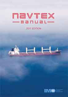
NAVTEX Manual, 2017 Edition

NAVTEX is an international automated direct-printing service for promulgation of navigational and meteorological warnings and other urgent information to ships. It is one of the two principle methods used for broadcasting maritime safety information in accordance with the provisions of the International Convention for the Safety of Life at Sea, 1974, as amended. It has been developed to provide a low-cost, simple and automated means of receiving maritime safety information and Search and Rescue alerts on board ships at sea and in coastal waters. The information transmitted may be relevant to all sizes and types of vessel and the selective message-rejection feature ensures that every mariner can receive safety information broadcasts which are relevant to their voyage.This manual is
intended, primarily, for use by maritime Administrations and others concerned with the preparation and broadcasting of maritime safety information. It will also be of interest to seafarers, shipowners and others who need to receive such information in order to safely go about their business at sea.
RIP - This product is no longer available on our network. It was last seen on 25.09.2019

This page now acts as a permanent archive for this product. Add more information using the comments box below to ensure it can still be found by future generations.

Use our search facility to see if it is available from an alternative contributor.
  • External links may include paid for promotion
  • Availability: Out Of Stock
  • Supplier: Stanfords
  • SKU: 9789280116625
Availability: In Stock
£15.00

Product Description

NAVTEX is an international automated direct-printing service for promulgation of navigational & meteorological warnings & other urgent information to ships. It is one of the two principle methods used for broadcasting maritime safety information in accordance with the provisions of the International Convention for the Safety of Life at Sea, 1974, as amended. It has been developed to provide a low-cost, simple & automated means of receiving maritime safety information & Search & Rescue alerts on board ships at sea & in coastal waters. The information transmitted may be relevant to all sizes & types of vessel & the selective message-rejection feature ensures that every mariner can receive safety information broadcasts which are relevant to their voyage. This manual is intended, primarily, for use by maritime Administrations & others concerned with the preparation & broadcasting of maritime safety information. It will also be of interest to seafarers, shipowners & others who need to receive such information in order to safely go about their business at sea.

Reviews/Comments

Add New

Intelligent Comparison

Oooops!
We couldn't find anything!
Perhaps this product's unique.... Or perhaps we are still looking for comparisons!
Click to bump this page and we'll hurry up.

Price History

Vouchers

No voucher codes found.
Do you know a voucher code for this product or supplier? Add it to Insights for others to use.

Facebook

Jargon Buster

Safety - prevents damage being caused.
Simple - Basic, easy no difficulty in understanding.
Manual - A book of instructions to build or operate items, also a form of labour which your hands are used.
Feature - An attribute that makes something stand out.

Supplier Information

Stanfords
Stanfords was established in 1853 and opened their iconic Covent Garden flagship store in 1901. They have become the top retailer of maps, travel books and accessories in the UK and arguably offer the largest selection of maps and travel books worldwide. Famous names such as Captain Robert Falcon Scott, Ranulph Fiennes and Michael Palin have purchased from Stanfords. They now have a shop in Bristol and both stores together with other venues operate a calendar of events including talks, book signings and exhibitions. As a specialist map retailer, the map selection is comprehensive and includes road maps, street maps and walking maps from worldwide destinations, as well as a selection of world atlases and wall maps. Books include travel guides and travel literature. Stanfords also stock globes, from miniatures made of blue marble to magnificent floor-standing globes. The website features a selection of interesting articles on travel topics.
Page Updated: 2023-11-12 20:15:36

Community Generated Product Tags

Oh No! The productWIKI community hasn't generated any tags for this product yet!
Menu