
 United Kingdom
 France
 Germany
 Netherlands
 Sweden
 USA
USA
 Italy
Italy
 Spain
Spain
More From Contributor


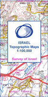
Netanya
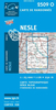
One of the titles in a series of maps from the Israeli Survey, in Hebrew - with some Roman alphabet equivalents, providing coverage of the whole of the West Bank and the Gaza Strip (pre-1967 boundaries are not shown). Most sheets were revised in the late 1990s - early 2000s, and although the areas of Palestinian Autonomy or shared responsibility are indicated, the political information and the effect of barrier on the road network may not necessarily be up to date.Relief is shown by contours at 25m intervals (20m on some sheets) and spot heights, with various types of terrain and land-use indicated by colours and symbols e.g. cliffs, sand, mudflats, orchards, olive groves, scrub, forest, nature reserves. Hydrographic information includes wadis, springs and wells. The maps show
various grades of roads, tracks and paths, as well as the country’s rail, indicating standard or narrow gauge lines. Symbols mark archaeological sites, ruins, synagogues and other places of worship, etc. The Israeli grid is shown at 1km intervals, with latitude and longitude given for the sheet corners. Map legend is in Hebrew and English. Some of the place names in Hebrew are printed in very small letters.
various grades of roads, tracks and paths, as well as the country’s rail, indicating standard or narrow gauge lines. Symbols mark archaeological sites, ruins, synagogues and other places of worship, etc. The Israeli grid is shown at 1km intervals, with latitude and longitude given for the sheet corners. Map legend is in Hebrew and English. Some of the place names in Hebrew are printed in very small letters.

Product Description
Reviews/Comments
Add New
Vouchers
No voucher codes found.
Do you know a voucher code for this product or supplier? Add it to Insights for others to use.
Do you know a voucher code for this product or supplier? Add it to Insights for others to use.
 Denmark