
 United Kingdom
 France
 Germany
 Netherlands
 Sweden
 USA
USA
 Italy
Italy
 Spain
Spain
More From Contributor

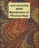


Old House Books: Nostalgia And Heritage Maps
Maps that explore and explain the past, published by the Old House Books from a variety of sources and on a wide range of subjects, from a Victorian map of the Thames to the aerodromes of Europe and tea plantations Ceylon and Java.Most titles are reproductions of maps and posters originally published in the late 19th and in the first decades of the 20th century. Each title comes with explanatory notes. All the titles are published as a folded map, with selected titles also available as a wall map.For more details please see individual descriptions.PLEASE NOTE: other maps from the Old House Books are listed on our website two more series:- “Great Britain: Reproductions of Old City Maps from the Old House Books”, with particularly interesting coverage of London.- “Great Britain:
Victorian England & Wales 1897 Maps from the Old House Books”- a series of 9 maps at 1” to 4 miles available either separately or as a set.
Victorian England & Wales 1897 Maps from the Old House Books”- a series of 9 maps at 1” to 4 miles available either separately or as a set.

Product Description
Reviews/Comments
Add New
Vouchers
No voucher codes found.
Do you know a voucher code for this product or supplier? Add it to Insights for others to use.
Do you know a voucher code for this product or supplier? Add it to Insights for others to use.
 Denmark