More From Contributor
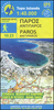
£9.50
Parnonas at 1:50, 000 in a series of contoured maps from Road Editions covering popular hiking areas of Greece. All the maps have altitude coloring & spot heights
- contour interval varies, as indicated in the descriptions of individual titles. Local footpaths are marked &, for road users the maps show picturesque routes, intermediate driving distances on minor roads, & locations of petrol stations & tyre repairs workshops. Boundaries of national parks & administrative regions are marked, & symbols show campsites, hotels & mountain refuges, & various landmarks & places of interest, e.g. archaeological sites, churches, etc. All place names are in both Greek & Latin alphabet. All the titles have latitude & longitude margin ticks, many also show GPS waypoints. Some maps come with a booklet or notes on the reverse side giving further information about the area and/or descriptions of hiking routes. Map legends include English. In this title: the Parnonas mountain range in eastern Peloponnese. Coverage extends from Sparta in the south-west corner of the sheet to the Aegean coast between Ayios Andhreas in the north & Pigadi in the south. The booklet has an index, a street plan of Sparta, & suggested routes to explore the area. Please note: Items from this publisher can have long delivery times. If your selected item is displayed as not in stock & you need the item within 4 weeks, to avoid disappointment we suggest you order a similar item from an alternative publisher.
...
Archived Product
£29.95
One of the maps in the topographic survey of Peru from the country’s national survey organization, Instituto Geográfico Nacional. Contours are at 25m intervals & colouring/symbols indicate different types of terrain & vegetation. Some of the maps may contain small blank spaces representing as yet unmapped areas. Each sheet covers 30’ latitude by 30’ longitude. The maps have a 1km UTM grid & margin ticks for latitude & longitude at intervals of 1’. Publication dates vary; most maps were published in 1960s to 1990s, with some sheets revised more recently. Map legend is in Spanish only, except in the more recent editions which also include English. ...
Archived Product
£14.95
Part of a series of books from Anavasi publishing showing certain Greek Islands from an angle rarely seen by the human eye
- from
...
Archived Product
£5.99
Paros at 1:40, 000 on a light, waterproof & tear-resistant, contoured & GPS-compatible map from Anavasi with English language descriptions of best sights. Topography is very clearly presented by contours at 20m intervals enhanced by relief shading & altitude colouring. The map indicates dirt roads in poor condition & shows locations of bus stops. The marking for footpaths distinguishes between easy to find & faint trails. Publishers’ recommendations for best hikes are highlighted. Symbols indicate various facilities & places of interest including campsites, tavernas, beaches & windsurfing sites, marinas, etc. The map has a 1-km UTM grid plus latitude & longitude crosshairs at 1’. Map legend

Includes::
English. On the reverse is a map showing Antiparos at the same scale, plus extensive bilingual notes on the island’s history & best sights. To see which other Greek islands are covered by maps from Anavasi, please click on the series link.

...
Archived Product
£9.99
Paros & Antiparos at 1:40, 000 on a contoured, GPS compatible hiking map published by Terrain Cartography group together with Skai Maps, & printed on light, waterproof & tear-resistant Polyart plastic paper, with extensive tourist information. Topography is very well presented by contours, enhanced by spot heights, subtle relief shading & additional altitude colouring. Contour interval, unless indicated below to the contrary, is 20m. National parks & other protected areas are marked. All place names are shown in both Greek & Latin alphabet. The maps have a UTM grid, plus latitude & longitude margin ticks. Hiking trails are graded between main routes & narrow trails. A wide range of symbols indicate various places of interest & recreational facilities, with main sights clearly highlighted. Most titles distinguish between sandy & pebble beaches; some also indicate beaches with natural shade and/or the type of sea bed. Road network is very clearly graded according to width & the type of surface, distinguishing between good & rough dirt roads. Distances are marked on most small local roads, as well as locations of petrol stations and/or tyre repair workshops. Scenic routes are highlighted. Each map also shows which ports are served by ferry services.* Map legend & all the text include English.** In this title:* street plan of Parikia at 1:4, 000. ...
Archived Product
£9.95
Paros & Antiparos at 1:40, 000 on a contoured, GPS compatible hiking map published by Terrain Cartography group together with Skai Maps, & printed on light, waterproof & tear-resistant Polyart plastic paper, with extensive tourist information. Topography is very well presented by contours, enhanced by spot heights, subtle relief shading & additional altitude colouring. Contour interval, unless indicated below to the contrary, is 20m. National parks & other protected areas are marked. All place names are shown in both Greek & Latin alphabet. The maps have a UTM grid, plus latitude & longitude margin ticks. Hiking trails are graded between main routes & narrow trails. A wide range of symbols indicate various places of interest & recreational facilities, with main sights clearly highlighted. Most titles distinguish between sandy & pebble beaches; some also indicate beaches with natural shade and/or the type of sea bed. Road network is very clearly graded according to width & the type of surface, distinguishing between good & rough dirt roads. Distances are marked on most small local roads, as well as locations of petrol stations and/or tyre repair workshops. Scenic routes are highlighted. Each map also shows which ports are served by ferry services. Map legend & all the text include English. In this title: street plan of Parikia at 1:4, 000. ...
Archived Product
£7.50
Road Edition maps are produced in co-operation with the Hellenic Army Geographical Service, the national survey organisation. The maps have contours with colour altitude tints. All the place names are shown in both Greek & Roman script. Road classification distinguishes between unsurfaced roads of good & poor quality. Tourist information

Includes::
scenic routes, petrol stations, archaeological sites, campsites, beaches, etc. Brief descriptions, in Greek & English, illustrate some of the interesting aspects of each isl&. Map legend

Includes::
English. On the reverse, there are lists of various types of accommodation from hotels to private rooms. Please note: deliveries from Road Editions are not very reliable. For titles currently not in stock it may be advisable to choose a map from another publisher.


...
Archived Product
£9.95
Paros & Antiparos in the Mc Gilchrist’s Greek Islands series focuses primarily on cultural tourism for the visitor who wishes to understand more about the art, history & architecture of the islands. The series contains no photographs, but has specially drawn maps for each island (66 in total) & site plans for every major site (57 in total), together with thoroughly comprehensive textual information. Each guide also recommends a small number of places to stay & eat selected for their simplicity & unpretentiousness. ...
Archived Product
£7.99
Olivier is a French aristocrat, the traumatized child of survivors of the Revolution. Parrot the son of an itinerant printer who always wanted to be an artist but has ended up a servant. Born on different sides of history, their lives will be brought together by their travels in America. When Olivier sets sail for the New World, ostensibly to study its prisons but in reality to save his neck from one more revolution
- Parrot is sent with him, as spy, protector, foe & foil. As the narrative shifts between the perspectives of Parrot & Olivier, & their picaresque travels together & apart
- in love & politics, prisons & the world of art
- Peter Carey explores the adventure of American democracy, in theory & in practice, with dazzling wit & inventiveness.


...
Archived Product
£7.99
Rumi was a thirteenth century poet, philosopher & mystic whose works have been studied for centuries, & still speak to us today. Some of his songs have been put to music by contemporary Western artists, & now this book brings a wise story about true love into the English language in book form. ...
Archived Product

Paros And Antiparos

Paros, including the nearby islands of Antiparos and Despotiko at 1:40, 000, from Kompass, with simple plans of Parikia, Antiparos town and Naousa. Contours at 20m intervals, spot heights, and very slight relief shading are used to denote topography; simple colour use displays areas of vegetation. Major and minor roads are shown with distances marked in kilometres.Points of interest such as surfing spots, beaches, archaeological sites, museums are clearly marked, with local facilities also displayed. The enlargement of Parikia is at 1:10, 000, with Naousa and Antiparos town at 1:5, 000; Parikia shows main places of interest and is accompanied by a list of 17 hotels and 20 restaurants. There is also a small map of ferry connections in the Aegean. The map place names are in both
Latin and Greek alphabet. Map legend includes English.
RIP - This product is no longer available on our network. It was last seen on 25.09.2019

This page now acts as a permanent archive for this product. Add more information using the comments box below to ensure it can still be found by future generations.

Use our search facility to see if it is available from an alternative contributor.
  • External links may include paid for promotion
  • Availability: Out Of Stock
  • Supplier: Stanfords
  • SKU: 9783850261074
Availability: In Stock
£6.95

Product Description

Paros, including the nearby islands of Antiparos & Despotiko at 1:40, 000, from Kompass, with simple plans of Parikia, Antiparos town & Naousa. Contours at 20m intervals, spot heights, & very slight relief shading are used to denote topography; simple colour use displays areas of vegetation. Major & minor roads are shown with distances marked in kilometres. Points of interest such as surfing spots, beaches, archaeological sites, museums are clearly marked, with local facilities also displayed. The enlargement of Parikia is at 1:10, 000, with Naousa & Antiparos town at 1:5, 000; Parikia shows main places of interest & is accompanied by a list of 17 hotels & 20 restaurants. There is also a small map of ferry connections in the Aegean. The map place names are in both Latin & Greek alphabet. Map legend

Includes::
English.

Reviews/Comments

Add New

Price History

Vouchers

No voucher codes found.
Do you know a voucher code for this product or supplier? Add it to Insights for others to use.

Facebook

Jargon Buster

Colour - The categorised spectrum of light visable to humans
Small - something that takes up less space than normal.
Simple - Basic, easy no difficulty in understanding.

Supplier Information

Stanfords
Stanfords was established in 1853 and opened their iconic Covent Garden flagship store in 1901. They have become the top retailer of maps, travel books and accessories in the UK and arguably offer the largest selection of maps and travel books worldwide. Famous names such as Captain Robert Falcon Scott, Ranulph Fiennes and Michael Palin have purchased from Stanfords. They now have a shop in Bristol and both stores together with other venues operate a calendar of events including talks, book signings and exhibitions. As a specialist map retailer, the map selection is comprehensive and includes road maps, street maps and walking maps from worldwide destinations, as well as a selection of world atlases and wall maps. Books include travel guides and travel literature. Stanfords also stock globes, from miniatures made of blue marble to magnificent floor-standing globes. The website features a selection of interesting articles on travel topics.
Page Updated: 2023-11-12 20:15:36

Community Generated Product Tags

Oh No! The productWIKI community hasn't generated any tags for this product yet!
Menu