
 United Kingdom
 France
 Germany
 Netherlands
 Sweden
 USA
USA
 Italy
Italy
 Spain
Spain
More From Contributor


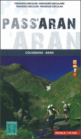
Pass`Aran Circuit: Couserans - Val D`Aran
A cross-border circuit in the Pyrenees linking the Couserans section of the GR10 in France with a route in the upper part of the Val d’Aran in Spain, presented by Editorial Alpina on a contoured and GPS compatible map at 1:25, 000, accompanied by a booklet with stage-by-stage descriptions and contact details for refuges.The map has contours at 10m intervals, enhanced by relief shading and altitude colouring. The course of the Pass’Aran circuit, including climbing detours to local peaks, is prominently highlighted. The map also shows other local hiking trails and indicates locations refuges, huts and gîtes, both along the main trail and in other parts of the area. The map has a 1km UTM grid, plus margin ticks for latitude and longitude at 1’ intervals. Map legend includes
English.Accompanying booklet, in French, Spanish and Catalan only, provides brief descriptions of the five stages of the route, with contact addresses of the accommodation options.
English.Accompanying booklet, in French, Spanish and Catalan only, provides brief descriptions of the five stages of the route, with contact addresses of the accommodation options.

Product Description
Reviews/Comments
Add New
Vouchers
No voucher codes found.
Do you know a voucher code for this product or supplier? Add it to Insights for others to use.
Do you know a voucher code for this product or supplier? Add it to Insights for others to use.
 Denmark