More From Contributor

£6.99
Slimline enough to wear under clothing & discreet enough to protect your belongings, this passport pouch is an essential travel companion. Its soft, comfy exterior makes it suitable for wearing on long journeys, while the 2 zipped front pockets protect passports, money & other valuables. A handy mesh compartment on the reverse ensures a place for everything. This pouch comes in 2 colours, beige & black. ...
Archived Product
£5.99
Passport to Holiday Fun is packed with amazing travel-themed doodles for children to colour & complete. Kids can create their own postcard designs, complete snowy scenes, rainforest adventures, & lots, lots more. The striking partially coloured artwork will inspire children of all ages to get creative & enjoy the excitement of new & exotic landscapes & locations. Passport to Holiday Fun is fun, simple & very creative but, best of all, no drawing skills are required! ...
Archived Product
£7.99
Passport Wallet is a small, multi functional case for carrying your passport & other valuables. The wallet is made from tough, black rip-stop fabric with orange detailing & has 2 EU sized passport slip in pockets, 1 document pocket, 3 credit card sized pockets, 1 ID card window & a pen loop. The wallet has a zipped main compartment section, a slip in front pocket, a belt loop & a removable neck cord. ...
Archived Product
£5.95
Everybody loves a passport
- especially children. With the exact shape & size of a passport, this delightful travel activity book
...
Archived Product
£17.99
With four major theme parks & 22 hotels, Disney World can be daunting -- this indispensable travel planner simplifies the process. Each of the four major parks gets in-depth coverage, complete with full-color fold-out maps & a description of every ride & attraction. Exhaustive profiles of Disney-owned resort hotels feature detailed maps, color photos, & room layouts. The guide also covers all of the park`s 300+ dining options. ...
Archived Product
£11.99
A cross-border circuit in the Pyrenees linking the Couserans section of the GR10 in France with a route in the upper part of the Val d’ Aran in Spain, presented by Editorial Alpina on a contoured & GPS compatible map at 1:25, 000, accompanied by a booklet with stage-by-stage descriptions & contact details for refuges. The map has contours at 10m intervals, enhanced by relief shading & altitude colouring. The course of the Pass’ Aran circuit, including climbing detours to local peaks, is prominently highlighted. The map also shows other local hiking trails & indicates locations refuges, huts & gîtes, both along the main trail & in other parts of the area. The map has a 1km UTM grid, plus margin ticks for latitude & longitude at 1’ intervals. Map legend

Includes::
English. Accompanying booklet, in French, Spanish & Catalan only, provides brief descriptions of the five stages of the route, with contact addresses of the accommodation options.

...
Archived Product
£8.99
Shortlisted for the 2012 Miles Franklin Award, PAST THE SHALLOWS is a powerful & hauntingly beautiful novel from an extraordinary new Australian writer who is compared with Cormac Mc Carthy & Tim Winton. ` If you read only one book this year, make sure it`s this` Sunday Times `I loved Past the Shallows` Kevin Powers, author of The Yellow Birds Everyone loves Harry. Except his father. Joe, Miles & Harry are growing up on the remote south coast of Tasmania. The brothers` lives are shaped by their father`s moods
- like the ocean he fishes, he is wild & unpredictable. He is a bitter man, with a devastating secret. Miles does his best to watch out for Harry, the youngest, but he can`t be there all the time. Often alone, Harry finds joy in the small treasures he discovers, in shark eggs & cuttlefish bones. In a kelpie pup, a mug of hot chocolate, & a secret friendship with a mysterious neighbour. But sometimes small treasures, or a brother`s love are not enough.
...
Archived Product
£9.99
Always in a hurry? Pasta provides the secrets to making simple & original dishes that are nutritionally balanced & quick & easy to prepare, using everyday ingredients & straightforward cooking techniques. ” Pasta”

Includes::
delicious dishes suitable for all occasions, whether a speedy supper or a sophisticated dinner party. Experience the pleasure of Italy`s most popular food, with success guaranteed.

...
Archived Product
£12.99
There are an infinite number of different pasta dishes, & they are all delicious! The simple & clear recipes go through the full range of pasta shapes that are available & describe the sauces that best suit each shape. Some are traditional Italian dishes, honed through centuries of honest home cooking, while others are new & original inventions, which play on the past & will surprise & delight the palate. ...
Archived Product
£14.99
Discover how to turn pulses, grains & sea vegetables into pasta dough, spiralized noodles, soups, pasta salads, pasta bowls, & baked pastas. From nutrient-filled artisan pastas to seaweed noodles, Pasta Reinvented has over 80 protein & fibre-packed recipes that offer exciting flavour combinations as well as being a unique alternative to traditional pasta recipes. Recipes are fully flexible with variations for making gluten-free & vegetarian options, & are complete with delicious pasta sauce suggestions so you can bring the best out of every dish. Pasta Reinvented is the perfect step-by-step guide to learning healthy pasta recipes that reinvent your favourite dish. ...
Archived Product

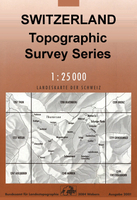
Passwang Swisstopo 1087

Map No. 1087, Passwang, in the topographic survey of Switzerland at 1:25, 000 from Bundesamt für Landestopographie (swisstopo), covering the whole country on 247 small format sheets, with special larger maps published for popular regions including some titles now available in hiking versions.Highly regarded for their superb use of graphic relief and hill shading, the maps give an almost 3-D picture of Switzerland`s mountainous terrain. Contours are at 10 m intervals, with 20m intervals in the mountainous areas. All the maps have a 1-km grid for Swiss national coordinates (datum CH 1903). *Small format sheets (Nos. 1011 - 1374)*Map legend in the language of the area covered by the map. Additional margin ticks show latitude and longitude in steps of 2`. The area covered by each map is
17 x 12 km (11 x 7 miles approx). *Special larger sheets (Nos. from 2501 onwards) – STANDARD editions:* No map legend is included but a separate leaflet can be provided instead. The area covered by each map is 25 x 17 km (15 x 11 miles approx).*Special larger sheets (Nos. from 2501 onwards) – HIKING editions:* An overprint highlights hiking, mountain and alpine paths, including regional and national long-distance trails. The maps also show bus routes with bus stops, plus inns in remote locations. The area covered by each map is 25 x 17 km (15 x 11 miles approx).
RIP - This product is no longer available on our network. It was last seen on 25.09.2019

This page now acts as a permanent archive for this product. Add more information using the comments box below to ensure it can still be found by future generations.

Use our search facility to see if it is available from an alternative contributor.
  • Availability: Out Of Stock
  • Supplier: Stanfords
  • SKU: 9783302010878
Availability: In Stock
£12.99

Product Description

Map No. 1087, Passwang, in the topographic survey of Switzerland at 1:25, 000 from Bundesamt für Landestopographie (swisstopo), covering the whole country on 247 small format sheets, with special larger maps published for popular regions including some titles now available in hiking versions. Highly regarded for their superb use of graphic relief & hill shading, the maps give an almost 3-D picture of Switzerland`s mountainous terrain. Contours are at 10 m intervals, with 20m intervals in the mountainous areas. All the maps have a 1-km grid for Swiss national coordinates (datum CH 1903). * Small format sheets (Nos. 1011
- 1374)* Map legend in the language of the area covered by the map. Additional margin ticks show latitude & longitude in steps of 2`. The area covered by each map is 17 x 12 km (11 x 7 miles approx). * Special larger sheets (Nos. from 2501 onwards) – STANDARD editions:* No map legend is included but a separate leaflet can be provided instead. The area covered by each map is 25 x 17 km (15 x 11 miles approx).* Special larger sheets (Nos. from 2501 onwards) – HIKING editions:* An overprint highlights hiking, mountain & alpine paths, including regional & national long-distance trails. The maps also show bus routes with bus stops, plus inns in remote locations. The area covered by each map is 25 x 17 km (15 x 11 miles approx).

Reviews/Comments

Add New

Intelligent Comparison

Oooops!
We couldn't find anything!
Perhaps this product's unique.... Or perhaps we are still looking for comparisons!
Click to bump this page and we'll hurry up.

Price History

Vouchers

No voucher codes found.
Do you know a voucher code for this product or supplier? Add it to Insights for others to use.

Facebook

Jargon Buster

Hiking - An outdoor activity envolving walking in nature
swiss - Short for Switzerland, one of the richest countries in the world
switzerland - A landlocked country in western Europe. One of the richest countries in the world
Language - the method of communication used in different areas. Humans and computers have many different languages.
Km - Kilometre. A unit of measurement equal to 1000 metres.
Small - something that takes up less space than normal.
Popular - Something that is admired and liked by many people.
Regional - An adjective to describe a set geographic area.
Language - The way humans communicate either written and spoken.

Supplier Information

Stanfords
Stanfords was established in 1853 and opened their iconic Covent Garden flagship store in 1901. They have become the top retailer of maps, travel books and accessories in the UK and arguably offer the largest selection of maps and travel books worldwide. Famous names such as Captain Robert Falcon Scott, Ranulph Fiennes and Michael Palin have purchased from Stanfords. They now have a shop in Bristol and both stores together with other venues operate a calendar of events including talks, book signings and exhibitions. As a specialist map retailer, the map selection is comprehensive and includes road maps, street maps and walking maps from worldwide destinations, as well as a selection of world atlases and wall maps. Books include travel guides and travel literature. Stanfords also stock globes, from miniatures made of blue marble to magnificent floor-standing globes. The website features a selection of interesting articles on travel topics.
Page Updated: 2023-11-12 20:15:36

Community Generated Product Tags

Oh No! The productWIKI community hasn't generated any tags for this product yet!
Menu