More From Contributor

£8.99
` Saunders is an astoundingly tuned voice
- graceful, dark, authentic & funny
- telling just the kind of stories we

...
Archived Product
£9.99
New in paperback, this book from master chef Michel Roux dispels the myth that pastry making is complicated & beyond the reach of most cooks. Designed in an easy-to-follow format, this chunky compilation presents all of the classic pastries in the simplest possible way, along with an inspiring collection of superb recipes. Divided into 10 chapters, focusing on a particular type of dough, each one opens with a detailed step-by step technique spread with tips on perfect results. There are chapters on shortcrust, puff, brioche, croissant, choux & filo amongst others, & each chapter has both savoury & sweet recipes using the basic dough with plenty of tips for perfect results. There are 100 recipes, beautifully photographed by Martin Brigdale, ranging from classics, such as Quiche Lorraine, Classic Pizza, Fillet of Beef in a Brioche Crust, Apple Tart, Pecan Pie, to contemporary approaches to canapes, seafood pastries & filo croustades. Classic recipes are given a modern twist while orginal recipes boast new combinations of flavours or a lighter, simpler style of cooking. Those who choose to buy their pastry rather than make it can still enjoy the recipes. ...
Archived Product
£10.99
Patagonia in a series of double-sided, indexed touring maps with plans of main towns. Road network, particularly in the less populated parts of the country,

Includes::
more minor roads & tracks & more small settlements than corresponding titles in the ACA Zonal series. Road information continues across the border with Chile. Faint relief shading with names of main mountain ranges indicates the topography. The maps show railway network, administrative boundaries, & national parks & protected areas. A range of symbols mark places of interest, campsites, sport & recreational resorts, etc. Each title also

Includes::
street plans of main towns. The maps have no geographical coordinates. Map legend is in Spanish only.* In this title:* an enlargement showing in greater detail the national parks of Lanín & Nahuel Huapi; street plans of Comodoro Rivadavia, Neuquén, Purto Madryn, Rios Gallegos, San Carlos de Barioche, Ushuaia, & Viedma; plus insets showing the zone of Antarctic & the South Atlantic islands claimed by Argentina.


...
Archived Product
£10.99
Patagonia on a laminated, waterproof & tear-resistant at 1:2, 750, 000 covering both the Argentinian & the Chilean side, with enlargements for Peninsula Valdés, the Lake District & Austral Patagonia, plus additional tourist information. The map covers both countries south of the Temuco/ Neuquén/ Bahía Blanca line & is designed for tourist wishing to explore both sides of the border, with crossing points prominently marked & named. Road network distinguishes between paved & unsurfaced roads, gives driving distances on main routes & markslocations of fuel supplies. Railway lines & local airports are also shown. Symbols highlight various places of interest. The topography is indicated by relief shading with names of main peaks. National parks & other protected areas are highlighted. The map has latitude & longitude lines at intervals of 2°. The index

Includes::
a separate list of border crossings with opening times, type of road access & facilities available there. On the reverse the three most visited areas are shown enlarged in greater detail:* Peninsula Valdés at 1:1, 200, 000 with a calendar for spotting whales, dolphins, etc.* The cross-border lake district at 1:1, 400, 000 from Villarrica & Pucón to beyond Puerto Montt on the Chilean side & in Argentina the region around the popular resorts of San Martín de los Andes, San Carlos de Bariloche & El Bolsón.* Austral Patagonia from Perito Moreno National Park to Punta Arenas, including the Torres del Paine National Park at 1:1, 400, 000. The map also provides additional tourist information with brief descriptions of main sights, a list of facilities in the national parks, a distance table, climate charts, etc. Map legend & all the text are in English.

...
Archived Product
£9.99
Patagonia & Tierra del Fuego on a double-sided map from ITMB showing the mainland on both sides of the Chile – Argentina border at 1:2, 200, 000 with Tierra del Fuego & the islands around the Magellan Straights in greater detail at 1:750, 000. Both sides show the topography by altitude colouring with plenty of names of mountain ranges, islands, straights & bays, etc. On one side is an indexed map at 1:2, 200, 000 covering South America southwards from Concepción & Chillán in Chile & from north of Bahía Blanca in Argentina. Topography is presented by altitude colouring, with graphics indicating national parks & other protected areas. The map shows the regions’ road network, including selected tracks & seasonal roads, as well locations accessible by air services & shipping routes from Puetro Montt along the Chilean fjords. Numerous places of interest are marked, some annotated with brief notes. The map has latitude & longitude lines at 3° intervals. On the reverse southernmost part of the continent, south of Puerto Natales & Rio Gallegos, is shown in greater detail at 1:750, 000. The map indicates border crossings between the two countries, presents the road network with locations of fuel supplies, & shows local airports/airfields & ferry connections. Symbols indicate locations with tourist accommodation, shelters & campsites, beaches, & other places of interest. The map is indexed & has latitude & longitude lines at 30’ & 1° irrespectively. Also included here is street plan of central Ushuaia indicating locations of hotels & other tourist facilities. ...
Archived Product
£14.99
Travel writer Wayne Bernhardson covers the best sights & adventures that Patagonia has to offer, from viewing the jagged peaks of Cuernos del Paine & hiking on Argentina`s Moreno Glacier to visiting Ushuaia, the world`s southernmost city. Bernhardson also offers various trip strategies, including The Andean Lakes Loop & The Natural History Tour. Including details on exploring the penguin-dotted Falkland Islands, staying in guest ranches in the Patagonian outback, & whale watching at the World Heritage Site of Peninsula Valdes, Moon Patagonia gives travellers the tools they need to create a more personal & memorable experience. ...
Archived Product
£12.00
Patagonia in the Landscapes of the Imagination guide series; providing an in-depth cultural & account of some of the world’s most memorable & evocative landscapes. Presented as a cultural & literary guide, each title in the series explores the cultural history of a landscape, providing an overview of the area’s development from its earliest roots to the modern day. Particular emphasis is placed on the literary, poetic, architectural, cultural & historical elements that make up the landscape & each title is written & researched by an academic expert. An Epilogue offers suggestion for further reading & indices of literary, artistic & historical names & places & landmarks. ...
Archived Product
£14.99
Patagonia at 1:160, 000 on a durable, waterproof & tear-resistant, contoured & GPS compatible map from terra Quest, providing continuous coverage from Monte Fitz Roy in the Los Glaciares NP to the Torres del Paine NP & Puerto Natales. The map divides the region north/south with a generous overlap between the sides. The northern half starts at 49°12’ – the northern tip of the Los Glaciares National Park & covers mostly the Argentinian side including the trekking areas from El Chaltén, Viedma Glacier, Upsala Glacier & the western inlets of Lago Argentino. On the reverse the map starts with Peninula Magellanes & the Perito Moreno Glacier on the Argentinian side & continues southwards into Chile across the Torres del Paine National Park to the Ultima Esperanza Sound & Puerto Natales. Topography is vividly presented by contours at 50m intervals enhanced by relief shading, with colouring and/or graphics to indicate glaciers & ice calving zones, shrub/bushes or forests & wetlands, plus plenty of names of mountain ranges, peaks, glaciers, passes, etc. Trekking routes are highlighted, indicating difficult passages & the map also shows canoe trails. Road network gives driving distances on main roads & many local tracks & shows locations of border crossings. Also marked are ferry routes & local airports. Symbols indicate settlements accessible by bus, hotels, campsites, mountain huts, bivouac places, ranger stations, fuel supplies, horse riding stables, medical help, etc. Latitude & longitude grid is at intervals of 2’. Multilingual map legend

Includes::
English. The map is laminated in a format similar to the old cloth-dissected maps so that sections of it can be easily folded back without damage, & can be annotated with write-on/wipe-off marker pens.

...
Archived Product
£13.95
This bilingual Spanish-English field guide

Includes::
an introduction to the natural history & the protected

...
Archived Product
£11.95
Double-sided map of Patagonia with enlargements for the national parks area in northern Patagonia, Peninsula Valdez, & the whole of the southern Patagonia with Tierra del Fuego, plus street plans of main towns & resorts. On one side is a map of the whole of the Argentinian Patagonia at 1:2, 500, 000, showing the region ...
Archived Product

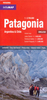
Patagonia (including The Falkland Islands) Handbook (ed. 2) SUPERCEDED

Seasoned travel writer Wayne Berhardson covers the best sights and adventures that Patagonia has to offer, from visiting Ushuaia, the world's southernmost city, to viewing the jagged peaks of Cuernos del Paine and hiking on Argentina's Moreno Glacier. Bernhardson also offers unique trip strategies including The Andean Lakes Loop and The natural History Tour. Complete with details for exploring the penguin-dotted Falkland Islands, staying in guest ranches in the Patagonian outback, and whale watching at the World Heritage Site of Pennsula Valds, Moon Patagonia gives travelers the tools they need to create a more personal and memorable experience.
RIP - This product is no longer available on our network. It was last seen on 25.09.2019

This page now acts as a permanent archive for this product. Add more information using the comments box below to ensure it can still be found by future generations.

Use our search facility to see if it is available from an alternative contributor.
  • Availability: Out Of Stock
  • Supplier: Stanfords
  • SKU: 9781598800869
Availability: In Stock
£12.99

Product Description

Seasoned travel writer Wayne Berhardson covers the best sights & adventures that Patagonia has to offer, from visiting Ushuaia, the world's southernmost city, to viewing the jagged peaks of Cuernos del Paine & hiking on Argentina's Moreno Glacier. Bernhardson also offers unique trip strategies including The Andean Lakes Loop & The natural History Tour. Complete with details for exploring the penguin-dotted Falkland Islands, staying in guest ranches in the Patagonian outback, & whale watching at the World Heritage Site of Pennsula Valds, Moon Patagonia gives travelers the tools they need to create a more personal & memorable experience.

Reviews/Comments

Add New

Intelligent Comparison

Oooops!
We couldn't find anything!
Perhaps this product's unique.... Or perhaps we are still looking for comparisons!
Click to bump this page and we'll hurry up.

Price History

Vouchers

No voucher codes found.
Do you know a voucher code for this product or supplier? Add it to Insights for others to use.

Facebook

Jargon Buster

Hiking - An outdoor activity envolving walking in nature
Argentina - A country in South America.
History - Anything that happens in the past. An acedemic subject.
World - A physical grouping, commonly used to describe earth and everything associated with ti
Natural - not manmade
Personal - Something that belongs more to an individual due to it affecting them more by relating to them.
Experience - To gain further knowledge by practising.

Supplier Information

Stanfords
Stanfords was established in 1853 and opened their iconic Covent Garden flagship store in 1901. They have become the top retailer of maps, travel books and accessories in the UK and arguably offer the largest selection of maps and travel books worldwide. Famous names such as Captain Robert Falcon Scott, Ranulph Fiennes and Michael Palin have purchased from Stanfords. They now have a shop in Bristol and both stores together with other venues operate a calendar of events including talks, book signings and exhibitions. As a specialist map retailer, the map selection is comprehensive and includes road maps, street maps and walking maps from worldwide destinations, as well as a selection of world atlases and wall maps. Books include travel guides and travel literature. Stanfords also stock globes, from miniatures made of blue marble to magnificent floor-standing globes. The website features a selection of interesting articles on travel topics.
Page Updated: 2023-11-12 20:15:36

Community Generated Product Tags

Oh No! The productWIKI community hasn't generated any tags for this product yet!
Menu