
 United Kingdom
 France
 Germany
 Netherlands
 Sweden
 USA
USA
 Italy
Italy
 Spain
Spain
More From Contributor


Patagonia
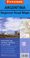
Patagonia in a series of double-sided, indexed touring maps with plans of main towns. Road network, particularly in the less populated parts of the country, includes more minor roads and tracks and more small settlements than corresponding titles in the ACA Zonal series. Road information continues across the border with Chile. Faint relief shading with names of main mountain ranges indicates the topography. The maps show railway network, administrative boundaries, and national parks and protected areas. A range of symbols mark places of interest, campsites, sport and recreational resorts, etc. Each title also includes street plans of main towns. The maps have no geographical coordinates. Map legend is in Spanish only.*In this title:* an enlargement showing in greater detail the
national parks of Lanín and Nahuel Huapi; street plans of Comodoro Rivadavia, Neuquén, Purto Madryn, Rios Gallegos, San Carlos de Barioche, Ushuaia, and Viedma; plus insets showing the zone of Antarctic and the South Atlantic islands claimed by Argentina.
national parks of Lanín and Nahuel Huapi; street plans of Comodoro Rivadavia, Neuquén, Purto Madryn, Rios Gallegos, San Carlos de Barioche, Ushuaia, and Viedma; plus insets showing the zone of Antarctic and the South Atlantic islands claimed by Argentina.

Product Description
Reviews/Comments
Add New
Vouchers
No voucher codes found.
Do you know a voucher code for this product or supplier? Add it to Insights for others to use.
Do you know a voucher code for this product or supplier? Add it to Insights for others to use.
 Denmark