
 United Kingdom
 France
 Germany
 Netherlands
 Sweden
 USA
USA
 Italy
Italy
 Spain
Spain
More From Contributor


Patricroft And Monton 1905
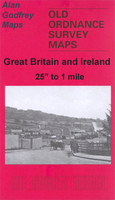
Patricroft and Monton 1905 in a fascinating series of reproductions of old Ordnance Survey plans in the Alan Godfrey Editions, ideal for anyone interested in the history of their neighbourhood or family. Selected towns in Great Britain and Ireland are covered by maps showing the extent of urban development in the last decades of the 19th and early 20th century.In this title: the map covers the Patricroft area, formerly part of the borough of Eccles, including Patricroft itself and stretches north to Monton and Monton Green, and west to Winton and Alder Forest. Features include the engine sheds and sidings at Patricroft (which was one of the last steam sheds to close), Bridgewater Foundry, Magnesium Metal Works, Barton on Irwell Workhouse, Ellesmere Iron Foundry, British Pluviusin
Works, Patricroft and Monton Green stations, Bridgewater Canal, Monton Dye Works, tramways, Parrin Lane, Worsley Road, Monton Unitarian Chapel. The Grange is at the western extremity. On the reverse are street directory entries for Monton Green, Monton Road and Parrin Lane. About the Alan Godfrey Editions of the 25
Works, Patricroft and Monton Green stations, Bridgewater Canal, Monton Dye Works, tramways, Parrin Lane, Worsley Road, Monton Unitarian Chapel. The Grange is at the western extremity. On the reverse are street directory entries for Monton Green, Monton Road and Parrin Lane. About the Alan Godfrey Editions of the 25
Product Description
Reviews/Comments
Add New
Intelligent Comparison
Archived Product
Patricroft And Monton 1905 Stanfords
£3.50
Vouchers
No voucher codes found.
Do you know a voucher code for this product or supplier? Add it to Insights for others to use.
Do you know a voucher code for this product or supplier? Add it to Insights for others to use.
 Denmark