
 United Kingdom
 France
 Germany
 Netherlands
 Sweden
 USA
USA
 Italy
Italy
 Spain
Spain
More From Contributor


Patrington 1904
Patrington 1904 in a fascinating series of reproductions of old Ordnance Survey plans in the Alan Godfrey Editions, ideal for anyone interested in the history of their neighbourhood or family. Selected towns in Great Britain and Ireland are covered by maps showing the extent of urban development in the last decades of the 19th and early 20th century.In this title: the map crosses the boundary between Lancashire and Cheshire, including a southern portion of Irlam, in Lancashire, and the village of Partington, in Cheshire. The Manchester Ship Canal runs through the map. Features include Cadishead or Glazebrook Bridge, Patent Fuel Works; Partington village with St Mary's church, The Green, Tannery (but not station). Directories of Irlam and Partington in 1918 are included on the
reverse.About the Alan Godfrey Editions of the 25
reverse.About the Alan Godfrey Editions of the 25
Product Description
Reviews/Comments
Add New
Intelligent Comparison
Archived Product
Patrington 1904 Stanfords
£3.50
Archived Product
Carrington 1904 Stanfords
£2.95
Archived Product

Carrington 1904 Stanfords
£3.50
Archived Product
Paignton 1904 Stanfords
£2.95
Archived Product
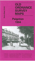
Paignton 1904 Stanfords
£3.50
Archived Product

Paddington 1914 Stanfords
£3.50
Archived Product

Warrington 1905 Stanfords
£3.50
Archived Product

Paddington 1893 Stanfords
£3.50
Vouchers
No voucher codes found.
Do you know a voucher code for this product or supplier? Add it to Insights for others to use.
Do you know a voucher code for this product or supplier? Add it to Insights for others to use.
 Denmark