
 United Kingdom
 France
 Germany
 Netherlands
 Sweden
 USA
USA
 Italy
Italy
 Spain
Spain
More From Contributor


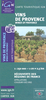


Provence: Camargue
Provence - Camargue at 1:160, 000 with several street plans in a series from Michelin covering popular holiday areas of France with maps either adapted to provide more convenient coverage or enlarged for greater clarity. Presentation of the road network includes scenic routes and viewpoints, classification according to the number of lanes, motorway junctions indicating full or partial interchanges, motorway services and rest areas, gradients, limited height and load, entry restrictions, etc. Railway lines are included. Small symbols mark various places of interest and recreational areas. Map legend includes English.In this title: contrary to its title, the map covers both sides of the lower Rh
Product Description
Reviews/Comments
Add New
Vouchers
No voucher codes found.
Do you know a voucher code for this product or supplier? Add it to Insights for others to use.
Do you know a voucher code for this product or supplier? Add it to Insights for others to use.
 Denmark