
 United Kingdom
 France
 Germany
 Netherlands
 Sweden
 USA
USA
 Italy
Italy
 Spain
Spain
More From Contributor


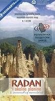
Radan And Sokolovica Mountains
Radan and Sokolovica Mountains at 1:50, 000 on a detailed contoured map from the Belgrade based Geokarta showing waymarked hiking trails, hotels and mountain huts, places of interest, etc. Plus extensive notes in English.The map indicates boundaries of local hunting grounds of Sokolovica, Kocanica and Šumata as well as the protected nature areas. Contours are at 20m intervals with colouring for forests. An overprint highlights hiking trails around Prolom Banja. Symbols indicate locations of hotels, mountain huts, restaurants, various places of interest, etc. All place names are in the Latin alphabet only. The map has no geographical coordinates. On the reverse is extensive text about the region, its fauna and flora, monuments, etc.Map legend and all the text include English.

Product Description
Reviews/Comments
Add New
Vouchers
No voucher codes found.
Do you know a voucher code for this product or supplier? Add it to Insights for others to use.
Do you know a voucher code for this product or supplier? Add it to Insights for others to use.
 Denmark