
 United Kingdom
 France
 Germany
 Netherlands
 Sweden
 USA
USA
 Italy
Italy
 Spain
Spain
More From Contributor


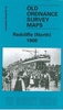


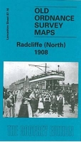
Radcliffe 1927
Radcliffe in 1927 in a fascinating series of reproductions of old Ordnance Survey plans in the Alan Godfrey Editions, ideal for anyone interested in the history of their neighbourhood or family. The map covers much of the Lancashire town of Radcliffe. Coverage stretches from Cams Lane eastward to Bury Street and from Cemetery Road southward to James Street. Features include St Thomas church, River Irwell, Sun Mills, Globe Iron Works, Irwell Mill, Crystal Mills, Cawdaw Dye Works, Clough Bleach Works, New Road Mills, Irwell Preserve Works, Wellington Mills, Pioneer Mills, Coronation Park, tramways, the Clifton-Accrington railway with Radcliffe Bridge station, the Manchester-Radcliffe line with Radcliffe New station, Radcliffe West Fork with sidings etc, East Lancashire
Paper Mill, Wilton Mill, Crow Oaks Works, Healey Maternity Home, Irwell Bleach and Dye Works, James Street Sidings, Sunny Bank Mill, St Philip`s Mission Church, Allen`s Green, Peel Park Ground, Spider Mill, Scotson Fold, Canal Mill, Holly Bank Mills, Manchester Bolton & Bury Canal, Smyrna Works, etc. Extracts from a contemporary trade directory are on the reverse.About the Alan Godfrey Editions of the 25” OS Series:Selected towns in Great Britain and Ireland are covered by maps showing the extent of urban development in the last decades of the 19th and early 20th century. The plans have been taken from the Ordnance Survey mapping and reprinted at about 15 inches to one mile (1:4, 340). On the reverse most maps have historical notes and many also include extracts from
contemporary directories. Most maps cover about one mile (1.6kms) north/south, one and a half miles (2.4kms) across; adjoining sheets can be combined to provide wider coverage.FOR MORE INFORMATION AND A COMPLETE LIST OF ALL AVAILABLE TITLES PLEASE CLICK ON THE SERIES LINK.

Product Description
Reviews/Comments
Add New
Intelligent Comparison
Archived Product
Radcliffe North 1908 Stanfords
£2.95
Archived Product
Radcliffe North 1908 Stanfords
£3.50
Vouchers
No voucher codes found.
Do you know a voucher code for this product or supplier? Add it to Insights for others to use.
Do you know a voucher code for this product or supplier? Add it to Insights for others to use.
 Denmark