More From Contributor

£10.50
A interesting & useful map for railways fans & travellers. On one side is the main map of the whole of Australia at 1:5, 500, 000 on which railways are highlighted. Colour coding distinguishes various gauges & identifies particular scenic, long-distance routes (including The Ghan) which are also described in information panels. The map is indexed not only for locations but also the numerous local rail & heritage train operators & rail museums nationwide, for which essential features are stated, along with phone numbers & website details. Miniature railways, preservation groups & some tour operators are also listed, although these are not cross-referenced to the map. On the reverse are cartograms (not-to-scale, stylized maps) depicting suburban rail & tram networks in Sydney, Perth, Adelaide, Melbourne & Brisbane, & other networks in further selected regions eg. northern Queensl&, southern NSW. These indicate gauges, operators, stops, journey times, service frequencies & some ferry connections. ...
Archived Product
£10.99
The definitive rail map for today`s independent traveller. This map shows passenger rail routes in Europe & is the ideal companion to the European Rail Timetable. Important Tourist Railways are also shown, many of which operate only during the tourist season.-Features every railway route across Europe-Colour coding for all high-speed routes-Highlighting for scenic lines-Also

Includes::
principal tourist & heritage lines (services on these lines may not run all year or on every day of the week)

...
Archived Product
£12.99
Florida visitors are often surprised by both the beauty of its trails & by the great variety of its landscapes. Although Florida doesn`t have any mountains, it does offer trails with views of everything from beaches & bluffs to prairies & wetlands. In this comprehensive trail guide, you`ll find some of the best, most beautiful trails in Florida. Many of the trails were converted from unused railroad corridors to become some of the best multiuse rail-trails in the state. In this guidebook, experts from Rail-to-Trails Conservancy present their final list of the top trails & rail-trails in Florida, selected from more than 100 in the state. In addition to details about each trail, in this guide, you`ll also find information about trail amenities including rest rooms, parking facilities & water fountains. ...
Archived Product
£14.99
Across the country, more than 1600 unused railroad corridors have been converted to level, public, multiuse trails, where people can enjoy a fitness run, a leisurely bike ride, or a stroll with the family. In this updated guide in the popular series, the Rails-to-Trails Conservancy presents the Mid-Atlantic region`s finest rail-trails plus other great multiuse trails. Rail-Trails Mid-Atlantic covers 60 trails in Delaware, Maryl&, Virginia, West Virginia, & Washington, D.C. Many rail-trails are paved & run through the most scenic parts of town. Others, such as the 34-mile Virginia Creeper National Recreation Trail, travel along dense forests, open fields, & lush waterways. Some explore the area`s history, such as Maryland`s 13-mile Baltimore & Annapolis Trail. Tour the nation`s capital, visit the site of an historic Civil War battle, & enjoy the serenity of the rural countryside along the Mid-Atlantic`s many great multiuse trails. This full-color book

Includes::
succinct descriptions of each trail from start to finish, plus at-a-glance summary information indicating permitted uses, surface type, length, & directions to trailheads for each trail. Every trip has a detailed map that

Includes::
start & end points, trailhead, parking, restroom facilities, & other amenities.


...
Archived Product
£13.99
Across the country, more than 1600 unused railroad corridors have been converted to level, public, multiuse trails, where people can enjoy a fitness run, a leisurely bike ride, or a stroll with the family. In this new guide in the popular series, the Rails-to-Trails Conservancy presents the Northwest region`s finest rail-trails plus other great multiuse trails. Rail-Trails Washington & Oregon

Includes::
detailed coverage of more than 40 great trails. Many rail-trails are paved & run through the most scenic parts of town. Others travel along dense forests, open fields, & lush waterways. Some explore the area`s history, & others help users enjoy the serenity of the rural countryside. Favorites noted by Rails-to-Trails Conservancy staff include the Chehalis Western Trail & Olympic Discovery Trail in Washington & the Banks-Vernonia State Trail in Oregon. This full-color book

Includes::
succinct descriptions of each trail from start to finish, plus at-a-glance summary information indicating permitted uses, surface type, length, & directions to trailheads for each trail. Every trip has a detailed map that

Includes::
start & end points, trailhead, parking, restroom facilities, & other amenities.


...
Archived Product
£25.00
The two volumes covering Rails Across Europe are divided into one covering the North & West of the continent, the other dealing with the South & East. The photos were taken by David Cable, well-regarded author of several photographic albums of trains throughout the world, supplemented by a few taken by friends. The books show pictures of modern traction mainly from the 1980s up to the current era, showing the huge variety of classes
- locomotives as well as multiple units
- & the panoply of colour schemes that continue to grow. The photos were taken both at railway stations & in the countryside & give a wide range of locations The first volume covers Scandinavia, the Baltic states, Germany, Pol&, the Benelux countries, the United Kingdom & Irel&. The second volume deals with France, Spain, Portugal, Italy, Switzerl&, Austria & the majority of Central European & Balkan countries, which had been in the former Soviet Eastern Block.

...
Archived Product
£25.00
The two volumes covering Rails Across Europe are divided into one, covering the North & West of the continent, the other dealing with the South & East. The photos were taken by David Cable, a well-regarded author of several photographic albums of trains throughout the world, supplemented by a few taken by friends. The books show pictures of modern traction mainly from the 1980s to the current era, covering the huge variety of classes
- locomotives as well as multiple units
- & the panoply of colour schemes that continue to grow. The photos were taken both at railway stations & in the countryside & give a wide range of locations. The first volume covers Scandinavia, the Baltic states, Germany, Pol&, the Benelux countries, the United Kingdom & Irel&. The second volume deals with France, Spain, Portugal, Italy, Switzerl&, Austria & the majority of Central European & Balkan countries, which had been in the former Soviet Eastern Block.

...
Archived Product
£7.99
Britain`s rail network is now among the safest in the world, but the journey that brought it to that point has been long & eventful. Early incidents like the felling of William Huskisson MP by Stephenson`s Rocket (1830) showed how new ideas could bring new dangers; yet from disaster came new safety measures, & within fifty years better signalling & braking methods had been made mandatory. The twentieth century saw accident repeatedly lead to action & further advances in rolling stock, track design & train protection systems. Greg Morse charts these changes through the events that helped to prompt them, including the Armagh collision (1889) & the Harrow & Wealdstone disaster (1952). He ends with a railway approaching a new `golden age` in the 1980s
- yet with the tragedy at Clapham Junction (1988) offering a solemn reminder against complacency.
...
Archived Product
£20.00
This new atlas compares the railway network in Ireland in 1920 with the network today. It is produced by the same authors as the successful Railway Atlas Then & Now which covers the railways in Britain & will follow the same layout & design which shows the historical map on one page & the current map on the facing page for comparison. As in Britain, the Irish railway network was built in the 19th century by numerous independent railway companies. Many of these were speculative ventures & served underpopulated rural areas & many were gradually taken over by larger railway groups. The main lines were split between eight major companies but there were numerous other smaller companies that maintained their independence but many, however, failed to generate their predicted revenue. 1920 was the peak year in the Irish railway network but the civil war & partition that followed that decade had a severe impact on the railways. Traffic declined still further during World War 2 & during the 1950s & 1960s swathes of the railway network were closed so that today`s network is only about half the size of that in 1920. The railways were built to a variety of gauges & the atlas will include the narrow gauge passenger railways as well as those built to the standard gauge in Irel&. The maps will be supplemented by historical photographs & a potted history of each line, with a timeline. There has long been an interest in Irish railways among British railway enthusiasts as well as those based in Ireland & this book will be a worthy addition to Ian Allan`s unrivalled library of railway atlases, providing a comprehensive historical record of the changes in the railway system in Irel&. ...
Archived Product
£19.99
There is an undoubted fascination both with railway atlases & with the ' Then & Now' approach to railway history. Unlike any other atlas published, The Railway Atlas Then & Now provides historical & present-day maps alongside each other for direct comparison. Based around the ' Pre-Grouping Atlas & Gazetteer', the left-hand of the two maps records the railway industry as it existed in 1923, whilst the right-hand page shows it as it exists today. The contemporary 2012 maps include information about the railway lines that have been closed & converted into either walking or cycling routes. Other information given

Includes::
the location of all steam sheds & current diesel depots. The book

Includes::
45 maps from each period
- making a total of 90pp of mapping in all
- alongside a detailed gazetteer & brief introduction.


...
Archived Product

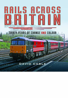
Rails Across Britain: Thirty Years Of Change And Colour

Rails Across Britain is a collection of full-size colour photographs of trains that have operated in Great Britain over the last thirty years. Compiled by a well-regarded author of several successfully published books showing many varying classes of trains throughout the world, this book covers the period from 1986 to the present day. It brilliantly illustrates the various classes and the huge myriad of colour schemes that have been used throughout the years, from the great days of the British Rail to the era of Privatisation. The contrast between the cash-strapped British Rail from an almost universal blue and grey colour scheme, to the well-funded privatised multi-coloured system seen today, is well portrayed in this comprehensive album, in which more than one photo of a class is
shown. This selection of photographs have been specifically chosen to demonstrate an undeniably wide range of locations from Fort William in Scotland to St Austell in Cornwall, and, of course, in a variety of British weather conditions. The emphasis is, therefore, on the beauty of the train in its surroundings.
RIP - This product is no longer available on our network. It was last seen on 25.09.2019

This page now acts as a permanent archive for this product. Add more information using the comments box below to ensure it can still be found by future generations.

Use our search facility to see if it is available from an alternative contributor.
  • External links may include paid for promotion
  • Availability: Out Of Stock
  • Supplier: Stanfords
  • SKU: 9781473849136
Availability: In Stock
£25.00

Product Description

Rails Across Britain is a collection of full-size colour photographs of trains that have operated in Great Britain over the last thirty years. Compiled by a well-regarded author of several successfully published books showing many varying classes of trains throughout the world, this book covers the period from 1986 to the present day. It brilliantly illustrates the various classes & the huge myriad of colour schemes that have been used throughout the years, from the great days of the British Rail to the era of Privatisation. The contrast between the cash-strapped British Rail from an almost universal blue & grey colour scheme, to the well-funded privatised multi-coloured system seen today, is well portrayed in this comprehensive album, in which more than one photo of a class is shown. This selection of photographs have been specifically chosen to demonstrate an undeniably wide range of locations from Fort William in Scotland to St Austell in Cornwall, &, of course, in a variety of British weather conditions. The emphasis is, therefore, on the beauty of the train in its surroundings.

Reviews/Comments

Add New

Intelligent Comparison

Oooops!
We couldn't find anything!
Perhaps this product's unique.... Or perhaps we are still looking for comparisons!
Click to bump this page and we'll hurry up.

Price History

Vouchers

No voucher codes found.
Do you know a voucher code for this product or supplier? Add it to Insights for others to use.

Facebook

Jargon Buster

Grey - A colour often associated with old age (going grey)
Blue - A primary colour
World - A physical grouping, commonly used to describe earth and everything associated with ti
Colour - The categorised spectrum of light visable to humans
Day - The time it takes a planet or other space objects to complete one rotation.
Size - is the measurement of how big an object is in space.
Weather - is the change of an atmospheres conditions.
Wide - Something with a large width.

Supplier Information

Stanfords
Stanfords was established in 1853 and opened their iconic Covent Garden flagship store in 1901. They have become the top retailer of maps, travel books and accessories in the UK and arguably offer the largest selection of maps and travel books worldwide. Famous names such as Captain Robert Falcon Scott, Ranulph Fiennes and Michael Palin have purchased from Stanfords. They now have a shop in Bristol and both stores together with other venues operate a calendar of events including talks, book signings and exhibitions. As a specialist map retailer, the map selection is comprehensive and includes road maps, street maps and walking maps from worldwide destinations, as well as a selection of world atlases and wall maps. Books include travel guides and travel literature. Stanfords also stock globes, from miniatures made of blue marble to magnificent floor-standing globes. The website features a selection of interesting articles on travel topics.
Page Updated: 2023-11-12 20:15:36

Community Generated Product Tags

Oh No! The productWIKI community hasn't generated any tags for this product yet!
Menu