
 United Kingdom
 France
 Germany
 Netherlands
 Sweden
 USA
USA
 Italy
Italy
 Spain
Spain
More From Contributor


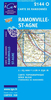

Ramsele
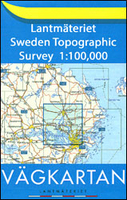
Topographic survey of Sweden at 1:100, 000, the Vägkartan, from the Lantmäteriet, covering most of the country in 79 double-sided maps. Please note: the mountainous regions of central and northern Sweden are not covered by this series but presented in a separate “Fjällkartan - Mountain Map” series also listed on our website.Each 1:100, 000 topographic survey map covers an area of 75 x 80km. The maps have contours at 10 metre intervals, plus relief shading and colouring for different types of landscape: open land, forests, alvar, marshes, etc. Boundaries of national parks and nature reserves, areas prohibited to cross-country vehicles, and restricted entry military zones are marked. The maps indicate privately maintained local roads, cycle paths with wind shelters,
footpaths, etc, and include all other information expected of topographic survey at this scale. The maps have a 2-km UTM grid, plus latitude and longitude lines 10’ intervals. Map legend includes English.For coverage of the country’s most visited hiking areas in central and northern Sweden please see Lantmäteriet’s Mountain Map series, listed separately on our website.
footpaths, etc, and include all other information expected of topographic survey at this scale. The maps have a 2-km UTM grid, plus latitude and longitude lines 10’ intervals. Map legend includes English.For coverage of the country’s most visited hiking areas in central and northern Sweden please see Lantmäteriet’s Mountain Map series, listed separately on our website.

Product Description
Reviews/Comments
Add New
Vouchers
No voucher codes found.
Do you know a voucher code for this product or supplier? Add it to Insights for others to use.
Do you know a voucher code for this product or supplier? Add it to Insights for others to use.
 Denmark