
 United Kingdom
 France
 Germany
 Netherlands
 Sweden
 USA
USA
 Italy
Italy
 Spain
Spain
More From Contributor


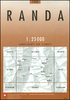
Rana West Nordeca 2617
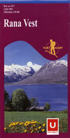
Rana West area in Norway in a series of GPS compatible recreational maps at 1:50, 000 with cartography from Norway’s topographic survey and additional tourist information. Contours lines are drawn at 20m intervals. The overprint varies from title to title, but includes local footpaths, in some cases distinguishing between easy and more difficult trails, as well as mountain huts and campsites. Many titles also indicate cycle or ski routes, other accommodation possibilities, sport and recreational facilities, including alpine skiing slopes, places of interest, etc. The maps have a UTM grid and margin ticks giving latitude and longitude. Map legend includes English. Several titles have on the reverse additional tourist information, although in most cases in Norwegian only.PLEASE
NOTE: this title is also available as part of a 2-map set which includes the Rana East map. To see the list of Turkart maps at 1:50, 000 and links to Turkart series at 25K, 100K and Hiking Sets please click on the series link above.
NOTE: this title is also available as part of a 2-map set which includes the Rana East map. To see the list of Turkart maps at 1:50, 000 and links to Turkart series at 25K, 100K and Hiking Sets please click on the series link above.

Product Description
Reviews/Comments
Add New
Vouchers
No voucher codes found.
Do you know a voucher code for this product or supplier? Add it to Insights for others to use.
Do you know a voucher code for this product or supplier? Add it to Insights for others to use.
 Denmark