
 United Kingdom
 France
 Germany
 Netherlands
 Sweden
 USA
USA
 Italy
Italy
 Spain
Spain
More From Contributor


Rand McNally Political World Wall Map PAPER
Medium size, 127 x 81.5cm (4ft 2 x 2ft 8 approx.), political map of the world from Rand McNally - PAPER version - with countries shown in lively but muted colours against light blue oceans. Country names are clearly legible print.The map has relief shading to show the mountainous areas, with names of main geographical features: mountain chains, peaks, deserts, rivers, etc. All place names are shown in their English version. Projection is Gall Stereographic. This map is also available laminated.
Product Description
Reviews/Comments
Add New
Intelligent Comparison
Archived Product
Rand McNally Political World Wall Map LAMINATED Stanfords
£18.99
Archived Product
Global Mapping Political World Wall Map A3 PAPER Stanfords
£4.99
Archived Product
NGS Executive Political World Wall Map PAPER Stanfords
£16.95
Archived Product

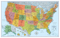
USA Rand McNally Classic Wall Map PAPER Stanfords
£14.99
Archived Product
World Rand McNally Classic Wall Map PAPER Stanfords
£14.99
Archived Product
USA Rand McNally Signature Wall Map PAPER Stanfords
£14.99
Archived Product
NGS Physical World Wall Map PAPER Stanfords
£14.95
Archived Product
Hema Upside Down Political World Wall Map PAPER Stanfords
£9.95
Vouchers
No voucher codes found.
Do you know a voucher code for this product or supplier? Add it to Insights for others to use.
Do you know a voucher code for this product or supplier? Add it to Insights for others to use.
 Denmark