More From Contributor

£6.99
Brimming with character profiles, fun facts, story"es & puzzles galore, this is the jam-packed sticker book that no Roald Dahl fan should be without. With appearances from Matilda, Willy Wonka, Mr Fox & all your other favourites, it`s the perfect companion to Roald Dahl`s wonderful world of incredible stories. ...
Archived Product
£3.99
Head inside Willy Wonka`s chocolate factory, where Charlie Bucket, Augustus Gloop, Veruca Salt & the rest await! In this fun collection of puzzles, you can complete the Oompa-Loompas` favourite songs, help lead violet Beauregarde to the juicing room, & find all of Mr Wonka`s finest products. This fun collection of activities

Includes::
full colour stickers & classic Quentin Blake artwork.

...
Archived Product
£7.99
Looking for the perfect Easter activity? Enter the world of James & the Giant Peach, & head off on an incredible insect adventure. Now you can join James, The Centipede, The Earthworm & the rest of the gang in this bug-packed journey through the world of insects. Perfect for Easter holiday activities; get your hands marvellously muddy & find out all the whacky & wondrous facts about your favourite creepy-crawlies! Based on Roald Dahl`s James & the Giant Peach, this phizz-whizzing activity book is packed with brilliant bugs & fun activities to try at home, like making your own ant farm & building your very own bug hotel. ...
Archived Product
£3.99
Crack Mr Wormwood`s secret code, guide Matilda to Miss Honey`s house & find the Trunchbull`s meanest words! Matilda is one of Roald Dahl`s most magical creations, & now she has her very own sticker book, packed full of fun activities & classic Quentin Blake artwork. ...
Archived Product
£10.99
Stanfords Adult Book of the Month April 2017 From cycling in Shetland to power cuts in Laos, Roam Alone is a celebration of inspiring writers who went it alone & lived to tell the tale. Featuring a foreword by TV presenter & newsreader Jan Leeming, Roam Alone: Inspiring Tales by Reluctant Solo Travellers is a unique title from Bradt, showcasing a brand new collection of remarkable travellers’ tales with a different slant, following on the heels of To Oldly Go!, one of the UK’s bestselling travel titles of 2015. Writers featured in Roam Alone include Phoebe Smith, Jennifer Barclay, Hilary Bradt, & 37 new travel writers chosen from a worldwide competition to find the best stories by reluctant solo travellers. ...
Archived Product
£12.99
Topographic survey of France at 1:25, 000 in IGN`s excellent TOP25 / Série Bleue series. All the maps are GPS compatible, with a 1km UTM grid plus latitude & longitude lines at 5’ intervals. Contours are at 5m intervals except for mountainous areas where the maps have contours at 10m intervals, vividly enhanced by hill shading & graphics for rocky terrain. Colouring with graphics indicates different types of vegetation or land use (deciduous or coniferous forests, moors, orchards, vineyards, etc). PLEASE NOTE: coverage of France at this scale is currently being revised – the format & the presentation of each title are indicated by the letters at the end of its Sheet Reference number (e.g. 0416ET, 3531ETR, 1923SB, etc.)MAPS WITH FULL TOURIST OVERPRINT & AN ENGLISH MAP LEGEND: all TOP25 maps & the SB editions of Série Bleue have an overprint highlighting waymarked walking trails including long-distance GR routes &, where appropriate, ski routes. Symbols indicate campsites, gîtes d’etape, refuges, equestrian centres & other recreational facilities or sites, tourist information centres, cultural heritage, etc. Towns & locations of particular interest are highlighted.- ET or OT = single-sided TOP25 map covering approx. 29x 21 km / 18x 13 miles.- ETR or OTR = waterproof & tear resistant TOP25 map covering the same area as the corresponding ET or OT number, but double-sided, printed on a smaller size sheet with a good overlap between the sides.- SB = Série Bleue map with full tourist overprint; these maps, first introduced in summer 2014, each cover approx. 29x 24km / 18x 15 miles.SÉRIE BLEUE maps with numbers ending in E (Est) or O (Ouest): most editions now indicate the GR routes, but do not show any other tourist information. Map legend is in French only. Each map covers approx. 14x 20km / 9x 12 miles. ...
Archived Product
£6.99
Meet a little boy whose toy animal friends come to life at bedtime in this riotous, shout out loud picture book by Joshua George. Children age 3 & up will laugh out loud when the animals make the wrong noises... & join in with the noisy fun when they finally get them right. ...
Archived Product
£12.99
• Waterproof • Tear-Resistant • Fishing & River Map The Roaring Fork & Fryingpan Rivers Fishing & River Map Guide is designed to be the perfect companion to anyone recreating on either of these two iconic Colorado rives. The Roaring Fork begins at Independence Pass & passes through the towns of Aspen, Basalt, & Carbondale before finally joining the mighty Colorado at Glenwood Springs. Along the way, it covers 68 river miles & drops 6, 700 feet in elevation & morphs from a small mountain stream into a mighty & powerful waterway known as ” Thunder River” by the local Ute Indians struck by its imposing roar. Numerous recreational opportunities are available from fishing along the Rail-to-Trails converted Rio Grande Trail that follows the river for most of its length to running the class IV rapids just downstream from Aspen. The Fryingpan River is known primarily for its Gold Medal waters that start at Ruedi Reservoir Dam & continue all the way to the confluence of the Roaring Fork in the historic outdoor recreation town of Basalt. This guide covers the Gold Medal Waters of the Fryingpan for 14 miles & ends at Ruedi Reservoir. Each Fishing & River Map Guide

Includes::
detailed river maps at a scale of 1 inch = 1/2 mile. At this scale every turn in the river & rapid is clearly shown & labeled. Each page is centered on the river & overlaps with the adjacent pages so finding any location along the river is easy. The maps include rapids, river miles, access points, private & public lands, gaging stations, recreation sites, & more. Also included are stream flow charts, hatch charts, & a table of river access points. More convenient & easier to use than folded maps, but just as compact & lightweight, National Geographic`s Fishing & River Map Guide booklets are printed on ” Backcountry Tough” waterproof, tear-resistant paper with stainless steel staples. A full UTM grid is printed on the map to aid with GPS navigation.

...
Archived Product
£15.99
The author has spent 5 years travelling & eating in search of the tastiest dishes from the snowiest climes, resulting in an irresistible collection of dishes from North America & Northern Europe. This re-issue of a classic & unique collection of recipes celebrates some of the world's most overlooked cuisines by using produce that can be found on our own doorsteps. There are potato & cheese dishes from Italy's skiing slopes, pastries from the coffee houses of Vienna & Budapest, & little appetizers that have been eaten at Russian celebrations since the days of the Tsar. These recipes will bring warmth to your heart as well as your home. ...
Archived Product
£25.00
A mix of modern & traditional Greek recipes, all inspired by the quaint & picturesque island of Paxos. This cookbook will appeal to fans of Mediterranean cuisine as well as those inspired by Greek island life. On the sleepy & beautiful Ionian island of Paxos, the local people still follow the old ways. They cook from ancient recipes: simple dishes, handed down the generations until they seem to have become part of the collective unconscious u in which good ingredients are allowed to speak for themselves. The food on this little island is special, because by happy accident of history & geography, Paxos is the place where Greek & Italian cuisines meet. Here, you have the simplicity & robust flavours of traditional Greek food, lifted with Italian style & panache. The result is the quintessence of Mediterranean cooking
- healthy, fresh ingredients used in delicious flavour combinations that are easy to prepare. Try your hand at real Tzatsiki & tasty Dolmades; learn a fuss-free way to prepare grilled meats & seafood; cook up one of Belinda`s warm pies on a cold winter night, & mix a glorious daquiri for a warm summer evening with friends. How many times have you fallen in love with something you have tasted on holiday, only to be disappointed when trying to recreate it at home? Roast Lamb in the Olive Groves not only brings a treasure-trove of tastes home safely, it shows how these dishes can be made dazzling & inspiring for modern cooks to serve at home. In sparkling, original recipes that are true to the spirit of Paxiot cooking, it shows how the ancient can be very modern indeed.
...
Archived Product

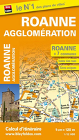
Roanne

Street plan of Roanne, part of an extensive series covering French cities and towns from Blay-Foldex, the country’s largest, oldest and most experienced publisher of urban mapping.Blay plans include outer suburbs and, where appropriate, adjoining localities forming part of the urban agglomeration and provide brief descriptions of the town’s main sights, contact details for hotels and other places of interest, etc. The plans show one way streets, car parks and pedestrian zones. Important public buildings are clearly marked and identified. Blay street maps are usually double-sided and include an enlargement for the town centre and a street index with separate lists of “edifices publics”: main public buildings, places of worship, schools, sport facilities, stations, etc.
Each of the outer suburbs or the adjoining localities, identified with its postcode, has a separate index. Many titles also provide a road map of the environs. All the text is in French only.PLEASE NOTE: to see the list of Blay-Foldex street plans of French towns and cities please click on the series link – the series description also includes a comparison between Blay and IGN street plans.
RIP - This product is no longer available on our network. It was last seen on 25.09.2019

This page now acts as a permanent archive for this product. Add more information using the comments box below to ensure it can still be found by future generations.

Use our search facility to see if it is available from an alternative contributor.
  • Availability: Out Of Stock
  • Supplier: Stanfords
  • SKU: 9782309500979
Availability: In Stock
£6.99

Product Description

Street plan of Roanne, part of an extensive series covering French cities & towns from Blay-Foldex, the country’s largest, oldest & most experienced publisher of urban mapping. Blay plans include outer suburbs &, where appropriate, adjoining localities forming part of the urban agglomeration & provide brief descriptions of the town’s main sights, contact details for hotels & other places of interest, etc. The plans show one way streets, car parks & pedestrian zones. Important public buildings are clearly marked & identified. Blay street maps are usually double-sided & include an enlargement for the town centre & a street index with separate lists of “edifices publics”: main public buildings, places of worship, schools, sport facilities, stations, etc. Each of the outer suburbs or the adjoining localities, identified with its postcode, has a separate index. Many titles also provide a road map of the environs. All the text is in French only.PLEASE NOTE: to see the list of Blay-Foldex street plans of French towns & cities please click on the series link – the series description also

Includes::
a comparison between Blay & IGN street plans.

Reviews/Comments

Add New

Intelligent Comparison

Oooops!
We couldn't find anything!
Perhaps this product's unique.... Or perhaps we are still looking for comparisons!
Click to bump this page and we'll hurry up.

Price History

Vouchers

No voucher codes found.
Do you know a voucher code for this product or supplier? Add it to Insights for others to use.

Facebook

Jargon Buster

Car - A machine used for transport which runs on roads
Road - a manmade lane or a path that is used to speed up travel.

Supplier Information

Stanfords
Stanfords was established in 1853 and opened their iconic Covent Garden flagship store in 1901. They have become the top retailer of maps, travel books and accessories in the UK and arguably offer the largest selection of maps and travel books worldwide. Famous names such as Captain Robert Falcon Scott, Ranulph Fiennes and Michael Palin have purchased from Stanfords. They now have a shop in Bristol and both stores together with other venues operate a calendar of events including talks, book signings and exhibitions. As a specialist map retailer, the map selection is comprehensive and includes road maps, street maps and walking maps from worldwide destinations, as well as a selection of world atlases and wall maps. Books include travel guides and travel literature. Stanfords also stock globes, from miniatures made of blue marble to magnificent floor-standing globes. The website features a selection of interesting articles on travel topics.
Page Updated: 2023-11-12 20:15:36

Community Generated Product Tags

Oh No! The productWIKI community hasn't generated any tags for this product yet!
Menu