
 United Kingdom
 France
 Germany
 Netherlands
 Sweden
 USA
USA
 Italy
Italy
 Spain
Spain
More From Contributor


Roehampton 1894
Roehampton in 1894 in a fascinating series of reproductions of old Ordnance Survey plans in the Alan Godfrey Editions, ideal for anyone interested in the history of their neighbourhood or family. The map covers the small, scattered village of Roehampton, which had under 300 houses in 1894. Roehampton Lane runs north-south through the centre of the map, with Trinity Church, the Convent of the Sacred Heart, Roehampton House and Downshire House. The map extends west to Priory Lane and Palewell Common; and eastward to Putney Park Lane, Putney Park, Gifford House and Granard church. The High Street is at the foot of the map.About the Alan Godfrey Editions of the 25” OS Series:Selected towns in Great Britain and Ireland are covered by maps showing the extent of urban development in the
last decades of the 19th and early 20th century. The plans have been taken from the Ordnance Survey mapping and reprinted at about 15 inches to one mile (1:4, 340). On the reverse most maps have historical notes and many also include extracts from contemporary directories. Most maps cover about one mile (1.6kms) north/south, one and a half miles (2.4kms) across; adjoining sheets can be combined to provide wider coverage.FOR MORE INFORMATION AND A COMPLETE LIST OF ALL AVAILABLE TITLES PLEASE CLICK ON THE SERIES LINK.
last decades of the 19th and early 20th century. The plans have been taken from the Ordnance Survey mapping and reprinted at about 15 inches to one mile (1:4, 340). On the reverse most maps have historical notes and many also include extracts from contemporary directories. Most maps cover about one mile (1.6kms) north/south, one and a half miles (2.4kms) across; adjoining sheets can be combined to provide wider coverage.FOR MORE INFORMATION AND A COMPLETE LIST OF ALL AVAILABLE TITLES PLEASE CLICK ON THE SERIES LINK.

Product Description
Reviews/Comments
Add New
Intelligent Comparison
Archived Product

Hampton 1894 Stanfords
£3.50
Archived Product

Northampton 1899 Stanfords
£3.50
Archived Product
Northampton 1899 Stanfords
£2.95
Archived Product

Lower Clapton 1894 Stanfords
£3.50
Archived Product

Kempston 1924 Stanfords
£3.50
Archived Product

Charlton 1894 Stanfords
£3.50
Archived Product
Brampton 1924 Stanfords
£2.95
Archived Product
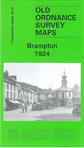
Brampton 1924 Stanfords
£3.50
Vouchers
No voucher codes found.
Do you know a voucher code for this product or supplier? Add it to Insights for others to use.
Do you know a voucher code for this product or supplier? Add it to Insights for others to use.
 Denmark