More From Contributor

£14.99
This is a book about how to drink rum of all kinds. It`s about classic rums & new-generation rums, about rhum agricole & about premium aged rums, about rums from all over the world. It`s about rum enjoyed with cola & ginger beer. About the best rum for a classic daquiri. About rum cocktails that ooze style & personality. Above all, it`s about enjoying your rum in ways you never thought possible. The premium rum market is growing at an astonishing rate. The mission of this book is to help drinkers appreciate this complex spirit, find the style they like & discover how this versatile spirit can best be enjoyed. It will help you to understand your rum
- how it`s produced (whether from molasses, cane syrup or cane juice) & whether it`s dry, sweet, fresh or oaky. More than 100 different rums are featured & analysed, from rich, sweet mellow Guyana rums to the vegetal peppery rums of Martinique or Guadeloupe & contemporary spiced rums. Dave Broom provides a description & graded tasting notes for each br&, allowing you to create the perfect mix every time. Finally, a selection of classic & contemporary cocktails shows just how wonderfully versatile this spirit is.
...
Archived Product
£14.99
Waterproof & tear-resistant OS Active version of map No. 39 from the Ordnance Survey’s Landranger series at 1:50, 000, with contoured & GPS compatible topographic mapping plus tourist information.MOBILE DOWNLOADS: As well as the physical edition of the map, each Landranger title now

Includes::
a code for downloading after purchase its digital version onto your smartphone or tablet for viewing on the OS smartphone app.OS LANDRANGER SERIES: to see the list of all the titles in the OS Landranger series, both paper & waterproof versions, please click on the series link. Maps in the Landranger series provide plenty of recreational & tourist information, indicating the traditional public right of way paths (except in Scotland where different laws apply), including bridleways & byways restricted or open to motorized traffic. National Trails & selected other long-distance paths are marked, as well as on-road & traffic-free cycle routes with their National/ Regional Cycle Network numbers. National Trust/ National Trust for Scotland & Forestry Commission land is clearly marked, indicating open or restricted access. A range of symbols highlights camping & caravanning sites, youth hostels, tourist information offices & visitors’ centres, parking & picnicking places, World Heritage sites, sport & recreational facilities, etc. The maps provide detailed presentation of topography with contours at 10m intervals, numerous spot heights & additional colouring and/or graphics for different types of woodlands, orchards or parkl&, rock features including scree & cliffs, water features inland & along the sea shore with marshl&, dunes, s&, mud, shingle & the high water mark. All the standard information expected of survey mapping at this scale is included: finely graded road network, railway lines with stations, cuttings, embankments, etc; individual isolated buildings; archaeological & historical sites, etc. For GPS users the British National Grid is shown at 1km intervals, with latitude & longitude given by margin ticks at 1` & cross hairs on the map at 5`. Each map covers an area of 40 x 40km, (approx. 25 x 25 miles).

...
Archived Product
£8.99
Paper version of map No. 39 from the Ordnance Survey’s Landranger series at 1:50, 000, with contoured & GPS compatible topographic mapping plus tourist information.MOBILE DOWNLOADS: As well as the physical edition of the map, each Landranger title now

Includes::
a code for downloading after purchase its digital version onto your smartphone or tablet for viewing on the OS smartphone app.OS LANDRANGER SERIES: to see the list of all the titles in the OS Landranger series, both paper & waterproof versions, please click on the series link. Maps in the Landranger series provide plenty of recreational & tourist information, indicating the traditional public right of way paths (except in Scotland where different laws apply), including bridleways & byways restricted or open to motorized traffic. National Trails & selected other long-distance paths are marked, as well as on-road & traffic-free cycle routes with their National/ Regional Cycle Network numbers. National Trust/ National Trust for Scotland & Forestry Commission land is clearly marked, indicating open or restricted access. A range of symbols highlights camping & caravanning sites, youth hostels, tourist information offices & visitors’ centres, parking & picnicking places, World Heritage sites, sport & recreational facilities, etc. The maps provide detailed presentation of topography with contours at 10m intervals, numerous spot heights & additional colouring and/or graphics for different types of woodlands, orchards or parkl&, rock features including scree & cliffs, water features inland & along the sea shore with marshl&, dunes, s&, mud, shingle & the high water mark. All the standard information expected of survey mapping at this scale is included: finely graded road network, railway lines with stations, cuttings, embankments, etc; individual isolated buildings; archaeological & historical sites, etc. For GPS users the British National Grid is shown at 1km intervals, with latitude & longitude given by margin ticks at 1` & cross hairs on the map at 5`. Each map covers an area of 40 x 40km, (approx. 25 x 25 miles).

...
Archived Product
£8.99
The islands of Rum, Eigg, Muck, Canna & Sanday on a detailed topographic & GPS compatible map No. 397, paper version, from the Ordnance Survey’s 1:25, 000 Explorer series.MOBILE DOWNLOADS: this title & all the other OS Explorer maps include a code for downloading after purchase the digital version onto your smartphone or tablet for viewing on the OS smartphone app.OS EXPLORER SERIES: to see the list of all the titles in the OS Explorer series, both paper & waterproof versions, please click on the series link. The Explorer series, Ordnance Survey’s most detailed maps recommended for anyone enjoying outdoor activities, provides topographic coverage of Great Britain at 1:25, 000 on GPS compatible maps with hiking trails, cycling routes & extensive tourist information. Each printed map is available either on paper or as a waterproof & tear-resistant OS Active Map, as indicated in its title. Britain’s National Parks & other areas of particular tourist interest are presented on often double-sided OL (Outdoor Leisure) maps, whilst most standard format Explorers cover an area of 30 x 20km (approx. 19 x 12 miles). All three versions (paper, waterproof & digital) are the same & provide plenty of recreational & tourist information, indicating the traditional public right of way paths (except in Scotland where different laws apply), including bridleways & byways. National Trails & other long-distance paths are marked, as well as permissive footpaths or bridleways & on-road or traffic-free cycle routes with, where appropriate, their National/ Regional Cycle Network numbers. Boundaries of access land are clearly marked. A wide range of symbols provides additional tourist information, highlighting camping & caravanning sites, information offices & visitors’ centres, parking & picnicking places, country pubs, sport & recreational facilities including cycle hire locations & mountain biking trails, historic buildings & museums, etc. Exceptionally clear presentation of the landscape is provided by contours at 5m or in the uplands at 10m intervals, with additional spot heights plus colouring and/or graphics for different types of woodlands, orchards, heath, marshl&, scree or boulders, & other topographic features. For GPS users the maps have British National Grid lines at 1km intervals, with latitude & longitude given by margin ticks at 1`. Clearly laid out map legend

Includes::
French & German translations for the tourist information symbols.

...
Archived Product
£14.99
The islands of Rum, Eigg, Muck, Canna & Sanday on a detailed topographic & GPS compatible map No. 397, waterproof version, from the Ordnance Survey’s 1:25, 000 Explorer series. MOBILE DOWNLOADS: this title & all the other OS Explorer maps include a code for downloading after purchase the digital version onto your smartphone or tablet for viewing on the OS smartphone app.OS EXPLORER SERIES: to see the list of all the titles in the OS Explorer series, both paper & waterproof versions, please click on the series link. The Explorer series, Ordnance Survey’s most detailed maps recommended for anyone enjoying outdoor activities, provides topographic coverage of Great Britain at 1:25, 000 on GPS compatible maps with hiking trails, cycling routes & extensive tourist information. Each printed map is available either on paper or as a waterproof & tear-resistant OS Active Map, as indicated in its title. Britain’s National Parks & other areas of particular tourist interest are presented on often double-sided OL (Outdoor Leisure) maps, whilst most standard format Explorers cover an area of 30 x 20km (approx. 19 x 12 miles). All three versions (paper, waterproof & digital) are the same & provide plenty of recreational & tourist information, indicating the traditional public right of way paths (except in Scotland where different laws apply), including bridleways & byways. National Trails & other long-distance paths are marked, as well as permissive footpaths or bridleways & on-road or traffic-free cycle routes with, where appropriate, their National/ Regional Cycle Network numbers. Boundaries of access land are clearly marked. A wide range of symbols provides additional tourist information, highlighting camping & caravanning sites, information offices & visitors’ centres, parking & picnicking places, country pubs, sport & recreational facilities including cycle hire locations & mountain biking trails, historic buildings & museums, etc. Exceptionally clear presentation of the landscape is provided by contours at 5m or in the uplands at 10m intervals, with additional spot heights plus colouring and/or graphics for different types of woodlands, orchards, heath, marshl&, scree or boulders, & other topographic features. For GPS users the maps have British National Grid lines at 1km intervals, with latitude & longitude given by margin ticks at 1`. Clearly laid out map legend

Includes::
French & German translations for the tourist information symbols.

...
Archived Product
£10.50
Putumayo presents Rumba Flamenco, a collection of upbeat music with influences from Spanish flamenco, salsa, & pop. Popularized worldwide by the Gipsy Kings, rumba flamenco (also known as gypsy rumba) is a blend of flamenco with Afro-Cuban rhythms. Rumba Flamenco brings attention to some of the many artists who share the same musical traditions as the Gipsy Kings. Gypsy rumba originated in the Catalan regions of northeastern Spain & southern France. This accessible & upbeat style of flamenco has attracted fans across the globe. Rumba Flamenco features music that reflects the soul of the gypsies, the passion of flamenco, & the irresistible beats of Cuba.CD Track listing:1 Maita Vende Ca, ' Rankankin' (Spain) 2 Javier Ruibal, ' Isla Mujere' (Spain) 3 Ojos de Brujo, ' Vacileo' (Spain) 4 Wafir, ' Lei' (Sudan/ Spain) 5 Peret, ' Una Chica Muy Guapa' (Spain) 6 Ziroq, ' Que Pena' (USA/ Spain) 7 Eric Fernandez, ' Shalom Israel' (France) 8 Chico & the Gypsies, ' Tengo Tengo' (France) 9 De Madera, ' Canaveral' (USA/ Australia/ Colombia) 10 Ojos de Brujo, ' Tesoro' (Spain) 11 Gitano Family, ' Hommage Aux Marquises' (France) 12 Ricao, ' Malacutum' (France) 13 Energipsy, ' Joselito' (France) About this series: Putumayo World Music was established to introduce people to the music of the world's cultures. The label grew out of Putumayo clothing company, founded by Dan Storper in 1975 & sold in 1997. Co-founder Michael Kraus joined Storper to help launch Putumayo World Music in 1993. Since then the label has become known primarily for its upbeat & melodic compilations of great international music characterized by the company's motto: ...
Archived Product
£10.50
Putumayo presents ” Rumba Flamenco”, a collection of upbeat music with influences from Spanish flamenco, salsa, & pop. Popularized worldwide by the Gipsy Kings, rumba flamenco (also known as gypsy rumba) is a blend of flamenco with Afro-Cuban rhythms. ” Rumba Flamenco” brings attention to some of the many artists who share the same musical traditions as the Gipsy Kings. Gypsy rumba originated in the Catalan regions of northeastern Spain & southern France. This accessible & upbeat style of flamenco has attracted fans across the globe. ” Rumba Flamenco” features music that reflects the soul of the gypsies, the passion of flamenco, & the irresistible beats of Cuba.CD Track listing:1 Maita Vende Ca, ` Rankankin` (Spain) 2 Javier Ruibal, ` Isla Mujere` (Spain) 3 Ojos de Brujo, ` Vacileo` (Spain) 4 Wafir, ` Lei` (Sudan/ Spain) 5 Peret, ` Una Chica Muy Guapa` (Spain) 6 Ziroq, ` Que Pena` (USA/ Spain) 7 Eric Fernandez, ` Shalom Israel` (France) 8 Chico & the Gypsies, ` Tengo Tengo` (France) 9 De Madera, ` Canaveral` (USA/ Australia/ Colombia) 10 Ojos de Brujo, ` Tesoro` (Spain) 11 Gitano Family, ` Hommage Aux Marquises` (France) 12 Ricao, ` Malacutum` (France) 13 Energipsy, ` Joselito` (France) About this series: Putumayo World Music was established to introduce people to the music of the world`s cultures. The label grew out of Putumayo clothing company, founded by Dan Storper in 1975 & sold in 1997. Co-founder Michael Kraus joined Storper to help launch Putumayo World Music in 1993. Since then the label has become known primarily for its upbeat & melodic compilations of great international music characterized by the company`s motto: “guaranteed to make you feel good!” ...
Archived Product
£12.99
This is a powerful & darkly humorous graphic polemic by a leading British comics artist that investigates our increasingly dangerous relationship with cars. If you want to get away with murder, buy a car. Combining autobiography, statistics, case histories, advertising & reportage, Woodrow Phoenix draws a compelling picture of the warped psychology behind our need for speed. ...
Archived Product
£9.50
Topographical survey of Belgium at 1:20, 000 from Nationaal Geografisch Instituut / Institut Géographique National, the country’s national survey organization. Each 20K map covers one quarter of the corresponding 1:50, 000 map (with adjustments in the border & coastal areas). The maps provide all the information expected of topographic mapping at this scale & in addition have an unusually large amount of vegetation and/or land use information (different types of woodlands, gardens, orchards, heath, etc). The maps have a 1-km UTM grid, with margin ticks for latitude & longitude at intervals of 1`. Map legend & a glossary of terms used on the maps include English. Stanfords keeps as regular stock 20K maps for the World War I battlefields around the Ypres, Messines & Passchendaele, & for the area of the Battle of Waterloo. The 1:20, 000 survey covers the whole of Belgium & maps for other regions can be supplied as special orders. To see the list of titles in this series please click on the series link.PLEASE NOTE: the Long-Distance Footpaths Map of Belgium at 1:300, 000 which shows the division of Belgium into the 50K survey sheets can also be used to see in more detail coverage by the 20K maps. ...
Archived Product
£10.99
It is often said that Rumi (aka Jalal al-Din, 1207-73) is now the most popular poet in the United States. This conquest of the new world by a middle-eastern medieval writer who died before Chaucer was even born has been achieved with extraordinary speed in less than thirty years. The main key to Rumi`s success is the spiritual appeal of his work. It combines lyrical beauty with philosophical profundity, a sense of rapture & an acute awareness of human suffering in ways which speak directly to contemporary audiences. Like the metaphysical poets, Donne, Vaughan & Herbert, Rumi yokes together everyday images with complex ideas. He talks about divine love in vivid human terms. As a religious teacher of the Dervish order, he expounds the mystical doctrines of Sufism which focus on the notion of union with the Beloved to whom many of the poems are addressed. Persian poetry of this period is not easy to translate. In order to give the greatest possible access to a wonderful poet this selection draws on avariety of translations from the early 20th century to the present, ranging from scholarly renderings to free interpretations. ...
Archived Product

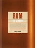
Rum: The Complete Guide

The diversity of flavours and colours of rum is as rich as the history and culture that surrounds this alcoholic beverage. This guide provides an overview of more than 300 different types of rum and then categorises them using an innovative taste model. For every rum, you receive a clear overview of its origins, taste and aroma. In addition, you can read all about the different types of rum, the production and maturing process, the perfect way to serve, and the best cocktails.
RIP - This product is no longer available on our network. It was last seen on 25.09.2019

This page now acts as a permanent archive for this product. Add more information using the comments box below to ensure it can still be found by future generations.

Use our search facility to see if it is available from an alternative contributor.
  • Availability: Out Of Stock
  • Supplier: Stanfords
  • SKU: 9789401450072
Availability: In Stock
£24.95

Product Description

The diversity of flavours & colours of rum is as rich as the history & culture that surrounds this alcoholic beverage. This guide provides an overview of more than 300 different types of rum & then categorises them using an innovative taste model. For every rum, you receive a clear overview of its origins, taste & aroma. In addition, you can read all about the different types of rum, the production & maturing process, the perfect way to serve, & the best cocktails.

Reviews/Comments

Add New

Intelligent Comparison

Oooops!
We couldn't find anything!
Perhaps this product's unique.... Or perhaps we are still looking for comparisons!
Click to bump this page and we'll hurry up.

Price History

Vouchers

No voucher codes found.
Do you know a voucher code for this product or supplier? Add it to Insights for others to use.

Facebook

Jargon Buster

History - Anything that happens in the past. An acedemic subject.
Innovative - An idea that shows new method and ways of thinking, an original design.
Model - A representation of a person or thing, usually smaller scale. It can also be a person that wears clothing.

Supplier Information

Stanfords
Stanfords was established in 1853 and opened their iconic Covent Garden flagship store in 1901. They have become the top retailer of maps, travel books and accessories in the UK and arguably offer the largest selection of maps and travel books worldwide. Famous names such as Captain Robert Falcon Scott, Ranulph Fiennes and Michael Palin have purchased from Stanfords. They now have a shop in Bristol and both stores together with other venues operate a calendar of events including talks, book signings and exhibitions. As a specialist map retailer, the map selection is comprehensive and includes road maps, street maps and walking maps from worldwide destinations, as well as a selection of world atlases and wall maps. Books include travel guides and travel literature. Stanfords also stock globes, from miniatures made of blue marble to magnificent floor-standing globes. The website features a selection of interesting articles on travel topics.
Page Updated: 2023-11-12 20:15:36

Community Generated Product Tags

Oh No! The productWIKI community hasn't generated any tags for this product yet!
Menu