More From Contributor
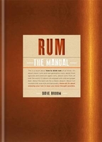
£9.00
These cards show the view forward from the deck of various vessels (power, sailing & fishing) of developing traffic situations at sea. In each case the mariner has to decide the correct course of action to navigate his vessel through the hazard. The reverse of the card gives the proper course & also"es the relevant collision rule. There are 50 cards in the pack. ...
Archived Product
£8.99
In the vast space of East Africa lives a close-knit tribe of expatriates. They all meet at dinner parties; they share the same doctors & eat at the same restaurants; they sleep with each other & take the same drugs. Set in contemporary Nairobi, Rules of the Wild is at once a sharp-eyed dissection of white society in modern Kenya & the moving story of a young woman, Esme, struggling to make sense of her place in Africa, & her feelings for the two men she loves
- Adam, a second generation Kenyan who is the first to show her the beauty of her adopted l&, & Hunter, a British journalist sickened by its horrors. Romantic, often very funny & always compulsively readable, Rules of the Wild will be recognised as a classic novel about the white man in Africa, a book to set beside Out of Africa & White Mischief
...
Archived Product
£12.95
Scottish islands of Rum Canna, Eigg & Muck at 1:25, 000 on a light, waterproof & tear-resistant map from Harvey Map Services. Most of Rum is shown on one side, with its westernmost part on the reverse with Cana & Sanday, plus on separate panels Eigg & Muck. Additional information

Includes::
contact details for transport to the islands, hostel accommodation, & general notes. Maps in Harvey’s Superwalker series have contours at 15m intervals, with additional graphics for various types of terrain (crags, large boulders, scattered rocks) & colouring for different kinds of land use or vegetation (pastures, bogs, forests or woodl&, etc). The maps show local hiking paths, indicating where appropriate long-distance routes, & boundaries of national parks or other protected areas. Scottish titles also indicate Munro, Corbett & Graham hills. Some maps in addition highlight local cycle routes. A range of symbols mark various facilities for walkers including youth or independent hostels, campsites & caravan sites, information points, etc. Each map has a 1-km British or Irish national grid. To see other titles in this series please click on the series link.

...
Archived Product
£14.95
Walking on Rum & the Small Isles hiking guide from Cicerone Press with recommendations for seven walks on Rum, plus two each on Eigg, Canna, Coll & Tiree, & one on Muck, all highlighted on extracts from the Ordnance Survey Landranger series.15 of the recommendations are day walks, including a challenging 9-10hrs tour of the Rum Cuillin, plus a two to three day tour of the coast of Rum. All the descriptions are accompanied by one or more extracts from the Ordnance Survey 1:50, 000 Landranger series overprinted with the route, while map numbers for the more detailed 1:25, 000 Explorer maps are"ed in the information panels. Introductory section for each island

Includes::
notes on its history, wildlife, etc; the guide’s overall introductory chapter gives more general information on this part of Scotl&, whilst appendices provide a summary of all the routes & recommendations for accommodation options.

...
Archived Product
£16.99
The Royal Naval rum was measured in half-gill tots & variously diluted, often into a two-gill (half-pint) measure. Our measures are made in the time-honoured way
- from skilfully h&-beaten brass, copper-plated, polished, then lined with silver to neutralise taste. The bases are stamped with the prestigious HMS logo. One supplied. Not gift boxed. Height 2”.
...
Archived Product
£14.99
Waterproof & tear-resistant OS Active version of map No. 39 from the Ordnance Survey’s Landranger series at 1:50, 000, with contoured & GPS compatible topographic mapping plus tourist information.MOBILE DOWNLOADS: As well as the physical edition of the map, each Landranger title now

Includes::
a code for downloading after purchase its digital version onto your smartphone or tablet for viewing on the OS smartphone app.OS LANDRANGER SERIES: to see the list of all the titles in the OS Landranger series, both paper & waterproof versions, please click on the series link. Maps in the Landranger series provide plenty of recreational & tourist information, indicating the traditional public right of way paths (except in Scotland where different laws apply), including bridleways & byways restricted or open to motorized traffic. National Trails & selected other long-distance paths are marked, as well as on-road & traffic-free cycle routes with their National/ Regional Cycle Network numbers. National Trust/ National Trust for Scotland & Forestry Commission land is clearly marked, indicating open or restricted access. A range of symbols highlights camping & caravanning sites, youth hostels, tourist information offices & visitors’ centres, parking & picnicking places, World Heritage sites, sport & recreational facilities, etc. The maps provide detailed presentation of topography with contours at 10m intervals, numerous spot heights & additional colouring and/or graphics for different types of woodlands, orchards or parkl&, rock features including scree & cliffs, water features inland & along the sea shore with marshl&, dunes, s&, mud, shingle & the high water mark. All the standard information expected of survey mapping at this scale is included: finely graded road network, railway lines with stations, cuttings, embankments, etc; individual isolated buildings; archaeological & historical sites, etc. For GPS users the British National Grid is shown at 1km intervals, with latitude & longitude given by margin ticks at 1` & cross hairs on the map at 5`. Each map covers an area of 40 x 40km, (approx. 25 x 25 miles).

...
Archived Product
£8.99
Paper version of map No. 39 from the Ordnance Survey’s Landranger series at 1:50, 000, with contoured & GPS compatible topographic mapping plus tourist information.MOBILE DOWNLOADS: As well as the physical edition of the map, each Landranger title now

Includes::
a code for downloading after purchase its digital version onto your smartphone or tablet for viewing on the OS smartphone app.OS LANDRANGER SERIES: to see the list of all the titles in the OS Landranger series, both paper & waterproof versions, please click on the series link. Maps in the Landranger series provide plenty of recreational & tourist information, indicating the traditional public right of way paths (except in Scotland where different laws apply), including bridleways & byways restricted or open to motorized traffic. National Trails & selected other long-distance paths are marked, as well as on-road & traffic-free cycle routes with their National/ Regional Cycle Network numbers. National Trust/ National Trust for Scotland & Forestry Commission land is clearly marked, indicating open or restricted access. A range of symbols highlights camping & caravanning sites, youth hostels, tourist information offices & visitors’ centres, parking & picnicking places, World Heritage sites, sport & recreational facilities, etc. The maps provide detailed presentation of topography with contours at 10m intervals, numerous spot heights & additional colouring and/or graphics for different types of woodlands, orchards or parkl&, rock features including scree & cliffs, water features inland & along the sea shore with marshl&, dunes, s&, mud, shingle & the high water mark. All the standard information expected of survey mapping at this scale is included: finely graded road network, railway lines with stations, cuttings, embankments, etc; individual isolated buildings; archaeological & historical sites, etc. For GPS users the British National Grid is shown at 1km intervals, with latitude & longitude given by margin ticks at 1` & cross hairs on the map at 5`. Each map covers an area of 40 x 40km, (approx. 25 x 25 miles).

...
Archived Product
£8.99
The islands of Rum, Eigg, Muck, Canna & Sanday on a detailed topographic & GPS compatible map No. 397, paper version, from the Ordnance Survey’s 1:25, 000 Explorer series.MOBILE DOWNLOADS: this title & all the other OS Explorer maps include a code for downloading after purchase the digital version onto your smartphone or tablet for viewing on the OS smartphone app.OS EXPLORER SERIES: to see the list of all the titles in the OS Explorer series, both paper & waterproof versions, please click on the series link. The Explorer series, Ordnance Survey’s most detailed maps recommended for anyone enjoying outdoor activities, provides topographic coverage of Great Britain at 1:25, 000 on GPS compatible maps with hiking trails, cycling routes & extensive tourist information. Each printed map is available either on paper or as a waterproof & tear-resistant OS Active Map, as indicated in its title. Britain’s National Parks & other areas of particular tourist interest are presented on often double-sided OL (Outdoor Leisure) maps, whilst most standard format Explorers cover an area of 30 x 20km (approx. 19 x 12 miles). All three versions (paper, waterproof & digital) are the same & provide plenty of recreational & tourist information, indicating the traditional public right of way paths (except in Scotland where different laws apply), including bridleways & byways. National Trails & other long-distance paths are marked, as well as permissive footpaths or bridleways & on-road or traffic-free cycle routes with, where appropriate, their National/ Regional Cycle Network numbers. Boundaries of access land are clearly marked. A wide range of symbols provides additional tourist information, highlighting camping & caravanning sites, information offices & visitors’ centres, parking & picnicking places, country pubs, sport & recreational facilities including cycle hire locations & mountain biking trails, historic buildings & museums, etc. Exceptionally clear presentation of the landscape is provided by contours at 5m or in the uplands at 10m intervals, with additional spot heights plus colouring and/or graphics for different types of woodlands, orchards, heath, marshl&, scree or boulders, & other topographic features. For GPS users the maps have British National Grid lines at 1km intervals, with latitude & longitude given by margin ticks at 1`. Clearly laid out map legend

Includes::
French & German translations for the tourist information symbols.

...
Archived Product
£14.99
The islands of Rum, Eigg, Muck, Canna & Sanday on a detailed topographic & GPS compatible map No. 397, waterproof version, from the Ordnance Survey’s 1:25, 000 Explorer series. MOBILE DOWNLOADS: this title & all the other OS Explorer maps include a code for downloading after purchase the digital version onto your smartphone or tablet for viewing on the OS smartphone app.OS EXPLORER SERIES: to see the list of all the titles in the OS Explorer series, both paper & waterproof versions, please click on the series link. The Explorer series, Ordnance Survey’s most detailed maps recommended for anyone enjoying outdoor activities, provides topographic coverage of Great Britain at 1:25, 000 on GPS compatible maps with hiking trails, cycling routes & extensive tourist information. Each printed map is available either on paper or as a waterproof & tear-resistant OS Active Map, as indicated in its title. Britain’s National Parks & other areas of particular tourist interest are presented on often double-sided OL (Outdoor Leisure) maps, whilst most standard format Explorers cover an area of 30 x 20km (approx. 19 x 12 miles). All three versions (paper, waterproof & digital) are the same & provide plenty of recreational & tourist information, indicating the traditional public right of way paths (except in Scotland where different laws apply), including bridleways & byways. National Trails & other long-distance paths are marked, as well as permissive footpaths or bridleways & on-road or traffic-free cycle routes with, where appropriate, their National/ Regional Cycle Network numbers. Boundaries of access land are clearly marked. A wide range of symbols provides additional tourist information, highlighting camping & caravanning sites, information offices & visitors’ centres, parking & picnicking places, country pubs, sport & recreational facilities including cycle hire locations & mountain biking trails, historic buildings & museums, etc. Exceptionally clear presentation of the landscape is provided by contours at 5m or in the uplands at 10m intervals, with additional spot heights plus colouring and/or graphics for different types of woodlands, orchards, heath, marshl&, scree or boulders, & other topographic features. For GPS users the maps have British National Grid lines at 1km intervals, with latitude & longitude given by margin ticks at 1`. Clearly laid out map legend

Includes::
French & German translations for the tourist information symbols.

...
Archived Product
£24.95
The diversity of flavours & colours of rum is as rich as the history & culture that surrounds this alcoholic beverage. This guide provides an overview of more than 300 different types of rum & then categorises them using an innovative taste model. For every rum, you receive a clear overview of its origins, taste & aroma. In addition, you can read all about the different types of rum, the production & maturing process, the perfect way to serve, & the best cocktails. ...
Archived Product

Rum The Manual

This is a book about how to drink rum of all kinds. It`s about classic rums and new-generation rums, about rhum agricole and about premium aged rums, about rums from all over the world. It`s about rum enjoyed with cola and ginger beer. About the best rum for a classic daquiri. About rum cocktails that ooze style and personality. Above all, it`s about enjoying your rum in ways you never thought possible. The premium rum market is growing at an astonishing rate. The mission of this book is to help drinkers appreciate this complex spirit, find the style they like and discover how this versatile spirit can best be enjoyed. It will help you to understand your rum - how it`s produced (whether from molasses, cane syrup or cane juice) and whether it`s dry, sweet, fresh or oaky. More than
100 different rums are featured and analysed, from rich, sweet mellow Guyana rums to the vegetal peppery rums of Martinique or Guadeloupe and contemporary spiced rums. Dave Broom provides a description and graded tasting notes for each brand, allowing you to create the perfect mix every time. Finally, a selection of classic and contemporary cocktails shows just how wonderfully versatile this spirit is.
RIP - This product is no longer available on our network. It was last seen on 25.09.2019

This page now acts as a permanent archive for this product. Add more information using the comments box below to ensure it can still be found by future generations.

Use our search facility to see if it is available from an alternative contributor.
  • Availability: Out Of Stock
  • Supplier: Stanfords
  • SKU: 9781845339623
Availability: In Stock
£14.99

Product Description

This is a book about how to drink rum of all kinds. It`s about classic rums & new-generation rums, about rhum agricole & about premium aged rums, about rums from all over the world. It`s about rum enjoyed with cola & ginger beer. About the best rum for a classic daquiri. About rum cocktails that ooze style & personality. Above all, it`s about enjoying your rum in ways you never thought possible. The premium rum market is growing at an astonishing rate. The mission of this book is to help drinkers appreciate this complex spirit, find the style they like & discover how this versatile spirit can best be enjoyed. It will help you to understand your rum
- how it`s produced (whether from molasses, cane syrup or cane juice) & whether it`s dry, sweet, fresh or oaky. More than 100 different rums are featured & analysed, from rich, sweet mellow Guyana rums to the vegetal peppery rums of Martinique or Guadeloupe & contemporary spiced rums. Dave Broom provides a description & graded tasting notes for each br&, allowing you to create the perfect mix every time. Finally, a selection of classic & contemporary cocktails shows just how wonderfully versatile this spirit is.

Reviews/Comments

Add New

Intelligent Comparison

Oooops!
We couldn't find anything!
Perhaps this product's unique.... Or perhaps we are still looking for comparisons!
Click to bump this page and we'll hurry up.

Price History

Vouchers

No voucher codes found.
Do you know a voucher code for this product or supplier? Add it to Insights for others to use.

Facebook

Jargon Buster

Contemporary - Modern era design
Contemporary - A design reference to indicate post war modern design
Dry - A term used to describe an item with has little or no water present
Dry - A term used in wine making to describe the lack of sugar (sweetness)
World - A physical grouping, commonly used to describe earth and everything associated with ti
Versatile - Something that can be adapted to various different tasks.
Contemporary - An object that is living in the same time.
Versatile - Something that is able to adapt to its surroundings or its requirements.
Manual - A book of instructions to build or operate items, also a form of labour which your hands are used.
Classic - Something that is still like it was originally a high quality standard.

Supplier Information

Stanfords
Stanfords was established in 1853 and opened their iconic Covent Garden flagship store in 1901. They have become the top retailer of maps, travel books and accessories in the UK and arguably offer the largest selection of maps and travel books worldwide. Famous names such as Captain Robert Falcon Scott, Ranulph Fiennes and Michael Palin have purchased from Stanfords. They now have a shop in Bristol and both stores together with other venues operate a calendar of events including talks, book signings and exhibitions. As a specialist map retailer, the map selection is comprehensive and includes road maps, street maps and walking maps from worldwide destinations, as well as a selection of world atlases and wall maps. Books include travel guides and travel literature. Stanfords also stock globes, from miniatures made of blue marble to magnificent floor-standing globes. The website features a selection of interesting articles on travel topics.
Page Updated: 2023-11-12 20:15:36

Community Generated Product Tags

Oh No! The productWIKI community hasn't generated any tags for this product yet!
Menu