
 United Kingdom
 France
 Germany
 Netherlands
 Sweden
 USA
USA
 Italy
Italy
 Spain
Spain
More From Contributor


Shipwrecks Of The Outer Banks USA NGS Wall Map PAPER
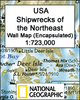
The Shipwrecks of the Outer Banks Wall Map, paper version – size 71 x 91cm (21 “ x 36”), from the National Geographic, covering the “Graveyard of the Atlantic” – the notorious coastline stretching form Cape Henry in Virginia to Cape Fear in North Carolina. For some of the region’s specific points, Cape Hatteras, Ocracoke Inlet or Cape Lookout, the map has lists of lost vessels.This title is part of a series of shipwreck maps from the NGS covering the coastline of the eastern seaboard of Unites States. Each title shows locations of hundreds of wrecks atop beautifully drawn bathymetric and coastal detail. Wreck sites have symbols to define class and type of each vessel, along with its name and, where available, the date of sinking. Coloring indicates whether the vessel
was lost in armed conflict or by natural causes. The maps also show locations of lighthouses and life boat stations, and include extensive historical notes. This title is also available as an encapsulated wall map or in a folded format – please click on the series link for these two options and more titles in this series. With the light blue sea beautifully contrasted against the sepia-coloured land and several lovely historical drawings, these maps are designed to enhance the décor of any home or office and would look very attractive when framed.
was lost in armed conflict or by natural causes. The maps also show locations of lighthouses and life boat stations, and include extensive historical notes. This title is also available as an encapsulated wall map or in a folded format – please click on the series link for these two options and more titles in this series. With the light blue sea beautifully contrasted against the sepia-coloured land and several lovely historical drawings, these maps are designed to enhance the décor of any home or office and would look very attractive when framed.
Product Description
Reviews/Comments
Add New
Vouchers
No voucher codes found.
Do you know a voucher code for this product or supplier? Add it to Insights for others to use.
Do you know a voucher code for this product or supplier? Add it to Insights for others to use.
 Denmark