
 United Kingdom
 France
 Germany
 Netherlands
 Sweden
 USA
USA
 Italy
Italy
 Spain
Spain
More From Contributor


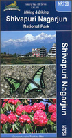
Shivapuri Nagarjun National Park
Shivapuri Nagarjun National Park just north of Kathmandu on a detailed map at 1:30, 000 from Nepa Maps highlighting numerous local trekking and cycling routes. The map covers both sections of the park: its main area between Kakani and Juhle, and the smaller section west of Kathmandu around Jamacho. Numerous treks are highlighted by different colouring and the map also shows which trails and local roads are recommended for cycling. Contour lines are at 20m intervals. Latitude and longitude are shown by margin ticks at 2’30” intervals. The index list places, passes, and locations with medical centres. On the inside cover are stage-by-stage distances and timings for several highlighted routes.PLEASE NOTE: the same area is also covered by the Ganesh Himal map which highlights fewer
trekking routes in the central area prominently annotated in this title.Titles in this Nepa Maps series have cartography is based on the country’s topographic survey, with contours usually at 40m or 50m intervals, enhanced by relief shading, colouring and graphics to show various features of the terrain, including glaciers, forested or cultivated areas, etc. Numerous peaks, with additional spot heights, plus names of glaciers and mountain ranges are prominently shown. The network of rivers, streams and lakes is shown in great detail, with many smaller rivers and lakes named. Overprint highlights main trekking routes and numerous local trails, with symbols indicating various places of interest and tourist facilities. Most maps are indexed and include additional information such
as route profiles, glossaries, etc. All the information is in English and heights are given in metres.To see other titles in this series please click in the series link.

Product Description
Reviews/Comments
Add New
Vouchers
No voucher codes found.
Do you know a voucher code for this product or supplier? Add it to Insights for others to use.
Do you know a voucher code for this product or supplier? Add it to Insights for others to use.
 Denmark