More From Contributor
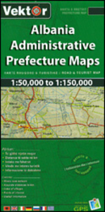
£8.50
Skopje’s city centre on both sides of the Vardar River on a lovely street plan from the local publishers Trimaks, with buildings drawn in 3-D vividly presenting the capital’s mixture of old buildings, the communist era architecture, & more recent additions. 68 locations, including museums & cultural institutions, selected embassies & other public buildings, historic sites, etc, are cross-referenced to a thematic index. Symbols indicate locations of restaurants, cafes or bars, & car parks. Street names are in the Latin alphabet. On the reverse numerous sites & institutions have descriptions accompanied by colour photos. Map legend & the text include English. ...
Archived Product
£9.99
Skopje with its outer suburbs in a street atlas at 1:22, 222 approx. from the locally based Trimaks, highlighting locations of various facilities & places of interest, , including hotels, banks, shopping malls, embassies, etc. Streets are shown with their names plus numbers and/or just numbers, & in some districts on housing estates individual buildings have numbers. In the outlaying suburbs only main streets are named. The plan indicates main traffic arteries & shows one way streets, car parks & locations of petrol stations. A wide range of symbols indicate various facilities & places of interest. All place names are in the Latin alphabet. Each page has its individual index, & there is a combined double index at the back of the atlas: alphabetically (but according to the Cyrillic alphabet, a, b, v, g, etc) & by street number. Also provided are lists of useful addresses and/or phone numbers, including selected embassies, hotels, banks, etc., plus a road map of Macedonia for route planning. Map legend

Includes::
English.

...
Archived Product
£14.99
The city of Skopje, from the ancient past to the present, with over 700 photographs, illustrations & maps offering information on the places to visit, where to stay, where to eat. The guide contains a city map showing all the streets & important buildings, as well as an index for easier navigation across the maps. The guide contains all points of interest about Skopje & its beauties, churches & monasteries, mosques, monuments, museums, restaurants & cafes, cinemas, the Fortress Kale, the Millennium Cross & many other famous natural beauties that adorn Skopje. All this is enriched with beautiful photographs & detailed descriptions in Macedonian & English, & maps of the city. ...
Archived Product
£19.95
Topographic survey of Faroe Islands at 1:20, 000 prepared by the Danish national mapping agency Kort og Matrikelstyrelsen. The islands’ topography is vividly presented by contours at 5 metre intervals, enhanced by relief shading plus colouring and/or graphics for different types of terrain or vegetation (scree, boulders, etc). The maps show all the detail expected of the topographic mapping at this scale & have a 1-km UTM grid, plus margin ticks for latitude & longitude at 1’ & 2` respectively. Map legend is in Danish only. The maps are available either separately or as sets of five of more sheets, each covering the main island group: Vagar, Sandoy, Suduroy, Nordoyar, Streymoy & Eysturoy. To see the list of all the titles in this series please click on the series link. ...
Archived Product
£16.99
Sverigeserien is an outdoor map series consisting of 116 sheets with coverage of southern & central Sweden & the northern coastline. The map is suitable for outdoor activities such as hiking, excursions, trail running, hunting, fishing, riding, cycling, mountain biking, paddling, skating & much more. Every sheet covers an area of 45x 68km. These topographical maps in scale 1:50 000 contain all the information needed for outdoor activities: Terrain information, hiking trails, illuminated tracks, camping, shelters, golf courses, leisure baths, historical remains, roads in different categories, railway lines & much more. Easy to read topography with contour lines, vertical interval 5 m. Sverigeserien is a high-quality map series & is durable for frequent use! Updated content with map data from Lantmäteriet (National Land Survey of Sweden) & printed on Polyart which is water & tear resistant. This means that the map can be folded repeatedly without breaking & can withstand the challenging weather in Sweden during both winter & summer. Legend is in Swedish, English & German. ...
Archived Product
£23.99
Skrim
- Vindfjell area in Norway in a series of GPS compatible recreational maps at 1:50, 000 with cartography from Norway’s topographic
...
Archived Product
£6.99
Meet the great Skulduggery Pleasant: wise-cracking detective, powerful magician, master of dirty tricks & burglary (in the name of the greater good, of course). Oh yeah. & dead. Then there`s his sidekick, Stephanie. She`s...well, she`s a twelve-year-old girl. With a pair like this on the case, evil had better watch out...” So you won`t keep anything from me again?” He put his hand to his chest. ” Cross my heart & hope to die.” ” Okay then. Though you don`t actually have a heart, ” she said. ”I know.” ” And technically, you`ve already died.” ”I know that too.” ” Just so we`re clear.” Stephanie`s uncle Gordon is a writer of horror fiction. But when he dies & leaves her his estate, Stephanie learns that while he may have written horror, it certainly wasn`t fiction. Pursued by evil forces intent on recovering a mysterious key, Stephanie finds help from an unusual source
- the wisecracking skeleton of a dead wizard. When all hell breaks loose, it`s lucky for Skulduggery that he`s already dead. Though he`s about to discover that being a skeleton doesn`t stop you from being tortured, if the torturer is determined enough. & if there`s anything Skulduggery hates, it`s torture... Will evil win the day? Will Stephanie & Skulduggery stop bickering long enough to stop it? One thing`s for sure: evil won`t know what`s hit it.
...
Archived Product
£16.99
Topographic survey of Sweden at 1:50, 000, the Terrängkartan, from the Lantmäteriet, covering most of the country in 244 double-sided maps. Please note: the mountainous regions of central & northern Sweden are not covered by this series but presented in a separate “ Fjällkartan
- Mountain Map” series also listed on our website. Each 1:50, 000 topographic survey map covers an area of 37.5 x 40km. The maps have contours at 5 metre intervals, plus relief shading & graphics for rocky outcrops & boulders. Further graphics and/or colouring show different types of land use or vegetation (forests, arable l&, orchards, marshes, peat bogs, etc). An unusual feature of this survey is the colouring indicating buildings below or above two storeys high & “leisure/holiday homes”. The maps indicate privately maintained roads & include all other information expected of topographic survey at this scale. The maps have a 1-km UTM grid, plus latitude & longitude lines 5’ intervals. Map legend

Includes::
English. For coverage of the country’s most visited hiking areas in central & northern Sweden please see Lantmäteriet’s Mountain Map series, listed separately on our website.


...
Archived Product
£8.99
The Skull & Crossbones Flag by World Wide Flags is an ideal decoration for Halloween or pirate themed party & also great for kids to play with. It features two eyelets for easy mounting on a pole or hanging on the wall. The flag is made from 100% polyester. ...
Archived Product
£146.00
The Skull Formal Cane by Classic Canes with R925 silver handle & hardwood shaft. This is an extremely elegant & formal cane, suitable for light balance & support. The skull is beautifully detailed, with suitably sinister eye & nasal sockets & a full set of teeth. The angle at which the skull is set onto the cane means that it is also extremely comfortable to hold & use. The black hardwood shaft is fitted with a smart, chrome ferrule to complete the formal appearance. Overall height 90cm. Not suitable for heavy or orthopaedic use. Hallmark explanation: The Italian-made handle is hallmarked 'R925': the European hallmark for silver that has been applied in a layer over a moulded head. The R stands for 'rivestito', Italian for 'covered'. The '925' means that the metal used contains at least 925 parts pure silver to each 1000 parts. European '925 silver' is the same quality of silver that in the UK is referred to as 'sterling silver'. ...
Archived Product

Skrapari Prefecture

Skrapari Prefecture at 1:100, 000 in a series of handy size, waterproof and tear-resistant, contoured and GPS compatible road maps from the Tirana-based publishers Vektor. Landscape is presented by altitude colouring and contours lines at 100m intervals, with spot heights and a few more names of topographic features than found on Vektor’s 200K road maps of the country. National parks and nature reserves are prominently highlighted. The prefecture maps appear to show the same small local dirt roads as in the 200K series, but given the increase in scale do so with greater clarity and also provide more detailed GPS coordinates (latitude and longitude lines are drawn at 5’ intervals), useful when travelling across the more remote parts of the country.Railway lines are included and
local airports are marked. Symbols highlight campsites, beaches, archaeological and historical sites, caves, etc. The maps also show subdivisions of prefectures and names of the communes, and indicate administrative status of towns. Map legend includes English.Please note: border crossings are prominently marked but beyond topographic colouring no road or other information is provided outside the country’s borders.
RIP - This product is no longer available on our network. It was last seen on 25.09.2019

This page now acts as a permanent archive for this product. Add more information using the comments box below to ensure it can still be found by future generations.

Use our search facility to see if it is available from an alternative contributor.
  • Availability: Out Of Stock
  • Supplier: Stanfords
  • SKU: 9789604488087
Availability: In Stock
£9.99

Product Description

Skrapari Prefecture at 1:100, 000 in a series of handy size, waterproof & tear-resistant, contoured & GPS compatible road maps from the Tirana-based publishers Vektor. Landscape is presented by altitude colouring & contours lines at 100m intervals, with spot heights & a few more names of topographic features than found on Vektor’s 200K road maps of the country. National parks & nature reserves are prominently highlighted. The prefecture maps appear to show the same small local dirt roads as in the 200K series, but given the increase in scale do so with greater clarity & also provide more detailed GPS coordinates (latitude & longitude lines are drawn at 5’ intervals), useful when travelling across the more remote parts of the country. Railway lines are included & local airports are marked. Symbols highlight campsites, beaches, archaeological & historical sites, caves, etc. The maps also show subdivisions of prefectures & names of the communes, & indicate administrative status of towns. Map legend

Includes::
English. Please note: border crossings are prominently marked but beyond topographic colouring no road or other information is provided outside the country’s borders.

Reviews/Comments

Add New

Intelligent Comparison

Oooops!
We couldn't find anything!
Perhaps this product's unique.... Or perhaps we are still looking for comparisons!
Click to bump this page and we'll hurry up.

Price History

Vouchers

No voucher codes found.
Do you know a voucher code for this product or supplier? Add it to Insights for others to use.

Facebook

Jargon Buster

GPS - Global Positioning System - Global position using satellites
Waterproof - Resistant to water, usualy specified by depth in metres
Size - is the measurement of how big an object is in space.
Small - something that takes up less space than normal.
Road - a manmade lane or a path that is used to speed up travel.
Resistant - Something that can repel against something.
Altitude - Something that can be quite high in relation to sea or ground level.
Borders - A line that sometimes can be built up separating off an area, e.g. countries "the welsh boarder"

Supplier Information

Stanfords
Stanfords was established in 1853 and opened their iconic Covent Garden flagship store in 1901. They have become the top retailer of maps, travel books and accessories in the UK and arguably offer the largest selection of maps and travel books worldwide. Famous names such as Captain Robert Falcon Scott, Ranulph Fiennes and Michael Palin have purchased from Stanfords. They now have a shop in Bristol and both stores together with other venues operate a calendar of events including talks, book signings and exhibitions. As a specialist map retailer, the map selection is comprehensive and includes road maps, street maps and walking maps from worldwide destinations, as well as a selection of world atlases and wall maps. Books include travel guides and travel literature. Stanfords also stock globes, from miniatures made of blue marble to magnificent floor-standing globes. The website features a selection of interesting articles on travel topics.
Page Updated: 2023-11-12 20:15:36

Community Generated Product Tags

Oh No! The productWIKI community hasn't generated any tags for this product yet!
Menu