More From Contributor

£17.50
Of the more than 5, 500 mammals species worldwide, at least 1, 200 occur in Africa. Stuarts` Field Guide to the Larger Mammals of Africa
- a classic & widely acclaimed work
- concentrates on the more visible & easily distinguished larger species, as well as some of the more frequently seen smaller mammals. This new edition has been extensively revised, expanded & redesigned &
Includes:: the most recent research & taxonomy; revised distribution maps & many new images; colour-coded grouping of orders; size icons; detailed descriptions of each species, offering insight into key identification characters, typical behaviour, preferred habitat, food choice, reproduction & longevity; whales & dolphins now featured too.


...
Archived Product
£8.95
Map No. 83, Stubai Alps, with a panorama map on the reverse, in a series of hiking maps from Kompass providing extensive coverage of Austria & Germany plus the Slovenian Alps, with hiking routes on a topographic base, various types of accommodation, recreational facilities, places of interest, etc. Many titles are now published as competitively priced sets of two or more maps, offering a wider coverage. Kompass are Europe ...
Archived Product
£10.95
Stubai Alps (No. 83), a detailed, GPS compatible map at 1:50, 000 from Kompass with local & long-distance footpaths, cycling routes, accommodation, etc, printed on durable, waterproof & tear-resistant synthetic paper. This title has on the reverse an additional panorama map of the region.KOMPASS HIKING & RECREATIONAL MAPS: This title is part of an extensive series covering Austria, much of Germany & the Slovenian Alps. Kompass are Europe ...
Archived Product
£11.99
Stubai Alps: Hochstubai area of the Alps in a hiking edition at 1:25, 000 from a series of detailed, GPS compatible maps published by the DAV
- Deutscher Alpenverein & produced by the German & Austrian Alpine Clubs using cartography from their respective survey organizations. Maps in this series have topography vividly presented by contours at 20 metres intervals, enhanced by shading & finely drawn graphic relief. An overprint highlights hiking paths and/or ski routes (please see the note below), campsites & various types of mountain huts & refuges. The area covered by each map varies according to the scale; for 1:25, 000 maps it is Approx. 25x 18 km (15 x 11 miles). The maps have a 1-km UTM grid, plus margin ticks with latitude & longitude at intervals of 1`. Map legend is in German only.PLEASE NOTE – THE OVERPRINT FOR HIKING and/or SKI ROUTES: all Sheet Ref. numbers shown on the accompanying grid are available with an overprint highlighting hiking trails, indicating sections with fixed climbing ropes &, where appropriate, the waymarking route numbers. Several titles are now published with both hiking & ski routes on them. Other areas are covered by two separate maps: a hiking edition plus a ski edition. The type of the overprint is indicated in our title of each map. To see the list of titles in this series please click on the series link.
...
Archived Product
£11.99
Stubai Alps: Sellrain area of the Alps in a hiking edition at 1:25, 000 from a series of detailed, GPS compatible maps published by the DAV
- Deutscher Alpenverein & produced by the German & Austrian Alpine Clubs using cartography from their respective survey organizations. Maps in this series have topography vividly presented by contours at 20 metres intervals, enhanced by shading & finely drawn graphic relief. An overprint highlights hiking paths and/or ski routes (please see the note below), campsites & various types of mountain huts & refuges. The area covered by each map varies according to the scale; for 1:25, 000 maps it is Approx. 25x 18 km (15 x 11 miles). The maps have a 1-km UTM grid, plus margin ticks with latitude & longitude at intervals of 1`. Map legend is in German only.PLEASE NOTE – THE OVERPRINT FOR HIKING and/or SKI ROUTES: all Sheet Ref. numbers shown on the accompanying grid are available with an overprint highlighting hiking trails, indicating sections with fixed climbing ropes &, where appropriate, the waymarking route numbers. Several titles are now published with both hiking & ski routes on them. Other areas are covered by two separate maps: a hiking edition plus a ski edition. The type of the overprint is indicated in our title of each map. To see the list of titles in this series please click on the series link.
...
Archived Product
£13.99
Stubai Alps (No. 83), a detailed, GPS compatible map at 1:50, 000 from Kompass with local & long-distance footpaths, cycling routes, accommodation, etc, printed on durable, waterproof & tear-resistant synthetic paper. This title has on the reverse an additional panorama map of the region.KOMPASS HIKING & RECREATIONAL MAPS: This title is part of an extensive series covering Austria, much of Germany & the Slovenian Alps. Kompass are Europe’s largest publishers of hiking maps; their mapping of other countries, including expanding coverage of Italy, is listed on our website separately.CARTOGRAPHY: The maps are contoured with additional shading, graphic relief & colouring to provide a more detailed picture of the terrain, vegetation and/or land use. Contour interval varies from 10m in the coastal areas of Northern Germany to 40 or 50 metres in the mountainous regions. All the maps highlight local & long-distance waymarked footpaths, including climbing trails. Most titles also show cycling routes, mountain bike trails, &, the in mountainous areas, ski routes. The maps indicate various types of accommodation (selected inns & hotels, youth hostels, campsites, mountain refuges), as well as recreational facilities, places of interest, etc. Latest editions also show access by public transport with bus stops and/or Park+ Ride facilities.GEOGRAPHICAL COORDINATES: Unless indicated to the contrary in the individual description, the maps have a UTM grid for GPS users. MAP LEGEND: Most maps now include full English legend, particularly titles covering the Alpine areas. Some maps covering mainly eastern Austria or the less popular parts of Germany may still have a legend in German only.OTHER
Features: Selected titles include on the reverse panorama drawings of their area with names of villages, peaks, valleys, etc. and/or have a booklet with pictures of local wild flowers with their Latin names. Many titles are now published as competitively priced sets of two or more maps, offering a wider coverage.BOOKLETS: PLEASE NOTE BEFORE ORDERING! Many titles come with a booklet describing the area and/or various hiking routes. Unless indicated in the individual description that the booklet

Includes::
English, these booklets are IN GERMAN only. The booklets are not necessary to use the maps since, as stated above, full English language map legend is provided.


...
Archived Product
£14.95
Pyrenean Haute Route is Tom Joosten’s guide to a classic high-level trek through the Pyrenees mountain range, snaking along the French & Spanish border. An 800km route of spectacular & challenging trekking through the highest section of the Pyrenees, the haute route is an unmarked long-distance walk described & mapped in 45 day stages, now with 500 GPS waymarks to help with route finding. Practical information is provided on the villages passed through, as well as accommodation options including mountain huts, guest houses, hotels & campsites. Variant routes which avoid trickier sections are detailed, as are ascents of ten Pyrenean summits for those who want a challenge of a different sort. ...
Archived Product
£11.95
Stubai Alps: Hochstubai, map no. 31/1
- ski edition, in a series of ski & hiking maps produced by the German & Austrian Alpine
...
Archived Product
£11.95
Stubai Alps: Sellrain, map no. 31/2
- ski edition, in a series of ski & hiking maps produced by the German & Austrian Alpine
...
Archived Product

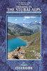
Stubai Alps And South Tirol

The guide is throughly researched and most of the time observations are based on personal aquaintance with all the routes described. A practical introduction and a section on valley bases is followed by listings of huts and mountain bases and a description of the different ranges that form the Stubai group. Photos and schemes complement text in indicating the routes of walks and climbs. These are graded according to difficulty.
RIP - This product is no longer available on our network. It was last seen on 25.09.2019

This page now acts as a permanent archive for this product. Add more information using the comments box below to ensure it can still be found by future generations.

Use our search facility to see if it is available from an alternative contributor.
  • Availability: Out Of Stock
  • Supplier: Stanfords
  • SKU: 9780906227510
Availability: In Stock
£14.95

Product Description

The guide is throughly researched & most of the time observations are based on personal aquaintance with all the routes described. A practical introduction & a section on valley bases is followed by listings of huts & mountain bases & a description of the different ranges that form the Stubai group. Photos & schemes complement text in indicating the routes of walks & climbs. These are graded according to difficulty.

Reviews/Comments

Add New

Intelligent Comparison

Oooops!
We couldn't find anything!
Perhaps this product's unique.... Or perhaps we are still looking for comparisons!
Click to bump this page and we'll hurry up.

Price History

Vouchers

No voucher codes found.
Do you know a voucher code for this product or supplier? Add it to Insights for others to use.

Facebook

Jargon Buster

Practical - Weather a task is easy to carry out and realistically succeed.
Personal - Something that belongs more to an individual due to it affecting them more by relating to them.

Supplier Information

Stanfords
Stanfords was established in 1853 and opened their iconic Covent Garden flagship store in 1901. They have become the top retailer of maps, travel books and accessories in the UK and arguably offer the largest selection of maps and travel books worldwide. Famous names such as Captain Robert Falcon Scott, Ranulph Fiennes and Michael Palin have purchased from Stanfords. They now have a shop in Bristol and both stores together with other venues operate a calendar of events including talks, book signings and exhibitions. As a specialist map retailer, the map selection is comprehensive and includes road maps, street maps and walking maps from worldwide destinations, as well as a selection of world atlases and wall maps. Books include travel guides and travel literature. Stanfords also stock globes, from miniatures made of blue marble to magnificent floor-standing globes. The website features a selection of interesting articles on travel topics.
Page Updated: 2023-11-12 20:15:36

Community Generated Product Tags

Oh No! The productWIKI community hasn't generated any tags for this product yet!
Menu