More From Contributor

£6.50
Topographic coverage of the Canary Islands at 1:25, 000 published by the Instituto Geográfico Nacional – Centro Nacional de Información Geografica, the country’s civilian survey organization. The maps have contours at 10m intervals & colouring and/or graphics to show different types of vegetation or land use. Boundaries of national parks & other protected areas are marked. In addition to all the usual information shown on topographic mapping at this scale: detailed presentation of the road network with rural tracks & paths, etc, the maps also show campsites. The maps have a 1-km UTM grid, plus margin ticks for latitude & longitude at 1` intervals. The majority of the titles have been published since late 1990s. Map legend is in Spanish only.COVERAGE: each 25K map covers one quarter of the corresponding 1:50, 000 map, with the numbering system: I = NW quarter, II = NE quarter, III = SW quarter, & IV = SE quarter. To see other titles in this series please click on the series link. ...
Archived Product
£9.99
Tehran street plan at from ITMB with, on the reverse, a road map of northern Iran, both indexed. Also included are a diagram of the metro network & a road map of the environs of the capital. All place names are shown in Latin alphabet only. On one side is a street plan of Tehran showing names of neighbourhoods & most streets. Main traffic arteries across the city are highlighted & access onto expressway is very clearly presented. Metro stations are prominently marked & annotated with line numbers. A range of symbols shows various places of interest, services & facilities: selected hotels (with names), embassies, places of worship, shopping centres, cultural institutions, bus terminals, etc. The index lists main streets, squares & neighbourhoods. Also provided are a diagram of the metro lines & a road map of the city’s environs with access to the international airport. On the reverse is an indexed map of northern Iran showing road & rail connections as well as local airports. Main historical & archaeological sites are highlighted & some also annotated with brief descriptions. Topography is shown by altitude colouring with spot heights. The map also shows internal administrative boundaries with names of the provinces. Coverage extends north to Baku, west to Baghdad & Kirkuk, south to Kuwait City &, within Iran, to Shiraz (including Persepolis) & Zahedan, & east to the borders with Turkmenistan & Afghanistan. The map has latitude & longitude lines at intervals of 2º. ...
Archived Product
£24.95
Central & northern Tehran on a street plan from the Gitashenasi Institute with all place names in Latin alphabet, a tourist map of the Alborz Mountains, English language map legend, & lists of hotels, places of interest, etc. Place names are in Latin alphabet only, with all other information, including the map legend, in English. Coverage extends from the Alborz Mountains to just beyond the central railway station. Symbols highlight metro stops & petrol stations, as well as 60 hotels, 25 museums, 80 embassies, 23 international airline offices & 107 various places of interest, all cross-referenced to the index on the reverse of the map where telephone numbers are also provided. Also included is a separate street index. A road map at 1:275, 000 covers the Alborz Mountain north of the city, highlighting main skiing & other recreational areas, selected hotels, monuments & locations of petrol stations ...
Archived Product
£33.95
Farsi/ English edition of a street plan of Tehran with its outer suburbs from the Gitashenasi Institute. Names of main traffic routes across the city, larger streets & most neighbourhoods are in both Farsi & Latin alphabet; smaller streets & parks are in Farsi only. Symbols highlight locations of selected hotels, petrol stations, monuments, & various industrial & agricultural sites. Within Alborz Mountains contours & peak heights are shown & main skiing areas highlighted. The map has latitude & longitude lines at intervals of 2 ...
Archived Product
£29.95
Tehran Province of Iran a large map from the Gitashenasi Institute showing its administrative subdivisions, with each district shown in different colour. Names of towns are shown in Farsi & Latin alphabet. The map shows the provinces road & rail network & symbols highlight locations of petrol stations, historical monuments, tourist accommodation, etc. Map legend is in Farsi & English. ...
Archived Product
£24.95
Geological faults in the Tehran Province of Iran & in the adjoining areas of neighbouring provinces, overprinted on a large road map from the Gitashenasi Institute with names of main towns shown in both Farsi & Latin alphabet. The map distinguishes between major & minor faults, indicates inferred reverse, reverse, thrust & strike slip faults & names several of them. Map legend is in Farsi & English. ...
Archived Product
£24.95
Tehran Underground map from the Gitashenasi Institute showing an overview plan of the city with five underground lines. Sections of routes & station symbols indicate whether already completed or under construction. Names of main streets & of most districts are given in both Farsi & Latin alphabet. Map legend is in Farsi & English. ...
Archived Product
£8.99
A wry & humorous account of Nahal Tajadod`s quest to get her Iranian passport renewed. She embarks on a bizarre & circuitous journey, meeting a colourful cast of characters along the way: two photographers who specialise in Islamic portraits, a forensic surgeon who trades in human organs & a grandmother who offers a live chicken to an implacable official. TEHRAN, LIPSTICK & LOOPHOLES is a fascinating look at the constraints & contradictions of contemporary life in Tehran from the author`s unique standpoint of being both a native of Iran & a foreigner. ...
Archived Product
£6.99
Teide National Park on Tenerife at 1:25, 000 on a contoured & GPS compatible map from IGN/CNIG with cartography from their topographic survey of Spain. The map is accompanied by a 79-page English language guide with descriptions of walks, contact details for recommended accommodation, etc. The map has contours at 10m intervals enhanced by relief shading, plus colouring & graphics to show different types of vegetation. Hiking trails are highlighted, indicating routes which are described in the guide. A wide range of symbols indicate various facilities & places of interest, including different types of accommodation (campsites, refuges, etc), sites for other recreational pursuits, bird watching locations, etc. The map has a 1km UTM grid & margin ticks for latitude & longitude. Map legend

Includes::
English. The accompanying guide is in English & describes 35 walks within the park, plus more trails outside the park boundary. Also included are suggestions for other recreational activities. The guide provides phone numbers for various accommodation options, general notes about the area, etc. To see other titles in this series please click on the series link.

...
Archived Product

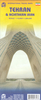
Tehran And Suburbs Street Atlas

Tehran and its suburbs at 1:40, 000 on an A5 paperback atlas from the locally based Gitashenasi Institute with street and district/township names in both Farsi and Latin alphabets, including an English language map legend.Names of larger streets and of districts or towns/villages are given both in Farsi and in the Latin alphabet. Smaller streets, geographical features and places of interest are in Farsi only. In the city suburbs the map is contoured showing the region
RIP - This product is no longer available on our network. It was last seen on 25.09.2019

This page now acts as a permanent archive for this product. Add more information using the comments box below to ensure it can still be found by future generations.

Use our search facility to see if it is available from an alternative contributor.
  • Availability: Out Of Stock
  • Supplier: Stanfords
  • SKU: 9789643421700
Availability: In Stock
£39.95

Product Description

Tehran & its suburbs at 1:40, 000 on an A5 paperback atlas from the locally based Gitashenasi Institute with street & district/township names in both Farsi & Latin alphabets, including an English language map legend. Names of larger streets & of districts or towns/villages are given both in Farsi & in the Latin alphabet. Smaller streets, geographical features & places of interest are in Farsi only. In the city suburbs the map is contoured showing the region

Reviews/Comments

Add New

Price History

Vouchers

No voucher codes found.
Do you know a voucher code for this product or supplier? Add it to Insights for others to use.

Facebook

Jargon Buster

Language - the method of communication used in different areas. Humans and computers have many different languages.
Language - The way humans communicate either written and spoken.

Supplier Information

Stanfords
Stanfords was established in 1853 and opened their iconic Covent Garden flagship store in 1901. They have become the top retailer of maps, travel books and accessories in the UK and arguably offer the largest selection of maps and travel books worldwide. Famous names such as Captain Robert Falcon Scott, Ranulph Fiennes and Michael Palin have purchased from Stanfords. They now have a shop in Bristol and both stores together with other venues operate a calendar of events including talks, book signings and exhibitions. As a specialist map retailer, the map selection is comprehensive and includes road maps, street maps and walking maps from worldwide destinations, as well as a selection of world atlases and wall maps. Books include travel guides and travel literature. Stanfords also stock globes, from miniatures made of blue marble to magnificent floor-standing globes. The website features a selection of interesting articles on travel topics.
Page Updated: 2023-11-12 20:15:36

Community Generated Product Tags

Oh No! The productWIKI community hasn't generated any tags for this product yet!
Menu