
 United Kingdom
 France
 Germany
 Netherlands
 Sweden
 USA
USA
 Italy
Italy
 Spain
Spain
More From Contributor


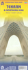
Tehran And Suburbs
Farsi/English edition of a street plan of Tehran with its outer suburbs from the Gitashenasi Institute. Names of main traffic routes across the city, larger streets and most neighbourhoods are in both Farsi and Latin alphabet; smaller streets and parks are in Farsi only.Symbols highlight locations of selected hotels, petrol stations, monuments, and various industrial and agricultural sites. Within Alborz Mountains contours and peak heights are shown and main skiing areas highlighted. The map has latitude and longitude lines at intervals of 2
Product Description
Reviews/Comments
Add New
Intelligent Comparison
Archived Product

Bern & Suburbs Stanfords
£8.99
Archived Product
Tehran And Suburbs Street Atlas Stanfords
£39.95
Vouchers
No voucher codes found.
Do you know a voucher code for this product or supplier? Add it to Insights for others to use.
Do you know a voucher code for this product or supplier? Add it to Insights for others to use.
 Denmark