More From Contributor

£12.95
Tel Aviv & Yafo at 1:14, 000 from Carta, with an enlargement for the Old Town of Jaffa & extensive index of streets, neighbourhoods, & various institutions. The plan extends northwards well beyond the Hayarkon (Yarqon) River & the Tel Aviv University to the academic sites of Kiryat Hinuch & the Kiryat Sha ...
Archived Product
£12.95
Tel Aviv & Yafo at 1:14, 000 from Carta, with an enlargement for the Old Town of Jaffa, plus an extensive index of streets, neighbourhoods, & various institutions. The plan extends northwards well beyond the Hayarkon (Yarqon) River & the Tel Aviv University to the academic sites of Kiryat Hinuch & the Kiryat Sha ...
Archived Product
£4.99
Jerusalem & Tel Aviv on two indexed street plans from New Holland in their Globetrotter series, with enlargements for the Old City & Old Jaffa, plus on the reverse a road map of the central part of Israel. On one side are the street plans. The plan of Jerusalem at 1:14, 000 extends from Mt Scopus & the Hebrew University to Mount Herzl & Yad Vashem. Main museums, public buildings & other places of interest are highlighted, as well as locations of several hotels. The plan provides names of selected streets & does not include some smaller passages & alleyways. The enlargement for the Old City, although large & at 1:4, 000, gives only the outlines of main routes across this densely built up area, without indicating access to the churches & other shrines shown on it. Along the Via Dolorosa Stations of the Cross are marked. Tel Aviv is covered on at 1:14, 700 with similar presentation as the Jerusalem map. Coverage extends from the Diaspora Museum to Old Jaffa, which is also shown on an enlargement at 1:6, 000. Both main street plans are indexed. On the reverse is an indexed road map of central Israel at 1:390, 000, from the northern boundary of the West Bank to the southern tip of the Dead Sea. The map shows the network of main roads, with railway lines also marked. Various places of interest are highlighted. Current political situation in this region is indicated by showing the whole of the West Bank, enclosed by a very approximate boundary & without Jerusalem, as a Palestinian Territory. The separation wall is not marked. Gaza Strip is similarly presented. ...
Archived Product
£9.99
Tel Aviv & Jerusalem in New Holland’s Globetrotter Travel Guide series, comprising a range of practical & accessible guides to a number of cities, regions & countries worldwide. Globetrotter guides incorporate essential information in an easy-to-carry & easy-to-reference format. They provide visitors with an introduction highlighting the country’s ‘must see’ areas, allowing readers to make the most of their time away. Presented in a paperback PVC format, each guide in the series provides vital tips for visitors &

Includes::
information on the best places to stay, eat & shop, star-rated top attractions, detailed regional profiles & recommendations of the best tours & excursions. Individual titles also have a separate, pull-out overview map in the rear pocket of the guide that serves as a companion to the book itself. An introductory section profiles the destination with details of the l&, a brief history, government & economy & the people. Every chapter is summarised in the ‘ At-a-Glance’ sections at the end of each chapter. There is also a Travel Tips section at the back of each guide providing practical guidance & information on tourist information services, entry requirements, customs, health requirements, getting there, what to pack, money matters, accommodation, transport, business hours, time difference, electricity, health precautions, useful phrases, personal safety, emergencies, etiquette & tipping.

...
Archived Product
£11.50
Index street plan of Tel Aviv from the Israeli national survey organization. The plan covers the city from Sede Dov Airport & the southern part of the University in the north to Yafo (Jaffa) in the south, & east to Givatayim & Ramat Gan (Bnei Brak is not included). All place names are in Roman alphabet only & the legend is in English. On the reverse, the index of place names also

Includes::
listings of airline offices, embassies, hotels & various institutions.

...
Archived Product
£4.99
Jerusalem & Tel Aviv on two indexed street plans from New Holland in their Globetrotter series, with enlargements for the Old City & Old Jaffa, plus on the reverse a road map of the central part of Israel. On one side are the street plans. The plan of Jerusalem at 1:14, 000 extends from Mt Scopus & the Hebrew University to Mount Herzl & Yad Vashem. Main museums, public buildings & other places of interest are highlighted, as well as locations of several hotels. The plan provides names of selected streets & does not include some smaller passages & alleyways. The enlargement for the Old City, although large & at 1:4, 000, gives only the outlines of main routes across this densely built up area, without indicating access to the churches & other shrines shown on it. Along the Via Dolorosa Stations of the Cross are marked. Tel Aviv is covered on at 1:14, 700 with similar presentation as the Jerusalem map. Coverage extends from the Diaspora Museum to Old Jaffa, which is also shown on an enlargement at 1:6, 000. Both main street plans are indexed. On the reverse is an indexed road map of central Israel at 1:390, 000, from the northern boundary of the West Bank to the southern tip of the Dead Sea. The map shows the network of main roads, with railway lines also marked. Various places of interest are highlighted. Current political situation in this region is indicated by showing the whole of the West Bank, enclosed by a very approximate boundary & without Jerusalem, as a Palestinian Territory. The separation wall is not marked. Gaza Strip is similarly presented. ...
Archived Product
£4.95
Tel Aviv in the Wallpaper City Guide series, published by Phaidon & encompassing a collection of pocket-size guides dedicated to the best design elements in major cities. Compiled by experts at the Wallpaper magazine, the guides are widely recognized for appealing to design-conscious travellers & are aimed at those interested in art, design & architecture. Each guide identifies the best bars, restaurants, hotels, places to shop, leisure activities & excursions with a unique emphasis on the finest examples of unusual architecture & design. Each Wallpaper City Guide has the same layout, with separate tabs allowing readers & travellers to access individual sections easily. The tabs consist of Landmarks, Hotels, 24 Hours, Urban Life, Architour, Shopping, Sports & Escapes. High quality colour photographs appear alongside brief descriptions of each hotel, bar or attraction, highlighting distinctive & unusual styles of architecture & design. Extra pages are provided at the back of each guide, allowing readers to record their own notes & sketches. ...
Archived Product
£5.95
Tel Aviv in the Wallpaper City Guide series, published by Phaidon & encompassing a collection of pocket-size guides dedicated to the best design elements in major cities. Compiled by experts at the Wallpaper magazine, the guides are widely recognized for appealing to design-conscious travellers & are aimed at those interested in art, design & architecture. Each guide identifies the best bars, restaurants, hotels, places to shop, leisure activities & excursions with a unique emphasis on the finest examples of unusual architecture & design. Each Wallpaper City Guide has the same layout, with separate tabs allowing readers & travellers to access individual sections easily. The tabs consist of Landmarks, Hotels, 24 Hours, Urban Life, Architour, Shopping, Sports & Escapes. High quality colour photographs appear alongside brief descriptions of each hotel, bar or attraction, highlighting distinctive & unusual styles of architecture & design. Extra pages are provided at the back of each guide, allowing readers to record their own notes & sketches. ...
Archived Product
£6.95
Tel Aviv in the Wallpaper* City Guide series, published by Phaidon & encompassing a collection of pocket-size guides dedicated to the best design elements in major cities. Compiled by experts at the Wallpaper* magazine, the guides are widely recognized for appealing to design-conscious travellers & are aimed at those interested in art, design & architecture. Each guide identifies the best bars, restaurants, hotels, places to shop, leisure activities & excursions with a unique emphasis on the finest examples of unusual architecture & design. Each Wallpaper* City Guide has the same layout, with separate tabs allowing readers & travellers to access individual sections easily. The tabs consist of Landmarks, Hotels, 24 Hours, Urban Life, Architour, Shopping, Sports & Escapes. High quality colour photographs appear alongside brief descriptions of each hotel, bar or attraction, highlighting distinctive & unusual styles of architecture & design. Extra pages are provided at the back of each guide, allowing readers to record their own notes & sketches. ...
Archived Product
£9.99
Waterproof & tear-resistant map from ITMB combining an indexed street plan of Jerusalem with a more detailed enlargement of its Old City, plus on the reverse a road map at 1:225, 000 covering the Holy Land: northern Israel & the Palestinian Territories. On both the plans & the road map all place names are shown only in Latin alphabet. Within Jerusalem’s Old City sites of religious importance are given their alternative names. On one side is coverage of Jerusalem. The city with its outer districts is shown on an indexed plan at 1:10, 000. On the eastern side of the Old City the plan

Includes::
the Mount of Olives & Mount Scopus; in the west it extends beyond the government district & the museum/university quarter but does not include Yad Vashem or Mount Herzl. Main traffic routes are highlighted & locations of petrol stations & car parks are marked. The Jerusalem light rail route is shown with stops. The plan highlights numerous places of interest & facilities, including selected hotels, embassies, museums & other cultural or educational institutions, places of worship, Israeli governmental buildings, etc. Accompanying the main plan are three additional panels: a large, very clear enlargement at 1:4, 000 showing the Old City in much greater detail, including the Stations of the Cross on Via Dolorosa; a road map of the city’s environs including Bethlehem & Jericho, indicating the course of the Separation Barrier at the time of the map’s publication in 2014; plus a diagram of the existing & proposed light rail lines within the whole of Israel. The reverse side is covered by an indexed road map of most of Israel at 1:225, 000, extending south to Rahat & the southern boundary of the West Bank (i.e. along the Dead Sea Masada & Ein Bokek are not included). The map has altitude colouring to show the topography, including the depression along the Jordan & the Dead Sea. National parks & other protected areas are marked. Road network indicates driving distances on main & selected secondary routes. Names of road junctions are not included. Railway lines marked, with a separate diagram of the network, & local airports are also shown. Towns with tourist accommodation are highlighted & symbols mark various other places of interest including campsites & youth hostels, archaeological sites, etc. Latitude & longitude lines are drawn at intervals of 10’. The map gives no indication which areas are now under the direct rule by the Palestinian authorities & the Separation Barrier is not marked.

...
Archived Product

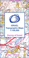
Tel Aviv - Yafo (Jaffa)

One of the titles in a series of maps from the Israeli Survey, in Hebrew - with some Roman alphabet equivalents, providing coverage of the whole of the West Bank and the Gaza Strip (pre-1967 boundaries are not shown). Most sheets were revised in the late 1990s - early 2000s, and although the areas of Palestinian Autonomy or shared responsibility are indicated, the political information and the effect of barrier on the road network may not necessarily be up to date.Relief is shown by contours at 25m intervals (20m on some sheets) and spot heights, with various types of terrain and land-use indicated by colours and symbols e.g. cliffs, sand, mudflats, orchards, olive groves, scrub, forest, nature reserves. Hydrographic information includes wadis, springs and wells. The maps show
various grades of roads, tracks and paths, as well as the country’s rail, indicating standard or narrow gauge lines. Symbols mark archaeological sites, ruins, synagogues and other places of worship, etc. The Israeli grid is shown at 1km intervals, with latitude and longitude given for the sheet corners. Map legend is in Hebrew and English. Some of the place names in Hebrew are printed in very small letters.
RIP - This product is no longer available on our network. It was last seen on 25.09.2019

This page now acts as a permanent archive for this product. Add more information using the comments box below to ensure it can still be found by future generations.

Use our search facility to see if it is available from an alternative contributor.
  • Availability: Out Of Stock
  • Supplier: Stanfords
  • SKU: XL00000025877
Availability: In Stock
£17.99

Product Description

One of the titles in a series of maps from the Israeli Survey, in Hebrew
- with some Roman alphabet equivalents, providing coverage of the whole of the West Bank & the Gaza Strip (pre-1967 boundaries are not shown). Most sheets were revised in the late 1990s
- early 2000s, & although the areas of Palestinian Autonomy or shared responsibility are indicated, the political information & the effect of barrier on the road network may not necessarily be up to date. Relief is shown by contours at 25m intervals (20m on some sheets) & spot heights, with various types of terrain & l&-use indicated by colours & symbols e.g. cliffs, s&, mudflats, orchards, olive groves, scrub, forest, nature reserves. Hydrographic information

Includes::
wadis, springs & wells. The maps show various grades of roads, tracks & paths, as well as the country’s rail, indicating standard or narrow gauge lines. Symbols mark archaeological sites, ruins, synagogues & other places of worship, etc. The Israeli grid is shown at 1km intervals, with latitude & longitude given for the sheet corners. Map legend is in Hebrew & English. Some of the place names in Hebrew are printed in very small letters.

Reviews/Comments

Add New

Intelligent Comparison

Oooops!
We couldn't find anything!
Perhaps this product's unique.... Or perhaps we are still looking for comparisons!
Click to bump this page and we'll hurry up.

Price History

Vouchers

No voucher codes found.
Do you know a voucher code for this product or supplier? Add it to Insights for others to use.

Facebook

Jargon Buster

Forest - A area with a high density of trees
Date - A day on a calendar
Date - A social activity whith a current or potential partner
Network - A link and communication between things. Often computers or people.
Small - something that takes up less space than normal.
Road - a manmade lane or a path that is used to speed up travel.

Supplier Information

Stanfords
Stanfords was established in 1853 and opened their iconic Covent Garden flagship store in 1901. They have become the top retailer of maps, travel books and accessories in the UK and arguably offer the largest selection of maps and travel books worldwide. Famous names such as Captain Robert Falcon Scott, Ranulph Fiennes and Michael Palin have purchased from Stanfords. They now have a shop in Bristol and both stores together with other venues operate a calendar of events including talks, book signings and exhibitions. As a specialist map retailer, the map selection is comprehensive and includes road maps, street maps and walking maps from worldwide destinations, as well as a selection of world atlases and wall maps. Books include travel guides and travel literature. Stanfords also stock globes, from miniatures made of blue marble to magnificent floor-standing globes. The website features a selection of interesting articles on travel topics.
Page Updated: 2023-11-12 20:15:36

Community Generated Product Tags

Oh No! The productWIKI community hasn't generated any tags for this product yet!
Menu