More From Contributor
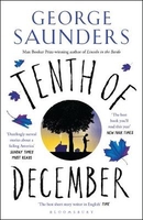
£19.95
Tennessee Recreational Atlas & Gazetteer at 1:150, 000 approx. in a series of large format paperback state atlases from De Lorme, with detailed, contoured, GPS compatible topographic mapping plus extensive recreational information, with lists of sites & facilities, etc. Each title covers one state & presents it on impressively detailed mapping at scales much more detailed than used on most state road maps. Particularly popular areas are often also presented on enlargements. The maps are contoured, show variation of terrain (deserts, glaciers, wetlands, woodlands, etc) & have latitude & longitude and/or UTM grid lines for GPS use. Various types of protected areas are distinguished by the colouring of their boundaries, e.g. national or state parks, forests, etc. Also marked are Indian Reservations & restricted entry military zones. Road network is shown in much more detail than on other state mapping, with local roads, unsurfaced back roads & tracks, forest trails, etc. Where appropriate, old historical routes are marked. Railway lines & local airports or landing strips are included & the maps also indicate administrative boundaries. Symbols highlight various recreational areas & facilities such as campgrounds, unique natural features, etc. Each title contains extensive lists of outdoor adventure sites (grouped into activities such as hiking, biking, paddling, fishing, skiing, etc.), diverse family outing sites, campgrounds, & tables showing what facilities can be found in the state ...
Archived Product
£30.00
Detailed physical wall map of Tennessee State at a scale of 1:500, 000. The cartography shows relief through a stunning, ...
Archived Product
£9.50
Topographical survey of Belgium at 1:20, 000 from Nationaal Geografisch Instituut / Institut Géographique National, the country’s national survey organization. Each 20K map covers one quarter of the corresponding 1:50, 000 map (with adjustments in the border & coastal areas). The maps provide all the information expected of topographic mapping at this scale & in addition have an unusually large amount of vegetation and/or land use information (different types of woodlands, gardens, orchards, heath, etc). The maps have a 1-km UTM grid, with margin ticks for latitude & longitude at intervals of 1`. Map legend & a glossary of terms used on the maps include English. Stanfords keeps as regular stock 20K maps for the World War I battlefields around the Ypres, Messines & Passchendaele, & for the area of the Battle of Waterloo. The 1:20, 000 survey covers the whole of Belgium & maps for other regions can be supplied as special orders. To see the list of titles in this series please click on the series link.PLEASE NOTE: the Long-Distance Footpaths Map of Belgium at 1:300, 000 which shows the division of Belgium into the 50K survey sheets can also be used to see in more detail coverage by the 20K maps. ...
Archived Product
£17.99
Topographic mapping from Mexico’s national survey agency, Instituto Nacional de Estadística, Geografía e Informática. The maps have contours at 20m intervals with relief shading & indicate various types of terrain & vegetation, e.g. dense vegetation, cultivated areas, swamps, sand dunes, salt pans, etc. UTM grid is at 10km intervals, with latitude & longitude shown by margin ticks at intervals of 5`. Map legend is in Spanish only. To see the other titles in this series please click on the series link. ...
Archived Product
£3.50
Tenterden & District in 1893 in a series of reproductions of Ordnance Survey’s famous ” Inch to the Mile” maps published in the Alan Godfrey Editions to provide a historical record of England & Wales in the second half of 19th & early 20th century. The map covers an area of south Kent & north-east Sussex, stretching from Ticehurst eastward to Appledore, & from Biddenden southward to Playden. Other locations include: in KENT Benenden, Bethersden, Boar`s Isle, Cranbrook, Goudhurst, Hartley, Hawkhurst, High Halden, Highgate, Horsmonden, Isle of Oxney, Kilndown, Newenden, Rolvenden, Sandhurst, Shodoxhurst, Sissinghurst, Wittersham & Woodchurch; plus in SUSSEX Beckley, Bodiam, Etchingham, Ewhurst, Hurst Green, Iden, Northiam, Peasmarsh, Playden, Salehurst & Ticehurst. On the reverse is a more detailed map of Tenterden where features include the station, High Street, St Mildred`s church, Hales Place, Huson Farm, etc. About the Alan Godfrey Editions of the OS Inch to the Mile Maps: the maps provide an invaluable overview of a wider area, typically 18 x 12 miles (29 x 19 kms approx.), & offer historical mapping for small towns & villages not covered by the more detailed series for which the Godfrey Editions are better known. On the reverse all the maps have historical notes & most titles also include a more detailed, large scale map of a small town or a village in the area. To see other titles in this series please click on the series link. ...
Archived Product
£14.99
In a nutshell
- everyone has 10 dice, someone says go & everyone rolls together to try & get all their dice on the number they
...
Archived Product
£9.99
Tepelena Prefecture at 1:90, 000 in a series of handy size, waterproof & tear-resistant, contoured & GPS compatible road maps from the Tirana-based publishers Vektor. Landscape is presented by altitude colouring & contours lines at 100m intervals, with spot heights & a few more names of topographic features than found on Vektor’s 200K road maps of the country. National parks & nature reserves are prominently highlighted. The prefecture maps appear to show the same small local dirt roads as in the 200K series, but given the increase in scale do so with greater clarity & also provide more detailed GPS coordinates (latitude & longitude lines are drawn at 5’ intervals), useful when travelling across the more remote parts of the country. Railway lines are included & local airports are marked. Symbols highlight campsites, beaches, archaeological & historical sites, caves, etc. The maps also show subdivisions of prefectures & names of the communes, & indicate administrative status of towns. Map legend

Includes::
English. Please note: border crossings are prominently marked but beyond topographic colouring no road or other information is provided outside the country’s borders.

...
Archived Product
£17.99
Topographic mapping from Mexico’s national survey agency, Instituto Nacional de Estadística, Geografía e Informática. The maps have contours at 20m intervals with relief shading & indicate various types of terrain & vegetation, e.g. dense vegetation, cultivated areas, swamps, sand dunes, salt pans, etc. UTM grid is at 10km intervals, with latitude & longitude shown by margin ticks at intervals of 5`. Map legend is in Spanish only. To see the other titles in this series please click on the series link. ...
Archived Product
£9.99
From our new series the Silk Series we bring internationally acclaimed author Hideo Dekura who has taught Japanese cooking all over the world to students & chefs working in 5 star restuarants on the techinques of cooking Japanese cusine. This series covers step by step instructions & photographs on how easy Japanese Cuisine is to make. Each book features over 60 recipes & a silk band cover. ...
Archived Product
£19.95
Tequila: a Mexican drink of superior quality
- & it`s making a strong comeback. Could Tequila become the new Gin? Tequila & Mezcal
...
Archived Product

Tenth Of December

WINNER OF THE 2014 FOLIO PRIZE AND SHORTLISTED FOR THE NATIONAL BOOK AWARD 2013George Saunders`s most wryly hilarious and disturbing collection yet, Tenth of December illuminates human experience and explores figures lost in a labyrinth of troubling preoccupations. A family member recollects a backyard pole dressed for all occasions; Jeff faces horrifying ultimatums and the prospect of DarkenfloxxTM in some unusual drug trials; and Al Roosten hides his own internal monologue behind a winning smile that he hopes will make him popular. With dark visions of the future riffing against ghosts of the past and the ever-settling present, this collection sings with astonishing charm and intensity.
RIP - This product is no longer available on our network. It was last seen on 25.09.2019

This page now acts as a permanent archive for this product. Add more information using the comments box below to ensure it can still be found by future generations.

Use our search facility to see if it is available from an alternative contributor.
  • Availability: Out Of Stock
  • Supplier: Stanfords
  • SKU: 9781408894811
Availability: In Stock
£8.99

Product Description

WINNER OF THE 2014 FOLIO PRIZE & SHORTLISTED FOR THE NATIONAL BOOK AWARD 2013 George Saunders`s most wryly hilarious & disturbing collection yet, Tenth of December illuminates human experience & explores figures lost in a labyrinth of troubling preoccupations. A family member recollects a backyard pole dressed for all occasions; Jeff faces horrifying ultimatums & the prospect of Darkenfloxx TM in some unusual drug trials; & Al Roosten hides his own internal monologue behind a winning smile that he hopes will make him popular. With dark visions of the future riffing against ghosts of the past & the ever-settling present, this collection sings with astonishing charm & intensity.

Reviews/Comments

Add New

Intelligent Comparison

Oooops!
We couldn't find anything!
Perhaps this product's unique.... Or perhaps we are still looking for comparisons!
Click to bump this page and we'll hurry up.

Price History

Vouchers

No voucher codes found.
Do you know a voucher code for this product or supplier? Add it to Insights for others to use.

Facebook

Jargon Buster

Dark - A colour which absorbs visable ligt so apears less light than objects that reflect light
Human - A highly developed and adapted mamal and deminant species on earth
Unusual - Something unique and different.
Experience - To gain further knowledge by practising.
Popular - Something that is admired and liked by many people.
Family - A group of people that live together made up from parents and children.

Supplier Information

Stanfords
Stanfords was established in 1853 and opened their iconic Covent Garden flagship store in 1901. They have become the top retailer of maps, travel books and accessories in the UK and arguably offer the largest selection of maps and travel books worldwide. Famous names such as Captain Robert Falcon Scott, Ranulph Fiennes and Michael Palin have purchased from Stanfords. They now have a shop in Bristol and both stores together with other venues operate a calendar of events including talks, book signings and exhibitions. As a specialist map retailer, the map selection is comprehensive and includes road maps, street maps and walking maps from worldwide destinations, as well as a selection of world atlases and wall maps. Books include travel guides and travel literature. Stanfords also stock globes, from miniatures made of blue marble to magnificent floor-standing globes. The website features a selection of interesting articles on travel topics.
Page Updated: 2023-11-12 20:15:36

Community Generated Product Tags

Oh No! The productWIKI community hasn't generated any tags for this product yet!
Menu