
 United Kingdom
 France
 Germany
 Netherlands
 Sweden
 USA
USA
 Italy
Italy
 Spain
Spain
More From Contributor

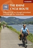


The Rhine Cycle Route: From The Source In The Swiss Alps To The North
Sea (1378km)
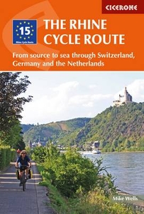
The cycle route along the Rhine, from the Oberalppass in the Swiss Alps to Hoek van Holland in a guide from Cicerone Press presenting the whole 1378 km / 861 mile route in 27 stages, although fit cyclists should be able to complete it in two weeks. This comprehensive guidebook offers a detailed stage-by-stage description of this epic route along the Rhine, one of Europe`s great rivers, which travels through six countries on its way from Switzerland to the North Sea. The route follows the river from its source in Switzerland into Liechtenstein, alternatives along the north or the south side of Lake Constance, along the French side, into Germany and the Netherlands, where the final stages are presented with a variant via Utrecht and Leiden. Descriptions of individual stages are
accompanied by overview maps of the route, with more detailed plans provided for main cities. Changes in the colour of the text usefully highlight names of locations where accommodation and/or refreshments can be found. Introductory chapter provides general information and advice, and a summary table, lists of youth hostels, principal tourist offices and other useful contacts, a glossary, etc. are provided.On its way, the Rhine Cycle Route passes the remains of Roman cities, medieval towns, castles, cathedrals, palaces, great cities of the industrial revolution and relics of 20th-century warfare. And it travels through a great range of stunning scenery. Starting in the Swiss Alps with high mountains, deep glacial valleys and gorges it soon reaches Europe`s third largest lake,
the Bodensee, and its greatest mainland waterfall. After Basel, the Rhine becomes a broad river, where straightening, flood dykes, locks and dams have created the world`s busiest river trading artery. The middle Rhine, between Bingen and Koblenz, forces its way through the narrow rocky Rhine gorge lined by romantic castles perched above Germany`s finest vineyards. The cycling is easy, downhill and along dedicated cycle routes. The countries visited are very cycle-friendly and the waymarking is excellent. And the whole trip can be completed in two weeks by a fit cyclist.
 "Pin It")
Product Description
Reviews/Comments
Add New
Vouchers
No voucher codes found.
Do you know a voucher code for this product or supplier? Add it to Insights for others to use.
Do you know a voucher code for this product or supplier? Add it to Insights for others to use.
 Denmark