
 United Kingdom
 France
 Germany
 Netherlands
 Sweden
 USA
USA
 Italy
Italy
 Spain
Spain
More From Contributor


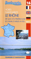
The Rhone
The Rhone in a series of guides from Editions Grafocarte/Editions de l`Ecluse to France’s canals and navigable waterways with mapping showing facilities and navigational hazards along each route, general information on signals and regulations, and descriptions of places of interest. Coverage extends from central Lyon and the confluence with the Saône to the Mediterranean at Port-St-Louis, including the Petit Rhône spur.Each guide provides mapping of the route showing locks, stop gates, mooring quays, tunnels, weirs, dangerous shoals, sand or mud banks, etc., as well as a wide range of facilities from drinking water and rubbish disposal to various types of shops, restaurants, pharmacies, shipyards and engine repair workshops, etc. The mapping is usually presented as
vertical 28 x 8.5cm panels which, together with the annotations, occupy one whole page of the guide and so each cover 14km or more of the route. Also included as necessary are more detailed enlargements of main basins or photographs of bridges, shown usually as viewed from both directions. The text providing navigational information and tips as well as descriptions of places of interest and a general background are kept separate from the maps but, where possible, placed on the adjoining page to the relevant section of the route.The guides also provide general information on rules and regulations, plus illustrations of navigational signals. Each guide also has an index of locations along the route annotated with symbols indicating various facilities, accompanied where possible with
contact details.*All of the text, explanations and the map legend are in French, English and German.**Please note:** The publishers’ name has changed from Editions Grafocarte to Editions de l’Ecluse and the series name shown on each title is Fluviacarte of Navicarte depending on whether mapping of coastal waters is included. Various combinations of these names can be found"ed in other publications on French waterways.

Product Description
Reviews/Comments
Add New
Vouchers
No voucher codes found.
Do you know a voucher code for this product or supplier? Add it to Insights for others to use.
Do you know a voucher code for this product or supplier? Add it to Insights for others to use.
 Denmark