
 United Kingdom
 France
 Germany
 Netherlands
 Sweden
 USA
USA
 Italy
Italy
 Spain
Spain
More From Contributor


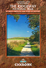


The Ridgeway Map Booklet
All the mapping you need to walk the Ridgeway National Trail an 87-mile (139km) route through southern England from Avebury in Wiltshire to Ivinghoe Beacon in Buckinghamshire. Following a ridge of chalk hills through the Chiltern Hills AONB and North Wessex Downs AONB, the Ridgeway is usually completed over 6-8 days and can be walked all year round. ?This booklet of Ordnance Survey 1:25, 000 Explorer maps shows the full line of the National Trail, along with the relevant extract from the OS Explorer map legend. It can be used when walking the trail in either direction, and is just the right size for slipping into a jacket pocket or top of a rucksack.

Product Description
Reviews/Comments
Add New
Vouchers
No voucher codes found.
Do you know a voucher code for this product or supplier? Add it to Insights for others to use.
Do you know a voucher code for this product or supplier? Add it to Insights for others to use.
 Denmark